Casper in Natrona County, Wyoming — The American West (Mountains)
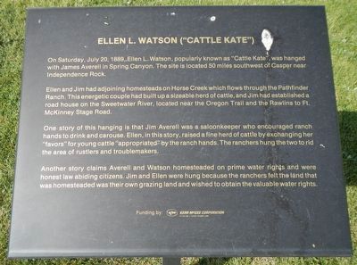
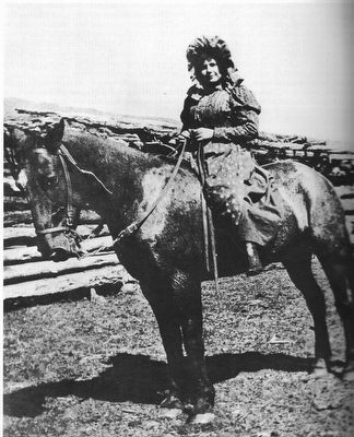
Ellen L. Watson (“Cattle Kate”)
Ella and Jim had adjoining homesteads on Horse Creek which flows through the Pathfinder Ranch. This energetic couple had built up a sizeable (sic) herd of cattle, and Jim had established a road house on the Sweetwater River, located near the Oregon Trail and the Rawlins to Fort McKinney Stage Road.
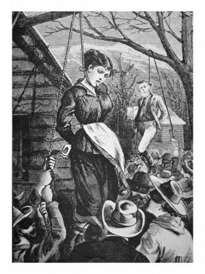
One story of this hanging is that Jim Averell was a saloonkeeper who encouraged ranch hands to drink and carouse. Ella, in this story, raised a fine herd of cattle by exchanging her “favors” for young cattle “appropriated” by the ranch hands. The ranchers hung the two to rid the area of rustlers and troublemakers.
Another story claims Averell and Watson homesteaded on prime water rights and were honest law abiding citizens. Jim and Ella were hanged because the ranchers felt the land that was homesteaded was their own grazing land and wished to obtain the valuable water rights.
Erected by Natrona County Historical Society.
Topics. This historical marker is listed in these topic lists: Agriculture • Roads & Vehicles • Waterways & Vessels • Women. A significant historical date for this entry is July 20, 1889.
Location. 42° 50.171′ N, 106° 22.331′ W. Marker is in Casper, Wyoming, in Natrona County. Marker can be reached from Fort Caspar Road, 0.1 miles west of Wyoming Route 258, on the right when traveling west. Touch for map. Marker is at or near this postal address: 4001 Fort Caspar Road, Casper WY 82604, United States of America. Touch for directions.
Other nearby markers. At least 8 other markers are within walking distance of this marker. Goose Egg Ranch (here, next to this marker); Railroads (here, next to this marker); Salt Creek Oil Field (here, next to this marker); Ranching in Wyoming (here, next to this marker); Bridger and Bozeman Trails (a few steps from this marker); Casper - Natrona County - State Founding (a few steps from this marker); Pony Express (a few steps from this marker); Richard Bridge and Military Complex (a few steps from this marker). Touch for a list and map of all markers in Casper.
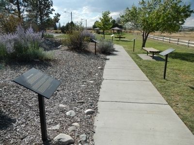
More about this marker. This marker is part of the Wyoming history walk in Centennial Park, which is adjacent to the Fort Caspar Museum and shares the parking lot.
Also see . . . Ellen Watson -- Wikipedia
. The day that Watson and Averell were lynched, George Henderson received a telegram. He immediately went to the Cheyenne Daily Sun and then other papers controlled by the WGSA. The next day those papers published lurid accounts of the crimes (of Watson and Averell)... These articles and those that followed marked the first time that the cattlemen had used the press as a tool to justify and glorify their violence. The tactic was so successful that it was resurrected during the violence of 1891-1892. (Submitted on December 26, 2015, by Barry Swackhamer of Brentwood, California.)
Credits. This page was last revised on January 12, 2021. It was originally submitted on December 25, 2015, by Barry Swackhamer of Brentwood, California. This page has been viewed 1,094 times since then and 71 times this year. Last updated on January 12, 2021, by Craig Baker of Sylmar, California. Photos: 1, 2. submitted on December 25, 2015, by Barry Swackhamer of Brentwood, California. 3, 4. submitted on December 26, 2015, by Barry Swackhamer of Brentwood, California.


