Mills in Natrona County, Wyoming — The American West (Mountains)
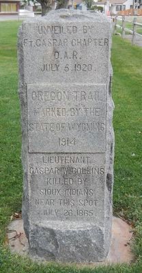
Oregon Trail
State of Wyoming
1914
Lieutenant
Caspar W. Collins
killed by
Sioux Indians
near this spot
July 26, 1865
Erected 1920 by Daughters of the American Revolution, Fort Caspar Chapter.
Topics and series. This historical marker is listed in these topic lists: Roads & Vehicles • Wars, US Indian. In addition, it is included in the Daughters of the American Revolution, and the Oregon Trail series lists. A significant historical date for this entry is July 26, 1865.
Location. 42° 50.694′ N, 106° 22.506′ W. Marker is in Mills, Wyoming, in Natrona County. Marker is on Platte Avenue near 9th Street, on the right when traveling north. Touch for map. Marker is at or near this postal address: 901 Platte Avenue, Mills WY 82644, United States of America. Touch for directions.
Other nearby markers. At least 8 other markers are within walking distance of this marker. The Town of Mills (here, next to this marker); The “Mormon” Ferry (a few steps from this marker); Guinard Bridge (approx. half a mile away); Site of Old Platte Bridge (approx. half a mile away); The Upper Crossing (approx. half a mile away); The Road to Zion (approx. half a mile away); a different marker also named The Mormon Ferry (approx. half a mile away); Reconstructed Fort Caspar (approx. 0.6 miles away). Touch for a list and map of all markers in Mills.
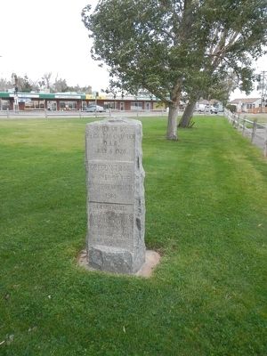
More about this marker. This marker is in City Memorial Park, a triangular park bounded by Platte Avenue, 9th Street and Southwest Wyoming Boulevard in Mills, Wyoming.
The original marker location was three blocks northwest at 4201 W Yellowstone Hwy, which was the site along the Oregon Trail where U.S. Army 2nd Lt. Caspar Collins died in a battle near Platte Bridge Station, later renamed Fort Caspar in his honor.
Credits. This page was last revised on January 12, 2021. It was originally submitted on January 3, 2016, by Barry Swackhamer of Brentwood, California. This page has been viewed 399 times since then and 16 times this year. Last updated on January 12, 2021, by Craig Baker of Sylmar, California. Photos: 1, 2. submitted on January 3, 2016, by Barry Swackhamer of Brentwood, California.

