Ewing Township in Hopewell Township in Mercer County, New Jersey — The American Northeast (Mid-Atlantic)
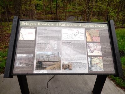
Bridges, Roads, and Railroads of Jacobs Creek
Bear Tavern Roa2qd
Although much of the surrounding countryside has changed over the course of the more than two centuries that have passed since George Washington and the Continental Army made their famous march to Trenton in late December of 1776, there are still readily identifiable elements on the modern landscape that provide a tangible connection to that pivotal moment in the Nation’s history.
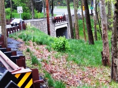
For example, Bear Tavern Road, which crosses Jacobs Creek immediately before you, was an important early colonial thoroughfare known then as the “River Road” or the “Great Road.” The current road generally follows its original alignment. During George Washington’s time, travelers along the road crossed the Creek by means of a ford. The current bridge, constructed in 2014, is at least the third bridge to stand on the site.
Bridges of Jacobs Creek
The first bridge was built in 1796, just upstream from the earlier ford. The road had to be relocated slightly to the north to facilitate its construction. That early bridge was replaced in 1882 by a wrought iron truss bridge that was manufactured by the King Iron Bridge and Manufacturing Company of Cleveland, Ohio. That bridge would stand for almost 125 years until storm damage to the bridge’s abutments required its removal.
The Lost Railroad
In 1874, interests of the Pennsylvania Railroad opened the Mercer & Somerset (M&S) branch of its Belvidere Delaware line along the east side of Jacobs Creek, near where you now stand. The line ran from Somerset Junction on the Delaware River through Pennington and Hopewell to Millstone, where it connected to another subsidiary line to New Brunswick. Initially constructed to frustrate the completion of the Reading Railroad’s competing Delaware & Bound Brook line for traffic between Philadelphia and New York City, the M&S line was a last-ditch effort by the Pennsylvania Railroad to protect its traffic monopoly between the two cities. The conflicts culminated in a frog war in Hopewell in January 1876. In railroad parlance, a frog is a device that allows two rails to cross, and a frog war occurs when one private railroad company attempts to cross the tracks of another, resulting in a standoff between the completing lines.
The Delaware & Bound Brook won the challenge, and by April 1876, the line was open. Its superior route and direct connections led to the almost immediate demise of the parallel Mercer & Somerset line, which was abandoned and sold at public auction in 1879.
Jacobs Creek Road
In the early 1880s, a new road was opened along the east side of Jacobs Creek, along the abandoned right-of-way of the Mercer & Somerset Railroad from the Delaware River eastwards to the Washington Crossing-Pennington Road. A short section of Bear Tavern Road, made redundant by the new road, was abandoned around the same time.
Topics. This memorial is listed in these topic lists: Railroads & Streetcars • Roads & Vehicles • War, US Revolutionary.
Location. 40° 17.448′ N, 74° 50.426′ W. Marker is in Hopewell Township, New Jersey, in Mercer County. It is in Ewing Township. Memorial is on Jacobs Creek Road. Touch for map. Marker is at or near this postal address: 117 Jacobs Creek Rd, Trenton NJ 08628, United States of America. Touch for directions.
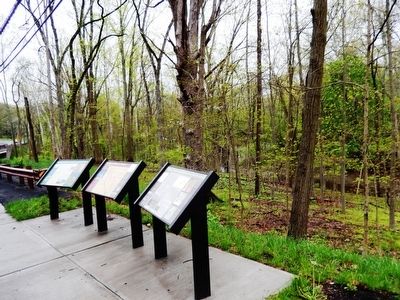
Other nearby markers. At least 8 other markers are within 2 miles of this marker, measured as the crow flies. Geography & Historic Landscape of Jacobs Creek (here, next to this marker); Washington’s March to Trenton (here, next to this marker); Washington’s March To Trenton (about 400 feet away, measured in a direct line); First Hunterdon County Militia (about 500 feet away); Bear Tavern Road (approx. 0.2 miles away); Mercer Airport (approx. ¾ mile away); Continental Lane (approx. 1.4 miles away); The March to Trenton (approx. 1.4 miles away). Touch for a list and map of all markers in Hopewell Township.
Credits. This page was last revised on August 19, 2023. It was originally submitted on May 21, 2016, by Don Morfe of Baltimore, Maryland. This page has been viewed 499 times since then and 29 times this year. Last updated on August 1, 2023, by Carl Gordon Moore Jr. of North East, Maryland. Photos: 1, 2, 3, 4. submitted on May 21, 2016, by Don Morfe of Baltimore, Maryland. • Bill Pfingsten was the editor who published this page.


