Near Harpers Ferry in Jefferson County, West Virginia — The American South (Appalachia)
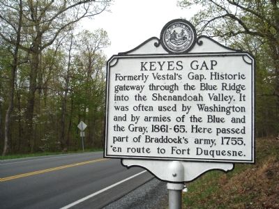
Keyes Gap
Erected by West Virginia Department of Archives and History.
Topics and series. This historical marker is listed in these topic lists: Natural Features • War, French and Indian • War, US Civil. In addition, it is included in the Braddock’s Road and Maj. Gen. Edward Braddock, and the West Virginia Archives and History series lists. A significant historical year for this entry is 1755.
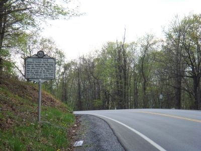
Location. This marker has been replaced by another marker nearby. It was located near 39° 15.612′ N, 77° 46.247′ W. Marker was near Harpers Ferry, West Virginia, in Jefferson County. Marker was on Charles Town Road (West Virginia Route 9) one mile west of Appalachian Trail, on the left when traveling west. The Appalachian Trail crosses Route 9 at the Virginia-West Virginia state line. In Virginia, Route 9 is known as the Charles Town Pike. Touch for map. Marker was at or near this postal address: 20449 Charles Town Rd, Harpers Ferry WV 25425, United States of America. Touch for directions.
Other nearby markers. At least 8 other markers are within 4 miles of this location, measured as the crow flies. A different marker also named Keyes Gap (approx. 0.4 miles away); Jefferson County / State of Virginia (approx. 0.4 miles away); Keyes' Switch Engagement (approx. 2˝ miles away); Iron Furnaces (approx. 2.6 miles away); John W. Mobberly (approx. 2.8 miles away in Virginia); Setting the Trap (approx. 3.2 miles away); Setting the Trap / Jackson Arrives (approx. 3.3 miles away); Mountains, Men, and Maneuvers (approx. 3.3 miles away). Touch for a list and map of all markers in Harpers Ferry.
Regarding Keyes Gap. The Shenandoah River runs just beyond Keys Gap to join the Potomac River seven miles north at Harpers Ferry, a strategic asset for both the North and South during the Civil War. En route to Fort Duquesne (now Pittsburgh, Pennsylvania) from Alexandria, Virginia, to fight the French and the Indians, British General Edward Braddock’s army, which included the young Colonel George Washington, split into two columns. One traveled through Virginia and this gap while the other traveled through Maryland. They met at Fort Federick, half-way between Hagerstown and Hancock in Maryland and continued from there to their rout at the Monongahela River, just short of Fort Duquesne. Throughout his life, George Washington traveled on horseback to Berkley Springs and points west to visit property he owned and to survey routes to the midwest.
Related markers. Click here for a list of markers that are related to this marker. Markers related to Vestal's Gap Road.
Additional commentary.
1. Keyes Gap marker
Sometime in 2010 (maybe earlier) this marker could no longer be found along Route 9 near the VA/WV line. It may have been hit by a car and destroyed since there is evidence of a damaged post, but no sign.
— Submitted April 24, 2011, by Christopher B Straight of Leesburg, Virginia.
Credits. This page was last revised on August 2, 2021. It was originally submitted on April 29, 2007, by J. J. Prats of Powell, Ohio. This page has been viewed 3,076 times since then and 95 times this year. Last updated on February 19, 2021, by Carl Gordon Moore Jr. of North East, Maryland. Photos: 1, 2. submitted on May 1, 2007, by J. J. Prats of Powell, Ohio. • J. Makali Bruton was the editor who published this page.

