Perryville in Boyle County, Kentucky — The American South (East South Central)
Donelson's Advance
Perryville ē The Battle For Kentucky
ó October 8, 1862 ó
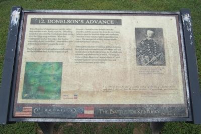
Shells exploded overhead and cannonballs crashed into the Southern lines, but the brigade surged forward. Casualties were horrible from the crossfire, and the accurate fire from the two Union batteries spun the Southern troops into confusion. Donelsonís lines wavered and changed direction twice. The unexpected artillery barrage nearly ended Donelsonís advance.
Although the fire from two Union artillery batteries had killed and wounded dozens of soldiers and had caused chaos in the Southern lines, the Confederates reformed and continued their attack. Pressing the Union soldiers, Donelsonís brigade drove a Union infantry regiment out from behind a fence and continued westward up the valley.
I ascertained from the fire of another battery of the enemyís further on our right that I did not have the proper direction. I accordingly gave orders for a charge...
Confederate Brigadier General Daniel Donelson
Brigade Commander
(caption) Confederate Colonel John H. Savage (shown above in his Mexican War uniform) commanded the 16th Tennessee Infantry under Donelson.
Erected by Perryville State Historic Site. (Marker Number 12.)
Topics. This historical marker is listed in this topic list: War, US Civil. A significant historical date for this entry is October 8, 1862.
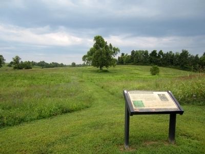
Location. This marker has been replaced by another marker nearby. 37° 40.395′ N, 84° 58.145′ W. Marker is in Perryville, Kentucky, in Boyle County. Marker can be reached from Park Road west of Battlefield Road (Kentucky Route 1920). Located in Perryville Battlefield State Historic Site. Touch for map. Marker is at or near this postal address: 1825 Battlefield Road, Perryville KY 40468, United States of America. Touch for directions.
Other nearby markers. At least 8 other markers are within walking distance of this location. The Valley of Death (here, next to this marker); Introduction (about 400 feet away, measured in a direct line); Lumsden's Battery (about 600 feet away); Soldiers' Reaction to Lincoln's Emancipation (about 700 feet away); Perryville and the Emancipation Proclamation (about 700 feet away); Confederate Cemetery (about 700 feet away); Squire Henry P. Bottom (about 700 feet away); Sgt. Harris B. Cope Memorial (about 700 feet away). Touch for a list and map of all markers in Perryville.
Related marker. Click here for another marker that is related to this marker. New Marker At This Location titled "The Valley of Death".
Credits. This page was last revised on November 2, 2021. It was originally submitted on August 25, 2011, by Bernard Fisher of Richmond, Virginia. This page has been viewed 708 times since then and 15 times this year. Photos: 1, 2. submitted on August 25, 2011, by Bernard Fisher of Richmond, Virginia.

