Near Nancy in Wayne County, Kentucky — The American South (East South Central)
Moulden's Hill
Union Artillery Position
— Battle of Mill Springs —
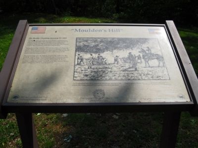
The Federal forces pursuing the beaten Confederates halted here near a small log school. This school building had been used by the Confederates as a headquarters for their pickets during their occupation of the area. The Federals now rested here and prepared to assault the Confederate earthworks in the morning.
During the evening of January 19th Federal artillery was deployed on the high ground around this area (known as Moulden's Hill). The batteries firing throughout the night discharged over 300 rounds into the Confederate fortified camp and at the small steam boat the southerners were using as a ferry.
The next morning when the Federals assaulted the earthworks they found the camp deserted. The Confederate army had escaped across the river during the night. Later Colonel Speed Fry of the 4th KY Infantry U.S. inquired to George Thomas why he did not attack the Confederate position the night of the 19th. General Thomas replied, "Hang it Fry, I never once thought of it."
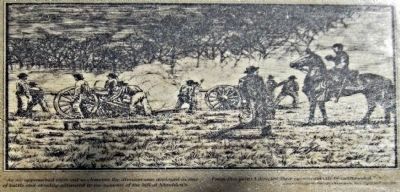
To the right is a drawing (below) of Union artillery being prepared for firing.
Erected 1997 by Mill Springs Battlefield Association & Kentucky Humanities Council.
Topics. This historical marker is listed in this topic list: War, US Civil. A significant historical date for this entry is January 19, 1905.
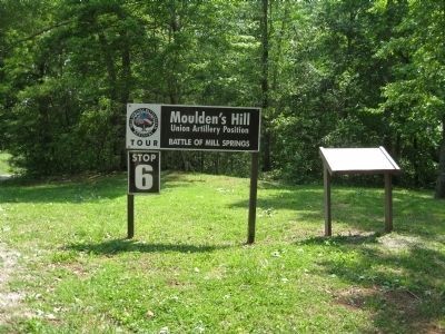
Location. This marker has been replaced by another marker nearby. It was located near 36° 57.682′ N, 84° 46.849′ W. Marker was near Nancy, Kentucky, in Wayne County. Marker was on Mill Springs Battlefield Road, 2.3 miles south of State Route 235, on the right when traveling south. Marker and Tour Stop sign are at a shaded parking pulloff just inside a forested area. This is Tour Stop 6 of the Mill Springs Battlefield Driving Tour. Touch for map. Marker was in this post office area: Nancy KY 42544, United States of America. Touch for directions.
Other nearby markers. At least 8 other markers are within 2 miles of this location, measured as the crow flies. Respite at Moulden's Hill (a few steps from this marker); Fortifications at Beech Grove (approx. 0.6 miles away); Winter Quarters (approx. 0.6 miles away); Beech Grove / Noble Ellis (approx. 0.6 miles away); Zollie's Den (approx. 0.6 miles away); The Noble Ellis Saves an Army (approx. 1.4 miles away); The Cumberland River (approx. 1.9 miles away); Home, Headquarters, Hospital (approx. 1.9 miles away). Touch for a list and map of all markers in Nancy.
More about this marker. This marker was replaced by a new one named Respite at Moulden's Hill (see nearby markers).
Additional keywords. Zollicoffer

Photographed By David Graff, April 26, 2012
3. Union Artillery on Moulden's Hill
Caption: "As we approached their entrenchments the division was deployed in line of battle and steadily advanced to the summit of the hill at Moulden's. From this point I directed their entrenchments be cannonaded" - General George H. Thomas, Commander U.S. forces, Mill Springs
Credits. This page was last revised on January 29, 2020. It was originally submitted on May 24, 2012, by David Graff of Halifax, Nova Scotia. This page has been viewed 577 times since then and 14 times this year. Photos: 1, 2, 3, 4. submitted on May 24, 2012, by David Graff of Halifax, Nova Scotia. • Craig Swain was the editor who published this page.


