Near Charlottesville in Albemarle County, Virginia — The American South (Mid-Atlantic)
Mulberry Row
Mulberry Row's Evolution
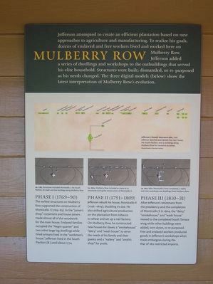
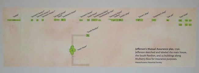
Jefferson attempted to create an efficient plantation based on new approaches to agriculture and manufacturing. To realize his goals, dozens of enslaved and free workers lived and worked here on Mulberry Row. Jefferson added a series of dwellings and workshops to the outbuildings that served his elite household. Structures were built, dismantled, or re-purposed as his needs changed. The three digital models (below) show the latest interpretation of Mulberry Row's evolution.
Phase I (1769-90)
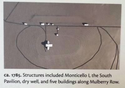
The earliest structures on Mulberry Row supported the construction of Monticello I (1769-83). In the "joiner's shop," carpenters and house joiners made almost all of the woodwork for the main house. Enslaved families occupied the "Negro quarter" and two other large log dwellings while hired artisans lived in the "workmen's house." Jefferson lived in the South Pavilion (B.) until about 1774.
Phase II (1791-1809)
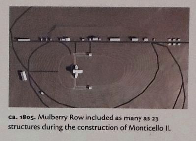
Jefferson rebuilt his house, Monticello II (1796-1809), doubling its size. He also shifted agricultural production on the plantation from tobacco to wheat and set up a nail factory. On Mulberry Row, he constructed new houses for slaves; a "smokehouse," "dairy," and "wash house" to serve the needs of his family and their guests; and a "nailery" and "smith's shop" for profit.
Phase III (1810-31)
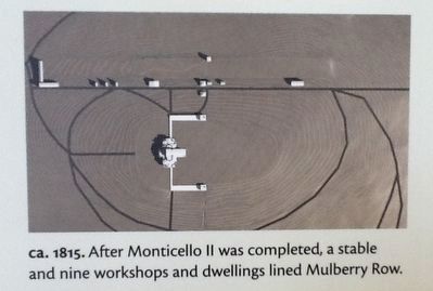
After Jefferson's retirement from the presidency and the completion of Monticello II in 1809, the "dairy," "smokehouse," and "wash house" moved to the completed South Terrace wing while other buildings were added, torn down, or re-purposed. Free and enslaved workers produced goods in Jefferson's workshops when trade embargoes during the War of 1812 restricted imports.
(Marker Number 02.)
Topics. This historical marker is listed in these topic lists: African Americans • Architecture • Patriots & Patriotism • Science & Medicine. A significant historical year for this entry is 1769.
Location. 38° 0.582′ N, 78° 27.088′ W. Marker is near Charlottesville, Virginia, in Albemarle County. Marker can be reached from Thomas Jefferson Parkway. Marker is on the grounds of Monticello—entrance fee is required. Marker is located on one of the walls of the large visitors building next to the gardens. Touch for map. Marker is at or near this postal address: 995 Monticello Loop, Charlottesville VA 22902, United States of America. Touch for directions.
Other nearby markers. At least 8 other markers are within walking distance of this marker. Textiles (within shouting distance of this marker); Slave Housing (within shouting distance of this marker); Vegetable Garden (within shouting distance of this marker); a different marker also named Mulberry Row (within shouting distance of this
marker); Sally Hemings (about 300 feet away, measured in a direct line); Sally Hemings's Life (about 300 feet away); Horses & Mules (about 300 feet away); A Presidential Scandal: (about 300 feet away). Touch for a list and map of all markers in Charlottesville.
More about this marker. This is marker #02—titled "Mulberry Row's Evolution"—in the "Mulberry Row at Monticello - Landscape of Slavery" panel/marker series (link to series provided on this page).
Also see . . .
1. Interactive view of the models. Here you can pan, zoom in, and see renderings of the various buildings as they might have appeared. (Submitted on December 2, 2016, by Michael C. Wilcox of Winston-Salem, North Carolina.)
2. Mulberry Row Reassessment. Thomas Jefferson's Monticello website entry (Submitted on January 17, 2023, by Larry Gertner of New York, New York.)
Credits. This page was last revised on February 2, 2023. It was originally submitted on December 2, 2016, by Michael C. Wilcox of Winston-Salem, North Carolina. This page has been viewed 636 times since then and 28 times this year. Photos: 1, 2, 3, 4, 5. submitted on December 2, 2016, by Michael C. Wilcox of Winston-Salem, North Carolina.
