Grooverville in Brooks County, Georgia — The American South (South Atlantic)
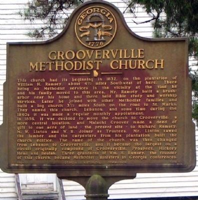
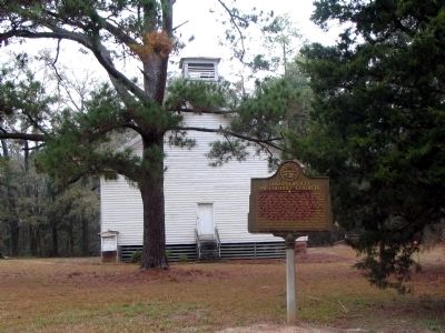
Grooverville Methodist Church
In 1856, it was decided to move the church to Grooverville, a more central location, and present site – to Richard Ramsey. M. W. Linton and W. R. Joiner as Trustees, Mr. Linton sawed the lumber and the carpenters from his plantation built the church edifice. The name of the church was then changed from Lebanon to Grooverville and it because the largest on a circuit originally composed of Grooverville, Prospect, Hickory head and Beulah. Three grandsons of Wm. H. Ramsey, the founder of this church, became Methodist ministers in Georgia conference.
Erected 1966 by Georgia Historical Commission. (Marker Number 014-10.)
Topics and series. This historical marker is listed in these topic lists: Agriculture • Churches & Religion • Settlements & Settlers. In addition, it is included in the Georgia Historical Society series list. A significant historical year for this entry is 1832.
Location. 30° 43.321′ N, 83° 43.607′ W. Marker is in Grooverville, Georgia, in Brooks County. Marker is on Beasley Road (County Route 79) 0 miles Grooverville Road (County Route 275), on the left when traveling north. Touch for map. Marker is in this post office area: Boston GA 31626, United States of America. Touch for directions.
Other nearby markers. At least 8 other markers are within 11 miles of this marker, measured as the crow flies. Liberty Baptist Church (about 500 feet away, measured in a direct line); Olive Baptist Church (approx. 7 miles away in Florida); Bethlehem Primitive Baptist Church (approx. 8.3 miles away); West End Cemetery (approx. 10˝ miles away); Civil War Slave Conspiracy (approx. 10.8 miles away); Quitman Veterans Memorial (approx. 10.8 miles away); Brooks County (approx. 10.8 miles away); Our Confederate Dead (approx. 10.9 miles away).
Credits. This page was last revised on January 26, 2020. It was originally submitted on August 6, 2008, by David Seibert of Sandy Springs, Georgia. This page has been viewed 1,954 times since then and 11 times this year. Photos: 1, 2. submitted on August 6, 2008, by David Seibert of Sandy Springs, Georgia. • Craig Swain was the editor who published this page.

