Near Greenfield in Monterey County, California — The American West (Pacific Coastal)
Metz Field/ Chapin Int'l Airport
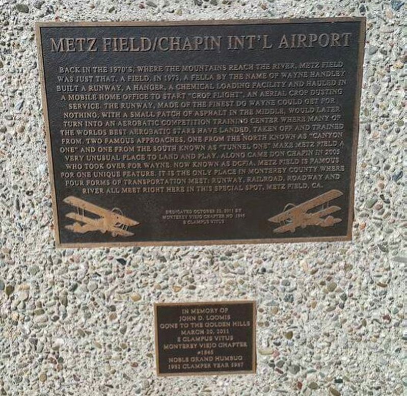
Upper Marker:
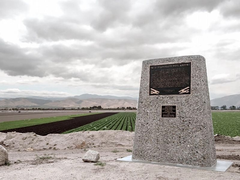
Back in the 1970s, where the mountains reach the river, Metz field was just that, a field. In 1973, a fella by the name of Wayne Handley built a runway, a hanger, a chemical loading facility and hauled in a mobile home office to start "Crop Flight," an aerial crop dusting service. The runway, made of the finest DG Wayne could get for nothing, with a small patch of asphalt in the middle, would later turn into an aerobatic competition training center where many of the worlds best aerobatic stars have landed, taken off, and trained from. Two famous approaches, one from the north known as "Canyon One" and one from the south known as "Tunnel One" make Metz Field a very unusual place to land and play. Along came Don Chapin in 2005 who took over for Wayne, now known as DCFIA. Metz Field is known for one unique feature, it is the only place in Monterey County where four forms of transportation meet: Runway, Railroad, Roadway, and River all meet right here at this special spot, Metz Field, CA.
Lower Marker:
In memory of John D. Loomis, gone to the Golden Hills March 20, 2011. E Clampus Vitus Monterey Viejo Chapter #1846, Noble Grand Humbug, 1982 Clamp Year 5987
Erected 2011 by Monterey Viejo Chapter 1846 of the Ancient and Honorable Order of E Clampus Vitus.
Topics and series. This historical marker is listed in this topic list: Air & Space. In addition, it is included in the E Clampus Vitus series list. A significant historical date for this entry is March 20, 2011.
Location. 36° 20.016′ N, 121° 11.408′ W. Marker is near Greenfield, California, in Monterey County. Marker can be reached from Metz Road, 0.7 miles south of Elm Avenue, on the right when traveling south. Touch for map. Marker is at or near this postal address: 40500 Metz Road, Greenfield CA 93927, United States of America. Touch for directions.
Other nearby markers. At least 8 other markers are within 10 miles of this marker, measured as the crow flies. De Anza Expedition 1775-1776 (approx. 9.1 miles away); Wind Power (approx. 9.1 miles away); Salinas Valley Cookwagon, c. 1888 / Cookwagon (approx. 9.1 miles away); La Gloria Schoolhouse (approx. 9.2 miles away); One Voice Murals Project (approx. 9.8 miles away); Mission San Antonio de Padua (approx. 9.9 miles away); Cesar Chavez Park (approx. 10.1 miles away); Railroad Station Site (approx. 10.1 miles away).
Credits. This page was last revised on February 14, 2021. It was originally submitted on December 15, 2016, by Frank Gunshow Sanchez of Hollister, California. This page has been viewed 606 times since then and 15 times this year. Last updated on February 13, 2021, by Craig Baker of Sylmar, California. Photos: 1. submitted on December 15, 2016, by Frank Gunshow Sanchez of Hollister, California. 2. submitted on February 13, 2021, by Craig Baker of Sylmar, California. • J. Makali Bruton was the editor who published this page.
Editor’s want-list for this marker. Wide area view of marker and its surroundings. • Can you help?

