St. Mary's City in St. Mary's County, Maryland — The American Northeast (Mid-Atlantic)
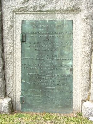
Here Lyeth The Body
Here lyeth the body of Lionel Copley of Wadworth, County York, England, born 1648, died Sept. 27, 1693. And of Anne Boteler, his wife, of Watton, Woodhull, County Herts, England, died March 5, 1692.
He was sometime Lieutenant Governour of Kingston Upon Hull, 1689–1690, Lieutenant General, Governour in Chief, and Chief Admiral of Maryland in America 1691–1693. His short tenure of life in this Province was marked by singular fidelity in troublous times to his God, his King, and his Country.
To him, the first Royal Governour of Maryland, the Maryland Society of Colonial Dames of America has erected this memorial, September 27, 1922.
Erected 1922 by the Maryland Society of Colonial Dames of America.
Topics and series. This historical marker is listed in these topic lists: Cemeteries & Burial Sites • Colonial Era • Settlements & Settlers. In addition, it is included in the Maryland, Saint Mary's City, and the The Colonial Dames of America, National Society of series lists. A significant historical month for this entry is March 1787.
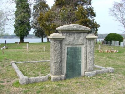
Location. 38° 11.25′ N, 76° 26.133′ W. Marker is in St. Mary's City, Maryland, in St. Mary's County. Marker can be reached from Trinity Church Road near Point Lookout Road (Maryland Route 5). It is at the Trinity Episcopal Church cemetery. Touch for map. Marker is at or near this postal address: 47477 Trinity Church Road, Saint Marys City MD 20686, United States of America. Touch for directions.
Other nearby markers. At least 10 other markers are within walking distance of this marker. Entrance to First State House of Maryland (a few steps from this marker); The First State House of Maryland (a few steps from this marker); Leonard Calvert (a few steps from this marker); a different marker also named Entrance to First State House of Maryland (a few steps from this marker); Trinity Church, St. Mary’s Parish (within shouting distance of this marker); John Llewellyn (within shouting distance of this marker); The Landing of the Ark and the Dove (within shouting distance of this marker); Laura Maryland Carpenter Blinn (within shouting distance of this marker); Thomas Allen Senior (within shouting distance of this marker); The St. Mary’s Chapel (about 300 feet away, measured in a direct line). Touch for a list and map of all markers in St. Mary's City.
Also see . . . Researchers Discover Ruins of Maryland’s Earliest Colonial Site, a 386-Year-Old Fort. Smithsonian Magazine website entry (Submitted on March 6, 2022, by Larry Gertner of New York, New York.)
Credits. This page was last revised on March 6, 2022. It was originally submitted on May 6, 2007, by J. J. Prats of Powell, Ohio. This page has been viewed 1,911 times since then and 32 times this year. Photos: 1, 2. submitted on May 6, 2007, by J. J. Prats of Powell, Ohio.

