Near Big Bar in Trinity County, California — The American West (Pacific Coastal)
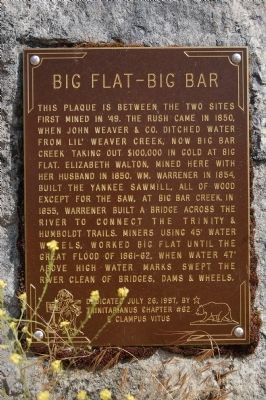
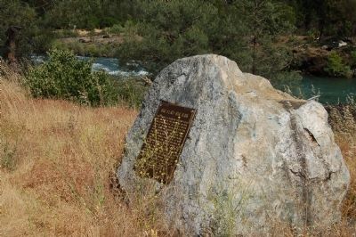
Big Flat – Big Bar
Erected 1997 by Trinitarianus Chapter #62, E Clampus Vitus.
Topics and series. This historical marker is listed in these topic lists: Industry & Commerce • Natural Resources • Notable Places • Settlements & Settlers. In addition, it is included in the E Clampus Vitus series list. A significant historical year for this entry is 1850.
Location. 40° 44.484′ N, 123° 12.947′ W. Marker is near Big Bar, California, in Trinity County. Marker is on California Route 229. This marker is on the south side of State Route 229,just east of the Big Flat Trinity River Access entrance. Touch for map. Marker is in this post office area: Big Bar CA 96010, United States of America. Touch for directions.
Other nearby markers. At least 6 other markers are within 14 miles of this marker, measured as the crow flies. Bagdad (approx. 5.2 miles away); Junction City Centennial (approx. 8½ miles away); Site of Cañon City (approx. 10½ miles away); Kellogg Cemetery (approx. 13 miles away); Dedrick (approx. 13.2 miles away); Japanese Bomb Balloon (approx. 13.7 miles away).
Credits. This page was last revised on December 22, 2016. It was originally submitted on June 7, 2012, by Barry Swackhamer of Brentwood, California. This page has been viewed 550 times since then and 29 times this year. Last updated on December 21, 2016, by Michael Kindig of Elk Grove, California. Photos: 1, 2. submitted on June 7, 2012, by Barry Swackhamer of Brentwood, California. • Syd Whittle was the editor who published this page.

