Near Jackson in Amador County, California — The American West (Pacific Coastal)
Argonaut and Kennedy Mines
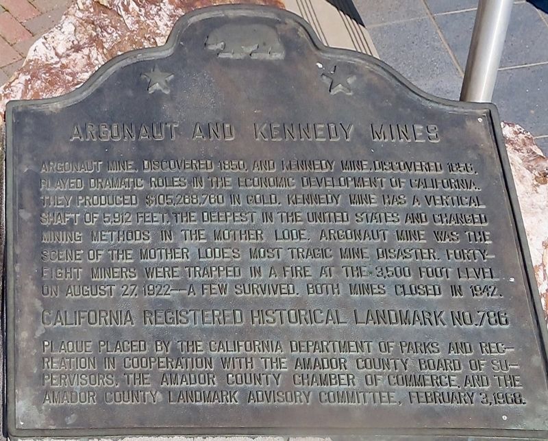
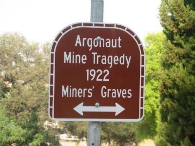
Argonaut Mine, discovered 1850, and Kennedy Mine, discovered 1856, played dramatic roles in the economic development of California. They produced $105,268,760 in gold. Kennedy Mine has a vertical shaft of 5,912 feet, the deepest in the United States and changed mining methods in the Mother Lode. The Argonaut Mine was the scene of the Mother Lode's most tragic mine disaster. Forty-eight miners were trapped in a fire at the 3,500 foot level on August 27, 1922 — a few survived. Both mines closed in 1942.
Erected 1968 by California Dept of Parks & Rec, Amador County Board of Supervisors, Amador County Chamber of Commerce, and Amador County Landmarks Advisory Committee. (Marker Number 786.)
Topics and series. This historical marker is listed in these topic lists: Disasters • Industry & Commerce • Settlements & Settlers. In addition, it is included in the California Historical Landmarks series list. A significant historical year for this entry is 1850.
Location. 38° 21.881′ N, 120° 47.228′ W. Marker is near Jackson, California, in Amador County. Marker can be reached from State Highway 49. Marker is located at the rest area across from the Kennedy Mine, 1.6 miles north of the town of Jackson. Touch for map. Marker is in this post office area: Jackson CA 95642, United States of America. Touch for directions.
Other nearby markers. At least 8 other markers are within walking distance of this marker. University of California Foothill Field Station (here, next to this marker); Amador County Veterans' Memorial (here, next to this marker); Argonaut Mine (a few steps from this marker); The Kennedy Mine / The Argonaut Mine (a few steps from this marker); Jackson (a few steps from this marker); Anthony Caminetti (within shouting distance of this marker); Kennedy Mining and Milling Company (approx. 0.4 miles away); Kennedy Mine Headframe (approx. 0.4 miles away). Touch for a list and map of all markers in Jackson.
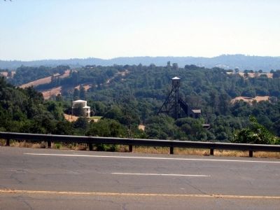
Regarding Argonaut and Kennedy Mines. Kennedy Mine Location: Highway 49, Jackson, across from Argonaut Lane. The Kennedy Gold Mine has gone through a metamorphosis in the last few years changing from what looked like an abandoned property into a thriving historical attraction, In the late 1850s, Andrew Kennedy discovered gold in an outcropping of quartz. The mine produced over $34.2 million in gold, making it one of the richest gold mines in the world. With a vertical depth of 5,912 feet, it was also the deepest mine in North America when it was closed by the War Production Board in 1942.
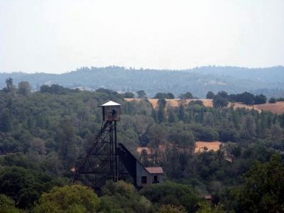
Visitors to the Kennedy Gold Mine can see the 125-foot high metal head frame, tour several mining buildings, and learn the history of the Kennedy Mine.
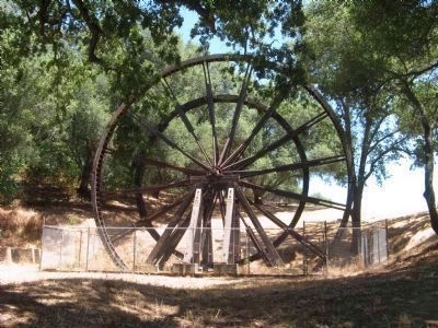
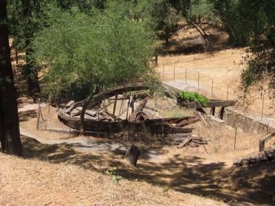
The Mine tours, which are guided by volunteers, take visitors up and down the hills on the property. Comfortable walking or hiking shoes are advised. the Kennedy Tailing Wheels Park is located nearby, featuring the remaining tailing wheels that were used to carry the processed rock from the Kennedy Mine to an impound dam.
Argonaut Mine Location: On Highway 49 at the top of the hill between the city of Jackson and Martell. Site of the worst gold mining tragedy in California history. In 1922, 47 miners died from deadly gas freed by a mine fire. From a vertical depth of 5,570 feet, the mine produced over $25 million in gold.
Also see . . .
1. The Kennedy Gold Mine. Mine website homepage (Submitted on October 29, 2008.)
2. Argonaut Online Mine Tour. Amadorgold website entry:
Historic photo's and information tour on the Argonaut Mine (Submitted on February 3, 2012, by Amador Gold of Jackson, California, Amador County.)
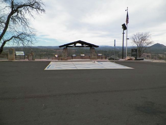
Photographed By James King, January 26, 2014
4. Argonaut and Kennedy Mines Monument
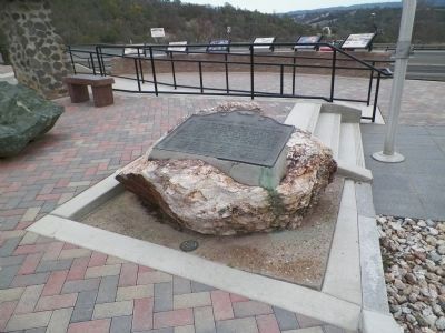
This marker is mounted on the boulder at right, in front of the black slab of the veterans' memorial. The next boulder to the left has the UC Foothill Field Station marker. The next one way to the left has the Argonaut Mine marker, and at the extreme left is the Jackson marker.
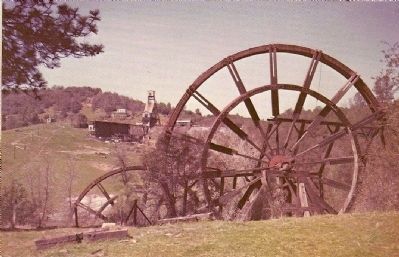
Merle Porter - Published by Royal Pictures - Colton,Ca
9. Tailing Wheels - Jackson, California
Description on Postcard:
These huge wheels were used to carry tailings across a canyon to dump it over a nearby hill. They are located below the Argonaut and Kennedy Mines, whose deposit shaft is over a mile deep. Up to 1931 the Argonaut produced $17,391,409 in gold. From 1848 to 1851 Jackson was a stopping point for teamsters who piled a collection of bottles along the creek where the National Hotel stands today. The town was given the name of Bottlieas later changed to Jackson after Col. Jackson an energenic citizen. Jackson is the county seat of Amador County after moving it from Double Springs and a time when Mokelumne Hill was the county seat. Col. Jackson went south and founded the camp of Jacksonville covered by water at the present time....M.P.
Photographed By Syd Whittle, February 21, 2010
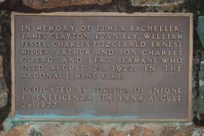
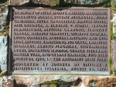
11. Argonaut Mine Fire Memorial Plaque
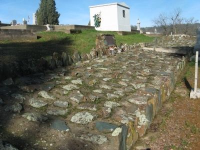
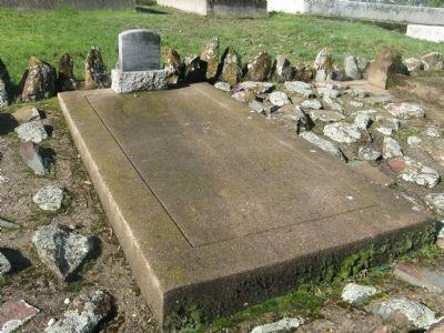
This memorial plaque is located at the miner's gravesites at the Jackson Catholic Cemetery;
In memory of Peter Bagoye, Rafaelo Baldocchi, Domenico Boleri, Eugene Busgaglia, John Gaminada, Peter Gavaglieri, Manuel Costa, Paul Delonga, A. Fazzini, V. Fideli, Simone Francisconi, Bautista Gamboni, Timothy Garcia, Maurice Gianetti, Giuseppe Giorza, Lugio Gonzales, brothers Antonio and Luis Leon, Battista Manachino, Pio Oliva, Emanuel Olobardi, Aldino Piagneri, Giovanaria Ruzzi, Domenico Simondi, George Steinman, Daniele Vilia, and Cesare Zanardi, who died August 28, 1922, in the Argonaut Mine Fire.
Dedicated by Societa di Unione e Beneficenza Italiana, August 28, 1977.
Credits. This page was last revised on June 16, 2023. It was originally submitted on October 29, 2008, by Syd Whittle of Mesa, Arizona. This page has been viewed 4,103 times since then and 71 times this year. Last updated on December 21, 2016, by Michael Kindig of Elk Grove, California. Photos: 1. submitted on June 16, 2023, by Craig Baker of Sylmar, California. 2. submitted on October 29, 2008, by Syd Whittle of Mesa, Arizona. 3. submitted on March 3, 2014, by James King of San Miguel, California. 4. submitted on March 2, 2014, by James King of San Miguel, California. 5, 6. submitted on October 29, 2008, by Syd Whittle of Mesa, Arizona. 7, 8. submitted on July 21, 2010, by Syd Whittle of Mesa, Arizona. 9, 10. submitted on October 29, 2008, by Syd Whittle of Mesa, Arizona. 11, 12, 13. submitted on March 3, 2010, by Syd Whittle of Mesa, Arizona. 14. submitted on May 31, 2011, by Barry Swackhamer of Brentwood, California.
