Cumberland Township near Gettysburg in Adams County, Pennsylvania — The American Northeast (Mid-Atlantic)
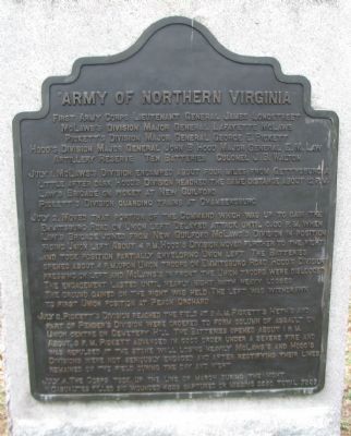
First Army Corps
Army of Northern Virginia
First Army Corps Lieutenant General James Longstreet
McLaws's Division Major General Lafayete McLaws
Pickett's Division Major General George E. Pickett
Hood's Division Major General John B. Hood, Major General E.M. Law
Artillery Reserve Ten Batteries Colonel J.B. Watson
July 1. McLaws's Division encamped about four miles from Gettysburg a little after dark. Hood's Division reached the same distance about 12 p.m. Law's Brigade on picket at New Guilford. Pickett's Division guarding trains at Chambersburg.
July 2. Moved that portion of the Command which was up to gain the Emmitsburg Road on Union left. Delayed attack until 3:30 p.m. when Law's Brigade joined from New Guilford. McLaw's Division in position facing Union left. About 4 p.m. Hood's Division moved further to the right and took position partially enveloping Union left. The Batteries opened about 4 p.m. upon Union troops on Emmitsburg Road. Hood's Division pressing on left and McLaws's in front. The Union troops were dislodged. The engagement lasted until nearly night with heavy losses. The ground gained on the right was held. The left was withdrawn to first Union position at Peach Orchard.
July 3. Pickett's Division reached the field at 9 a.m. Pickett's Heth's and part of Pender's Division were ordered to form column of assault on Union centre on Cemetery Hill. The Batteries opened about 1 p.m. About 3 p.m. Pickett advanced in good order under a severe fire and was repulsed at the stone wall losing heavily. McLaws's and Hood's Divisions were not seriously engaged and after rectifying their lines remained on the field during the day and night.
July 4. The Corps took up the line of march during the night.
Casualties killed 910 wounded 4339 captured or missing 2290 Total 7539
Erected 1907 by Gettysburg National Military Park Commission.
Topics. This historical marker is listed in this topic list: War, US Civil. A significant day of the year for for this entry is July 1.
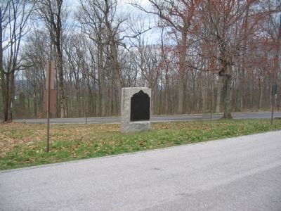
Location. 39° 48.071′ N, 77° 15.386′ W. Marker is near Gettysburg, Pennsylvania, in Adams County. It is in Cumberland Township. Marker is at the intersection of West Confederate Avenue and Millerstown Road, on the right when traveling south on West Confederate Avenue. Located near stop six (Pitzer Woods) of the driving tour of Gettysburg National Military Park, just north of the Longstreet Observation tower. Touch for map. Marker is in this post office area: Gettysburg PA 17325, United States of America. Touch for directions.
Other nearby markers. At least 8 other markers are within walking distance of this marker. Taylor's Battery - Alexander's Battalion (a few steps from this marker); Alexander's Battalion (a few steps from this marker); Parker's Battery - Alexander's Battalion (within shouting distance of this marker); Madison Light Artillery (within shouting distance of this marker); The Bedford Virginia Artillery (about 300 feet away, measured in a direct line); A Valuable Little Property (about 400 feet away); The Brooks Artillery (about 400 feet away); Lieut. General James Longstreet (about 400 feet away). Touch for a list and map of all markers in Gettysburg.
Photographed By Craig Swain, July 24, 2008
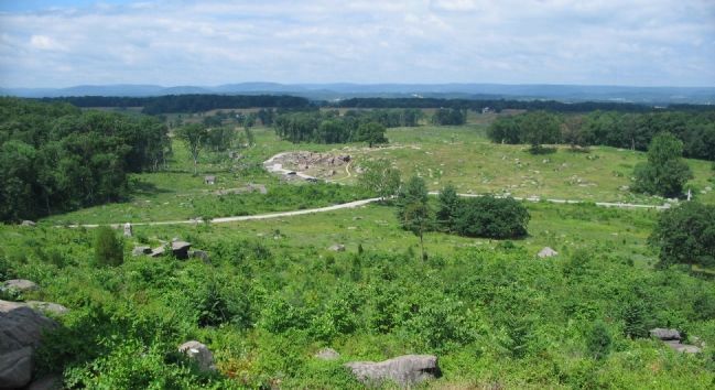
3. Second Day Attack
Hood's Division turned into the Federal left flank in and around three major terrain features - Big Round Top, Little Round Top, and Devils Den. These bounded the "Valley of Death" seen here in the center of the photo. Some of the most dramatic fighting anywhere in the American Civil War occurred here.
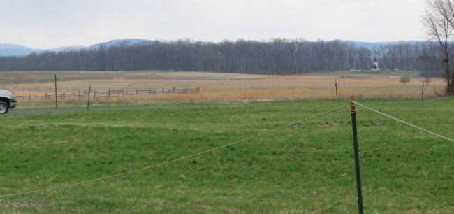
Photographed By Craig Swain, April 7, 2007
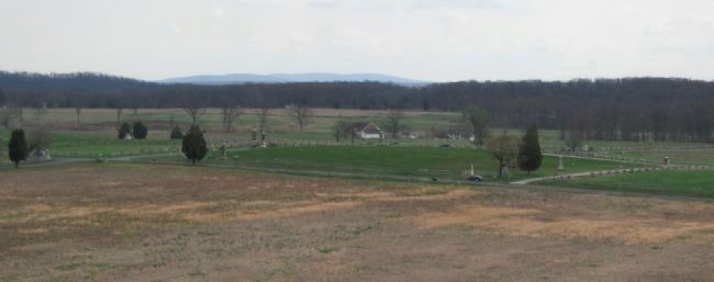
5. Pickett's Division Advances, Third Day
Looking from Cemetery Ridge, to the west, toward Confederate lines. Pickett's Division advanced with it's center of mass near the present day Virginia memorial (right distance). The charge, among the most famous in all military history, was repulsed.
Credits. This page was last revised on February 7, 2023. It was originally submitted on August 9, 2008, by Craig Swain of Leesburg, Virginia. This page has been viewed 898 times since then and 22 times this year. Photos: 1, 2, 3, 4, 5. submitted on August 9, 2008, by Craig Swain of Leesburg, Virginia.
