Near Alma in Buffalo County, Wisconsin — The American Midwest (Great Lakes)
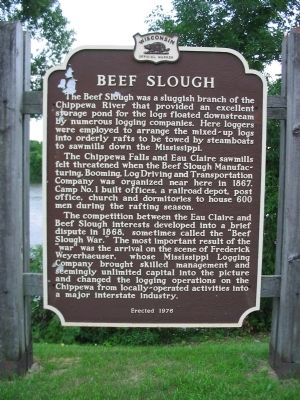
Beef Slough
The Chippewa Falls and Eau Claire sawmills felt threatened when the Beef Slough Manufacturing, Booming, Log Driving and Transportation Company was organized near here in 1867. Camp No. 1 built offices, a railroad depot, post office, church and dormitories to house 600 men during the rafting season.
The competition between the Eau Claire and Beef Slough interests developed into a brief dispute in 1868, sometimes called the "Beef Slough War." The most important result of the "war" was the arrival on the scene of Frederick Weyerhaeuser, whose Mississippi Logging Company brought skilled management and seemingly unlimited capital into the picture and changed the logging operations on the Chippewa from locally-operated activities into a major interstate industry.
Erected 1976 by the Wisconsin Historical Society. (Marker Number 230.)
Topics and series. This historical marker is listed in these topic lists: Industry & Commerce • Waterways & Vessels. In addition, it is included in the Wisconsin Historical Society series list. A significant historical year for this entry is 1867.
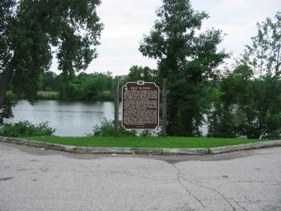
Location. 44° 21.602′ N, 91° 56.473′ W. Marker is near Alma, Wisconsin, in Buffalo County. Marker is on The Great River Road (State Highway 35) 0.3 miles north of Iron Creek Road (County Highway I), on the left when traveling north. Marker is northwest of Alma at a highway pull-off. Touch for map. Marker is in this post office area: Alma WI 54610, United States of America. Touch for directions.
Other nearby markers. At least 8 other markers are within 5 miles of this marker, measured as the crow flies. Lock & Dam No. 4 (approx. 2.7 miles away); Veterans Memorial (approx. 3.1 miles away); a different marker also named Veterans Memorial (approx. 4˝ miles away); Minnesota Territory 1849-1858 / Wabasha County Takes Shape (approx. 4.6 miles away in Minnesota); Grace Memorial Episcopal Church (approx. 4.7 miles away in Minnesota); Wapahasha I / Wapahasha II / Wapahasha III (approx. 4.7 miles away in Minnesota); a different marker also named Veterans Memorial (approx. 4.8 miles away in Minnesota); The Bridge (approx. 4.9 miles away in Minnesota). Touch for a list and map of all markers in Alma.
Credits. This page was last revised on October 9, 2020. It was originally submitted on August 9, 2008, by Keith L of Wisconsin Rapids, Wisconsin. This page has been viewed 4,354 times since then and 107 times this year. Photos: 1, 2. submitted on August 9, 2008, by Keith L of Wisconsin Rapids, Wisconsin. • Craig Swain was the editor who published this page.

