Dzibilchaltún in Mérida, Yucatán, Mexico — The Southeast (Yucatan Peninsula)
Central Square
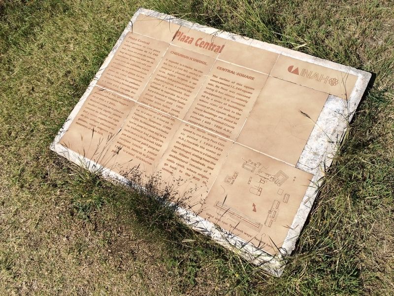
Plaza Central
La superficie de esta plaza cubre alrededor de 12,240 m2.; tuvo un piso de estuco, hoy desaparecido casi en su totalidad. Esta rodeada por una serie de edificios, cuyas escalinatas se orientan hacie el centro de la plaza. La mayoría de estas construcciones se fecha en los periodos Clásico Tardío y Terminal (600 a 1,000 d.C.), excepto dos edificios menores situados al norte (39 y 50), que corresponden al Posclásico Temprano (1,000 a 1,200).
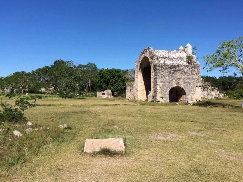
Hacia el centro de la plaza se localiza una capilla abierta colonial de finales del siglo XVI y restos arquitectónicos de una antigua estancia de ganado, cuyos orígenes se remontan al siglo XVII.
Maya-Yucateco:
Chúumuk k’iiwikil.
U nojochil le k’iiwika’ ku chukik kek 12,240 M2; anchaj ti’ jum’’eel u y’aanalil luk’ tikinta’an, bejla’e’ ta’aytak u mina’antal. Bak’pachta’an tyo’olal jayp’éel najo’ob, u yeebilo’obe’ aktáan ti’ u chúumukil. Óoli’ tuláakal le najo’oba’ ku ts’a’abal u k’iino’ob ti’ Clásico Tardío yéetel Terminal (600 – 1000 ts’o’okol ki’ich kelem yuum), chéen ka’ap’éel chan najo’ob yano’ob xaman (39 yéetel 50), ku ts’a’abal u k’iino’ob ti’ Postclásico Temprano (1000 – 1200). Tu chúumukil le k’iiwika’ tya’an jump’éel chan naj tu’ux ku k’ulinta’al k’uj je’epaja’an, ku ts’abal u k’iin tu ts’ook 1600 yan xan xóoxot’ pak’il jump’éel úuchben kúuchil u yantal wakaxo’ob, beet’ab tu ja’abil 1700 ts’o’okol ki’ichkelem yuum.
English:
Central Square
The surface of this square covers around 12,240 square mts. Its floor was stuccoed today it has almost entirely disappeared. It is surrounded by a series of buildings, whose stairs all look to the center of the square. Most of these buildings are dated in the Late and Terminal Classic periods (600-1000 A.D.), except two smaller buildings to the North which correspond to the Early Post Classic period (1000-1200 A.D.). Towards the center of the square there is a Colonial open chapel, dating from the late fifteen hundreds and architectural remains of a cattle ranch, whose origins go back to the XVIIth century.
Erected by Instituto Nacional de Antropología e Historia (INAH).
Topics. This historical marker is listed in these topic lists: Anthropology & Archaeology • Architecture • Native Americans.
Location. 21° 5.448′ N, 89° 35.832′ W. Marker is in Dzibilchaltún, Yucatán, in Mérida. The marker is located about 100 meters to the right after the entrance to the Dzibilchaltun Archaeological Zone, near the north of the central square. The park is off the road towards the small village of Dzilbilchaltun, to the
east some 20 km north of Mérida on the Mérida-Progeso Highway (Hwy. 261). Touch for map. Marker is in this post office area: Dzibilchaltún YU 97300, Mexico. Touch for directions.
Other nearby markers. At least 8 other markers are within walking distance of this marker. Edifice 44 (within shouting distance of this marker); The Open Chapel (within shouting distance of this marker); Structure 36 (within shouting distance of this marker); Substructure 38 (about 120 meters away, measured in a direct line); Dzibilchaltún Archaeological Site (about 210 meters away); Sacbe 1 (about 240 meters away); The Habitational Complex (approx. 0.4 kilometers away); Adjoining Rooms (approx. 0.6 kilometers away). Touch for a list and map of all markers in Dzibilchaltún.
Credits. This page was last revised on October 14, 2022. It was originally submitted on January 29, 2017, by J. Makali Bruton of Accra, Ghana. This page has been viewed 216 times since then and 6 times this year. Photos: 1, 2. submitted on January 29, 2017, by J. Makali Bruton of Accra, Ghana.

