Near Manassas in Prince William County, Virginia — The American South (Mid-Atlantic)
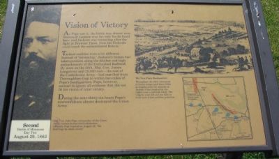
Vision of Victory
— Second Battle of Manassas - Day Two - August 29, 1862 —
Tactical realities were a bit different. Instead of "retreating," Jackson's troops had taken position along the ditches and high embankments of the Unfinished Railroad. By noon on the 29th, Maj. Gen. James Longstreet and 28,000 men - the rest of the Confederate Army - had marched from Thoroughfare Gap to within two miles of Pope's headquarters. Pope, however, seemed to ignore all evidence that did not fit his vision of total victory.
During the next thirty-six hours Pope's overconfidence almost destroyed the Union Army.
Topics. This historical marker is listed in this topic list: War, US Civil.
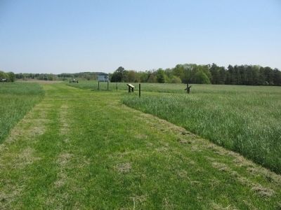
Location. Marker has been reported missing. It was located near 38° 49.476′ N, 77° 31.936′ W. Marker was near Manassas, Virginia, in Prince William County. Marker could be reached from Sudley Road (U.S. 234) half a mile north of Lee Highway (Route 29), on the right when traveling north. Located in the Manassas National Battlefield Park, along the Matthews Hill trail. Touch for map. Marker was in this post office area: Manassas VA 20109, United States of America. Touch for directions.
Other nearby markers. At least 8 other markers are within walking distance of this location. The Fight for Matthews Hill (within shouting distance of this marker); Rhode Island Battery (within shouting distance of this marker); Blocking the Union Advance (about 600 feet away, measured in a direct line); 2nd Rhode Island Infantry (about 700 feet away); 4th Alabama Infantry (about 700 feet away); The Matthew Farm (approx. 0.2 miles away); First Contact (approx. 0.2 miles away); Matthews Hill (approx. 0.2 miles away). Touch for a list and map of all markers in Manassas.
More about this marker. On the far left is a portrait of Maj. Gen. John Pope, commander of the Union Army. Certain he had the Confederate cornered, Pope boasted on August 28, "We shall bag the whole crowd."
On the upper right is a drawing of The View from Headquarters
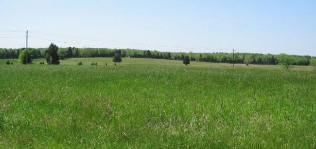
Throughout the 29th, thousands of Union troops used these fields as staging areas for assaults on Jackson's line (marked by the tallest trees a half-mile west). The ridge to your left and low hills in front were Union artillery positions.
The caption references a battle map on the lower right.
Also see . . . Second Manassas. General Pope's account of the battle. (Submitted on June 21, 2008, by Craig Swain of Leesburg, Virginia.)

Photographed By Craig Swain, May 4, 2008
3. View from Pope's Headquarters
Looking northwest across Sudley Road. The Confederate line was anchored on an unfinished railroad bed running in the far distance. As mentioned on the marker, the line is among the larger trees about a half mile distant. Landscape restoration projects at the battlefield should restore the ground to 1862 tree lines. Thus offering a more "historic" view.
Credits. This page was last revised on November 16, 2022. It was originally submitted on June 21, 2008, by Craig Swain of Leesburg, Virginia. This page has been viewed 1,088 times since then and 2 times this year. Last updated on February 19, 2017, by Shane Oliver of Richmond, Virginia. Photos: 1. submitted on June 21, 2008, by Craig Swain of Leesburg, Virginia. 2. submitted on June 16, 2008, by Craig Swain of Leesburg, Virginia. 3. submitted on June 21, 2008, by Craig Swain of Leesburg, Virginia. • Bill Pfingsten was the editor who published this page.

