Cobá in Tulum, Quintana Roo, Mexico — The Yucatan Peninsula (The Southeast)
The City of Cobá
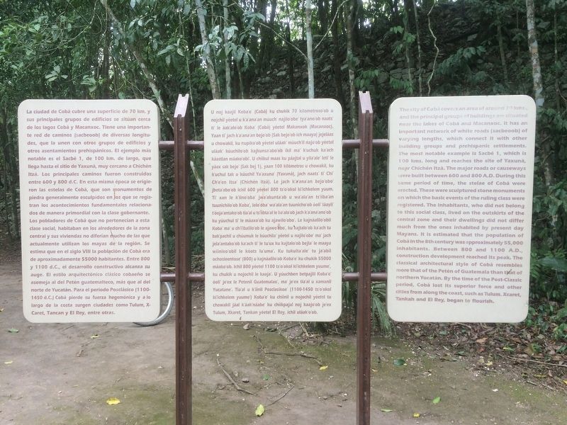
La ciudad de Cobá cubre una superficie de 70 km. y sus principales grupos de edificios se sitúan cerca de los lagos Cobá y Macanxoc. Tiene una importante red de caminos (sacbeoob) de diversas longitudes, que la unen con otros grupos de edificios y otros asentamientos prehispánicos. El ejemplo más notable es el Sacbé 1, de 100 km. de largo, que llega hasta el sitio de Yaxuná, muy cercano a Chichén Itzá. Los principales caminos fueron construidos entre 600 y 800 d.C. En esta misma época se erigieron las estelas de Cobá, que son monumentos de piedra generalmente esculpidos en los que se registran los acontecimientos fundamentales relacionados de manera primordial con la clase gobernante. Los pobladores de Cobá que no pertenecían a esta clase social, habitaban en los alrededores de la zona central y sus viviendas no diferían mucho las que actualmente utilizan los mayas de la región. Se estima que en el siglo VIII la población de Cobá era de aproximadamente 55000 habitantes. Entre 800 y 1100 d C., el desarrollo constructivo alcanza su auge. El estilo arquitectónico clásico cobaeńo se asemeja al del Petén guatemalteco, más que al del norte de Yucatán. Para el periodo Posclásico (1100-1450 d C.) Cobá pierde su fuerza hegemónica y a lo largo de la costa surgen ciudades como Tulum, X-Caret, Tancan y El Rey, entre otras.
Maya-Yucateco:
U noj kaajil Koba'e' (Cobá) ku chukik 70 kilometroso'ob u nojchil yéetel u k'a'anaan múuch' najilo'obe' tya'ano'ob naats' ti' le áak'alo'ob Koba' (Cobá) yéetel Makanxok (Macanxoc). Yaan ti' jach ka'ana'an bejo'ob (Sak bejo'ob ich maaya) jejeláas u chowakil, ku nupiko'ob yéetel uláalk' múuch'il najo'ob yéetel uláak' kúuchilo'ob kajkunsa'abo'ob ikil ma' k'uchuk ka'ach káastlan máako'obi'. U chíikul maas ku páajtal u yila'ale' leti' le yáax sak bejo' (Sak bej 1), yaan 100 kilómetros u chowakil, ku k'uchul tak u kúuchil Ya'axuna' (Yaxuná), jach naats' ti' Chi' Ch'e'en Itsa' (Chichén Itzá). Le jach k'a'ana'an bejo'obo' jbeta'abo'ob ichil 600 yéetel 800 ts'o'okol ki'ichkelem yuum. Ti' xan le k'iino'oba' jwa'akunta'ab u wa'ala'an ts'iiba'an tuunichilo'ob Kobá, lelo'oba' wa'ala'an tuunicho'ob óoli' láayli' t'óoja'antako'ob tia'al u ts'iibta'al le ba'alo'ob jach k'a'ana'ano'ob ku yúuchul ti' le máaxo'ob ku ajawilo'obo'. Le kajnáalilo'obil Koba' ma' u chi'i'ibalilo'ob le ajawo'obo', ku kajtalo'ob ka'ach tu bak'pachil u chúumuk le kúuchila' yéetel u najilo'obe' ma' jach jela'antako'ob ka'ach ti' le tu'ux ku kajtalo'ob bejla' le maaya wii'niko'obil le kóots lu'uma'. Ku tukulta'ale' tu ja'abil ochosieentose' (800) u kajnáalilo'ob Koba'e' ku chukik 55000 máako'ob. Ichil 800 yéetel 1100 ts'o'okol ki'ichkelem yuume', ku chukik u nojochil le kaaja'. U yúuchben betpajlil Koba'e' óoli' je'ex le Petenil Guatemalao', ma' je'ex tia'al u xamanil Yucatane'. Tia'al u k'iinil Posclasikoe' (1100-1450 ts'o'okol ki'ichkelem yuume') Koba'e' ku chiinil u nojochil yéetel tu chowakil jáal káak'náabe' ku chiikpajal noj kaajo'ob je'ex Tulum, Xkaret, Tankan yéetel El Rey, ichil uláak'o'ob.
English:
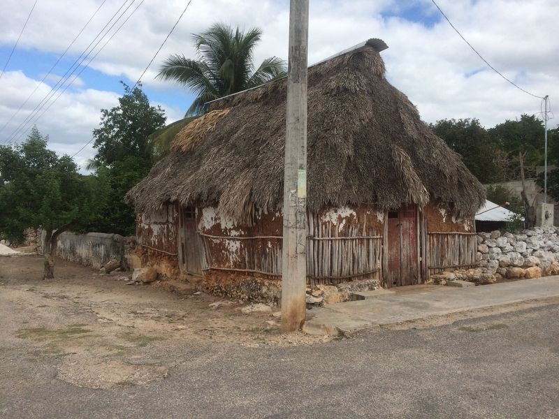
The city of Cobá covers an area of around 70 kms., and the principal groups of buildings are situated near the lakes of Coba and Macanxoc. It has an important network of white roads (sacbeoob) of varying lengths, which connect it with other building groups and prehispanic settlements. The most notable example is Sacbé 1, which is 100 kms. long and reaches the site of Yaxuná, near Chichén Itzá. The major roads or causeways were built between 600 and 800 A.D. During this same period of time, the stelae of Cobá were erected. These were sculptured stone monuments on which the basic events of the ruling class were registered. The inhabitants, who did not belong to this social class, lived on the outskirts of the central zone and their dwellings did not differ much from the ones inhabited by present day Mayans. It is estimated that the population of Cobá in the 8th century was approximately 55,000 inhabitants. Between 800 and 1100 A.D., construction development reached its peak. The classical architectural style of Cobá resembles more that of the Petén of Guatemala than that of northern
Yucatán. By the time of the Post-Classic period, Cobá lost its superior force and other cities from along the coast, such as Tulum, Xcaret, Tankah and El Rey, began to flourish.
Topics. This historical marker is listed in these topic lists: Anthropology & Archaeology • Man-Made Features • Native Americans • Settlements & Settlers.
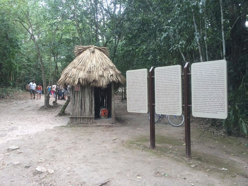
Location. 20° 29.439′ N, 87° 43.971′ W. Marker is in Cobá, Quintana Roo, in Tulum. The marker is on the right, directly after the entrance to the Cobá Archaeological Site. Touch for map. Marker is in this post office area: Cobá QR 77793, Mexico. Touch for directions.
Other nearby markers. At least 4 other markers are within 21 kilometers of this marker, measured as the crow flies. The Coba Group (within shouting distance of this marker); Paintings Complex (approx. 0.8 kilometers away); Nohoch Mul Group (approx. 1.4 kilometers away); Otoch Ma’ax Yetel Kooh Ramsar Site (approx. 20.2 kilometers away).
Credits. This page was last revised on March 4, 2017. It was originally submitted on March 4, 2017, by J. Makali Bruton of Accra, Ghana. This page has been viewed 157 times since then and 8 times this year. Photos: 1, 2, 3. submitted on March 4, 2017, by J. Makali Bruton of Accra, Ghana.


