Pisté in Tinum, Yucatán, Mexico — The Southeast (Yucatan Peninsula)
The Observatory
El Caracol
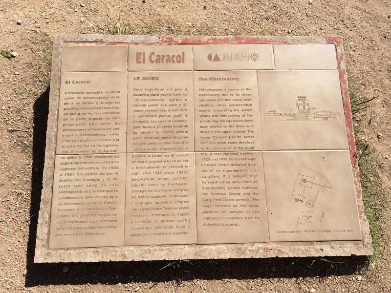
Estructura conocida también como "El Observatorio" debido a su forma y a algunas posibles asociaciones astrales, ya que para las tres ventanas de la parte superior se han propuesto una serie de alineaciones relacionadas con eventos astronómicos, entre ellos con el planeta Venus y la puesta del Sol en los equinoccios. El nombre de “El Caracol” se debe a unas escaleras en espiral que conducen a la parte superior del edificio. De 1925 a 1931 fue explorado por la Institución Carnegie y se detectó una serie de seis sobreposiciones; se cree que su construcción data de una época intermedia entre el Clásico Terminal y el Posclásico Temprano. Las grandes zanjas en sus plataformas superiores son calas de excavación consolidadas con fines didácticos.
Maya-Yucateco:
Le Juubo’
Pak’il k’ajóolta’an xan je’ex u kúuchil u yila’al yóok’ol kaab wa “El observatorio” tyo’olal u wiinklil yéetel xan yaan u yil yéetel yóok’ol kaab, tumen tia’al u yóoxp’éelil paakat joolil le ka’analilo’ ts’u ya’ala’al u tsoolile’ yaan ba’ax u yil yéetel ba’alo’ob ku yúuchul tu ka’anlil yóok’ol kaab, ichilo’obe’ yéetel Venus wa noj eek’ yéetel u chiinil k’iin ti’ le ekinoksio’obo’ (Equinoccios). U k’aaba’il le juubo’ wa El caracol ku taal ti’ jayp’éel eebo’ob ku bin u kots’kubaob’ob tu yóok’olil le naja’. Ichil 1925 yéetel 1931e’ jmeyajta’ab tumen jump’éel kúuchil xook ku k’aaba’atik Carnegie ka ila’ab’ yaan wakp’éel wa seis u táasilo’ob; ku tukla’ale’ u betpajlile’ ku taal ti’ jump’éel k’iinil ichil Clásico Terminal yéetel Posclásico Temprano. Le nojoch k’óomo’ob tu ka’anal but’bil lu’umo’obe’ jbeeta’ab tia’al u páajtal u xo’okol bix le kúuchila’.
English:
The Observatory
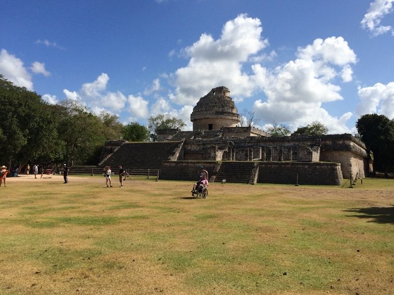
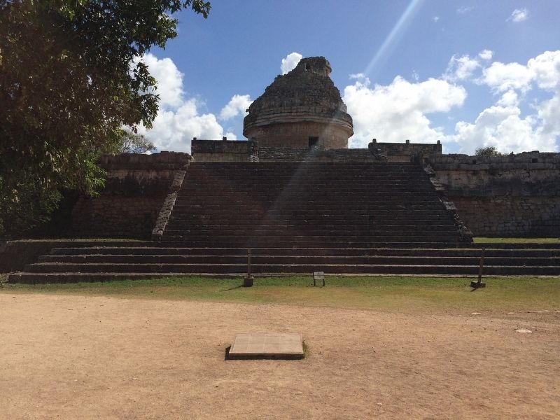
This structure is known as the Observatory due to its shape and some possible astral associations, since astronomical events concerning the planet Venus and the setting of the sun during the equinoxes have been related to the three windows in the upper section. The name “Caracol” (conch) comes from the spiral stairs that lead to the upper part of the building. It was explored between 1925 and 1931 by the Carnegie Institute which detected a series of six superimposed constructions. It is believed that its construction dates from an intermediary period between the Terminal Classic and the Early Post Classic periods. The large trenches on the upper platform are samples of consolidated excavations used for didactical purposes.
Erected by Instituto Nacional de Antropología e Historia (INAH).
Topics. This historical marker is listed in these topic lists: Anthropology & Archaeology
• Architecture • Man-Made Features • Native Americans. A significant historical year for this entry is 1925.
Location. 20° 40.768′ N, 88° 34.264′ W. Marker is in Pisté, Yucatán, in Tinum. Marker can be reached from Carretera Costera de Golfo (at milepost 180),. This marker is just west of The Observatory at the Chichén Itzá Archaeological Site. Touch for map. Marker is in this post office area: Pisté YU 97751, Mexico. Touch for directions.
Other nearby markers. At least 8 other markers are within walking distance of this marker. The Church (about 120 meters away, measured in a direct line); The Nunnery Patios and Ball Court (about 150 meters away); House of the Grinding Stones & House of the “Mestizas” (about 180 meters away); Platform of the Tombs (about 210 meters away); The Ossuary or Tomb of the Great Priest (about 210 meters away); Platform of Venus and Round Platform (about 210 meters away); Temple of Xtoloc (approx. 0.3 kilometers away); Sacbeob 5 & 15 (approx. 0.3 kilometers away). Touch for a list and map of all markers in Pisté.
Credits. This page was last revised on March 12, 2017. It was originally submitted on March 12, 2017, by J. Makali Bruton of Accra, Ghana. This page has been viewed 376 times since then and 5 times this year. Photos: 1, 2, 3. submitted on March 12, 2017, by J. Makali Bruton of Accra, Ghana.


