Biloxi in Harrison County, Mississippi — The American South (East South Central)
Biloxi Lighthouse
— Historic Biloxi —
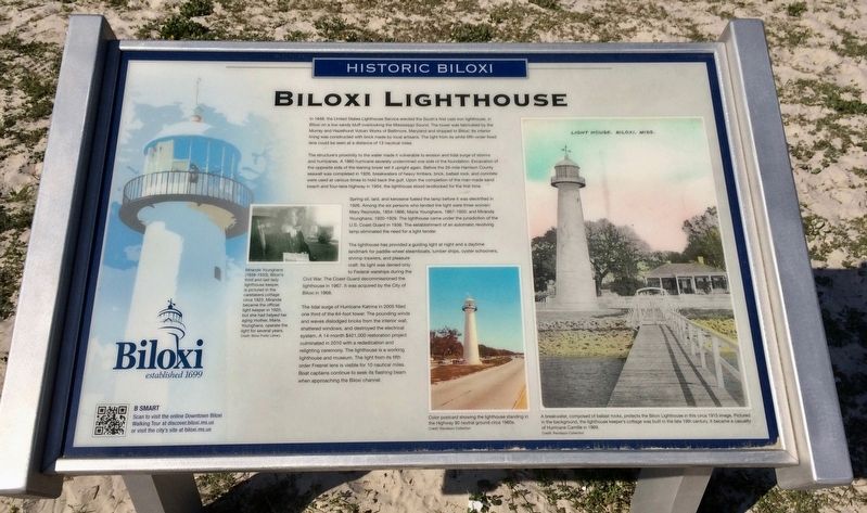
The structure's proximity to the water made it vulnerable to erosion and tidal surge of storms and hurricanes. A 1860 hurricane severely undermined one side of the foundation. Excavation of the opposite side of the leaning tower set it upright again. Before the 26-mile Harrison County seawall was completed in 1926, breakwaters of heavy timbers, brick, ballast rock, and concrete were used at various times to hold back the gulf. Upon the completion of the man-made sand beach and four lane highway in 1954, the lighthouse stood landlocked for the first time.
Spring oil, lard, and kerosene fueled the lamp before it was electrified in 1926. Among the six persons who tended the light were three women: Mary Reynolds, 1854-1866; Maria Younghans, 1867-1920; and Miranda Younghans, 1920-1929. The lighthouse came under the jurisdiction of the U.S. Coast Guard in 1938. The establishment of an automatic revolving lamp eliminated the need for a light tender.
The lighthouse has provided a guiding light at night and a daytime landmark for paddle-wheel steamboats, lumber ships, oyster schooners, shrimp trawlers, and pleasure craft. Its light was denied only to Federal warships during the Civil War. The Coast Guard decommissioned the lighthouse in 1967. lt was acquired by the City of Biloxi in 1968.
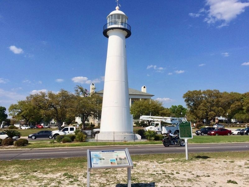
The tidal surge of Hurricane Katrina in 2005 filled one third of the 64-foot tower. The pounding winds and waves dislodged bricks from the interior wall shattered windows, and destroyed the electrical system. A 14-month $421,000 restoration project culminated in 2010 with a rededication and relighting ceremony. The lighthouse is a working lighthouse and museum. The light from its fifth order Fresnel lens is visible for 10 nautical miles. Boat captains continue to seek its flashing beam when approaching the Biloxi channel.
[Photo captions]
Left middle: Miranda Younghans (1853-1933), Biloxi's third and last lady lighthouse keeper, is pictured in the caretakers cottage circa 1923. Miranda became the official light keeper in 1920, but she had helped her aging mother, Maria Younghans, operate the light for several years.
Credit: Biloxi Public Library
Bottom middle: Color postcard showing the
lighthouse standing in the Highway 90 neutral ground circa 1960s.
Credit: Randazzo Collection
Bottom right: A breakwater, composed of ballast rocks, protects the Biloxi Lighthouse in this circa 1915 image. Pictured in the background, the lighthouse keeper's cottage was built in the late 19th century. It became a casualty of Hurricane Camille in 1969.
Credit: Randazzo Collection
Erected 2015 by the City of Biloxi.
Topics and series. This historical marker is listed in these topic lists: Disasters • Notable Places • War, US Civil • Waterways & Vessels. In addition, it is included in the Lighthouses series list. A significant historical year for this entry is 1848.
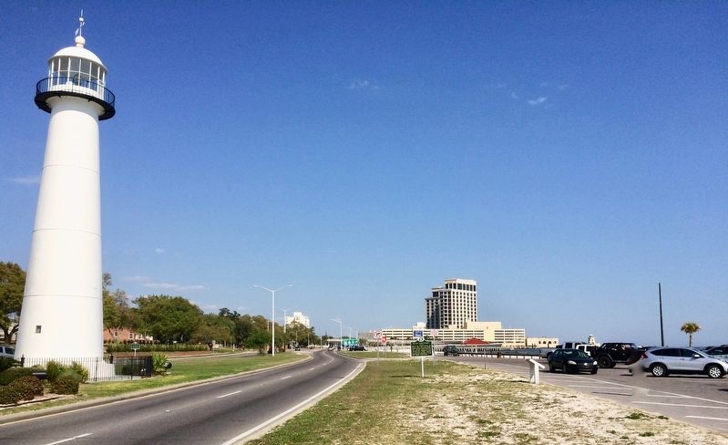
Location. 30° 23.654′ N, 88° 54.077′ W. Marker is in Biloxi, Mississippi, in Harrison County. Marker is at the intersection of Beach Boulevard (U.S. 90) and Porter Avenue, on the right when traveling east on Beach Boulevard. Located in the Biloxi Pier parking area, across from the Lighthouse. Touch for map. Marker is at or near this postal address: 1050 Beach Boulevard, Biloxi MS 39530, United States of America. Touch for directions.
Other nearby markers. At least 8 other markers are within walking distance of this marker. A different marker also named Biloxi Lighthouse (here, next to this marker); a different marker also named The Biloxi Lighthouse (a few steps from this marker); Astronaut Fred Haise
(within shouting distance of this marker); Biloxi Beach Wade-In (within shouting distance of this marker); Design for Future Beach Wade-In Memorial (within shouting distance of this marker); Sea Turtles of the Mississippi Sound (within shouting distance of this marker); Civil Rights Wade-Ins (within shouting distance of this marker); The Landing of Pierre LeMoyne D'Iberville (within shouting distance of this marker). Touch for a list and map of all markers in Biloxi.
Also see . . . Wikipedia article on the Biloxi Lighthouse. (Submitted on March 24, 2017, by Mark Hilton of Montgomery, Alabama.)
Credits. This page was last revised on February 22, 2022. It was originally submitted on March 24, 2017, by Mark Hilton of Montgomery, Alabama. This page has been viewed 520 times since then and 29 times this year. Photos: 1, 2, 3. submitted on March 24, 2017, by Mark Hilton of Montgomery, Alabama. 4. submitted on February 16, 2022, by Craig Doda of Napoleon, Ohio.


