Tupelo in Lee County, Mississippi — The American South (East South Central)
Tupelo Campaign: Harrisburg July 14
Inscription.
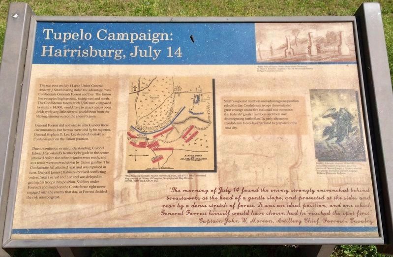
The sun rose on July 14 with Union General Andrew J. Smith having stolen the advantage from
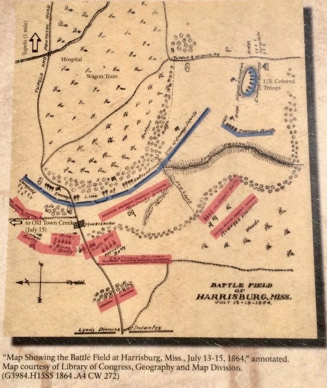
Confederate Generals Forrest and Lee. The Union line occupied high ground, facing west and north
The Confederate forces, with 7,500 men compared to Smith's 14,000, would have to attack across open fields with very little cover to shield them from the blazing summer sun or the enemy's guns.
General Forrest did not wish to attack under these circumstances, but he was overruled by his superior General Stephen D. Lee. Lee decided to make a frontal assault on the Union position.
Due to confusion or misunderstanding, Colonel Edward Crossland's Kentucky brigade in the center attacked before the other brigades were ready, and as a result were mowed down by Union gunfire. The Confederate left attacked next and was repulsed in turn. General James Chalmers received conflicting orders from Forrest and Lee and was delayed in getting his troops into position. Soldiers under Forrest's command on the Confederate right never engaged with the enemy that day, as Forrest decided the risk was too great.
Smith's superior numbers and advantageous position ruled the day. Confederate troops demonstrated great courage under fire but could not overcome the Federals' greater numbers and their own disintegrating battle plan. By early afternoon Confederate forces had retreated to prepare for the next day.
"The morning of July 14 found the enemy strongly entrenched behind breastworks at the head of a gentle slope, and protected at the sides and rear by a dense stretch of forest. It was an ideal position, and one which General Forrest himself would have chosen had he reached the spot first."
Captain John W. Morton, Artillery Chief, Forrest's Cavalry
[Photo Captions]
Top Right: "Battle Field of Tupelo. House of the Three Chimneys,"
by Elijah E. Edwards, chaplain of the 7th Minnesota Infantry.
DePauw University Archives.
Right Middle: Elijah E. Edwards, chaplain of the 7th
Minnesota Infantry, drew this
picture of General Joseph A. Mower, who led
the infantry during the Tupelo Campaign.
DePauw University Archives.
Erected by the Civil War Trust.
Topics. This historical marker is listed in this topic list: War, US Civil. A significant day of the year for for this entry is July 14.
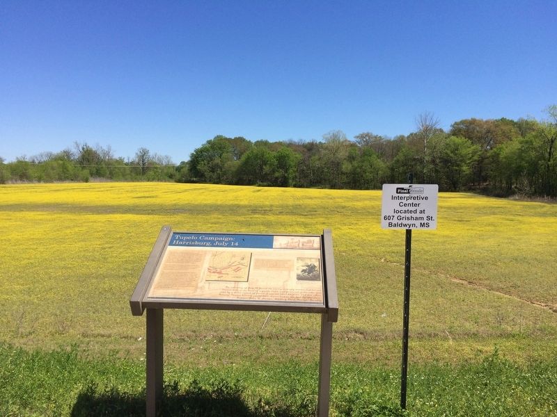
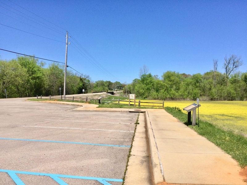
Location. 34° 18.428′ N, 88° 44.254′ W. Marker is in Tupelo, Mississippi, in Lee County. Marker is on Mt. Vernon Road north of Creely Road, on the right when traveling north. Touch for map. Marker is at or near this postal address: 3454 Mt Vernon Road, Tupelo MS 38804, United States of America. Touch for directions.
Other nearby markers. At least 8 other markers are within
4 miles of this marker, measured as the crow flies. Tupelo Campaign: Pontotoc Road, July 13 (a few steps from this marker); Tupelo Campaign: Old Town Creek, July 15 (a few steps from this marker); Natchez Trace at Lee County (approx. 0.8 miles away); Old Town Creek (approx. 0.8 miles away); Chickasaw Village Site (approx. 2 miles away); Carver School / Desegregation of Schools Across the South (approx. 3 miles away); The Green Street Business District / Social Hub (approx. 3.1 miles away); Mayhorn Grocery (approx. 3.2 miles away). Touch for a list and map of all markers in Tupelo.
Regarding Tupelo Campaign: Harrisburg July 14. Following the repulse near Tupelo July 14, Federal troops moved north and camped at Old Town Creek. The Confederates mounted a surprise attack on the camp July 15, but the Southerners were repulsed. Forrest was wounded during the fight and was kept out of action for three weeks. A 12-acre section of the battlefield has been preserved.
Also see . . . Wikipedia article on the Battle of Tupelo. (Submitted on April 14, 2017, by Mark Hilton of Montgomery, Alabama.)
Credits. This page was last revised on April 14, 2017. It was originally submitted on April 14, 2017, by Mark Hilton of Montgomery, Alabama. This page has been viewed 423 times since then and 32 times this year. Photos: 1, 2, 3, 4. submitted on April 14, 2017, by Mark Hilton of Montgomery, Alabama.


