Near Spotsylvania Courthouse in Spotsylvania County, Virginia — The American South (Mid-Atlantic)
Grant's May 18th Attack
The Battle of Spotsylvania Court House
— Fredericksburg and Spotsylvania National Military Park —
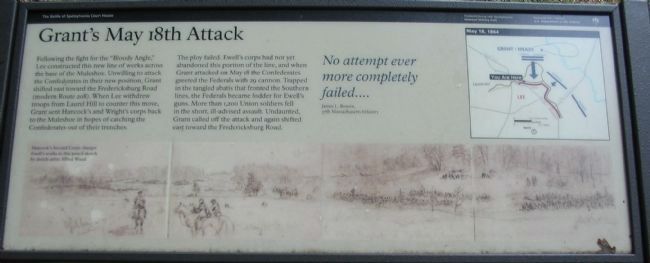
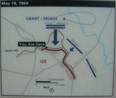
Following the fight for the "Bloody Angle," Lee constructed this new line of works across the base of the Muleshoe. Unwilling to attack the Confederates in their new position, Grant shifted east toward the Fredericksburg Road (modern Route 208). When Lee withdrew troops from Laurel Hill to counter this move, Grant sent Hancock's and Wright's corps back to the Muleshoe in hopes of catching the Confederates out of their trenches.
The ploy failed. Ewell's corps had not yet abandoned this portion of the line, and when Grant attacked on May 18 the Confederates greeted the Federals with 29 cannon. Trapped in the tangled abatis that fronted the Southern lines, the Federals became fodder for Ewell's guns. More than 1,200 Union soldiers fell in the short, ill-advised assault. Undaunted, Grant called off the attack and gain shifted east toward the Fredericksburg Road.
No attempt more completely failed ....
James L. Bowen
17th Massachusetts Infantry
Erected by National Park Service, U.S. Department of the Interior.
Topics. This historical marker is listed in this topic list: War, US Civil. A significant historical month for this entry is May 1862.
Location. 38° 12.851′ N, 77° 36.471′ W. Marker is near Spotsylvania Courthouse, Virginia, in Spotsylvania County. Marker is on Anderson Drive, on the right when traveling south. Located beyond stop four (Harrison House) on the driving tour of Spotsylvania Battlefield unit of the Fredericksburg and Spotsylvania National Military Park. Touch for map. Marker is in this post office area: Spotsylvania VA 22553, United States of America. Touch for directions.
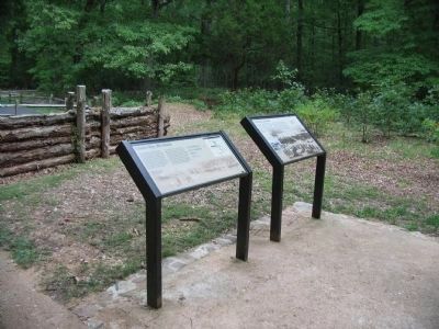
Other nearby markers. At least 8 other markers are within walking distance of this marker. Civil War Earthworks (a few steps from this marker); Spotsylvania Campaign (a few steps from this marker); a different marker also named Spotsylvania Campaign (within shouting distance of this marker); Lee's Last Line (approx. 0.2 miles away); Harrison House Site (approx. 0.3 miles away); Lee to the Rear! (approx. 0.3 miles away); The Harrison House (approx. 0.3 miles away); Fight for the Fences (approx. 0.4 miles away). Touch for a list and map of all markers in Spotsylvania Courthouse.
More about this marker. Across the lower half of the marker is a series of sketches making a panorama of the battlefield. Hancock's Second Corps charges Ewell's works in this pencil sketch by sketch-artist Alfred Waud. On the upper right is a map illustrating the tactical maneuvers discussed in the text.
Also see . . . History of the Battle of Spotsylvania Court House. National Park Service website entry (Submitted on December 7, 2022, by Larry Gertner of New York, New York.)

Photographed By Craig Swain, July 6, 2008
4. Hancock and Wright Attack
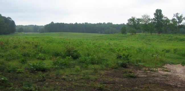
Looking north from a point on the Spotsylvania History Trail loop, north of the marker location. In this view is the Harrison House site (on the right in the stand of trees) and the road leading to the McCoull House (distant center). At the time of the battle, the open fields here extended further south to the area of Ewell's entrenchments. However, most of the ground was covered with debris from previous fighting and obstacles laid by the Confederates to defend this sector. The Federal advance was toward the camera's point of view from the distant tree lines.
Credits. This page was last revised on December 7, 2022. It was originally submitted on August 15, 2008, by Craig Swain of Leesburg, Virginia. This page has been viewed 930 times since then and 14 times this year. Photos: 1, 2. submitted on August 15, 2008, by Craig Swain of Leesburg, Virginia. 3. submitted on August 25, 2008, by Craig Swain of Leesburg, Virginia. 4. submitted on August 15, 2008, by Craig Swain of Leesburg, Virginia.


