Near Spotsylvania Courthouse in Spotsylvania County, Virginia — The American South (Mid-Atlantic)
Farm to Killing Field
The Battle of Spotsylvania Court House
— Fredericksburg and Spotsylvania National Military Park —
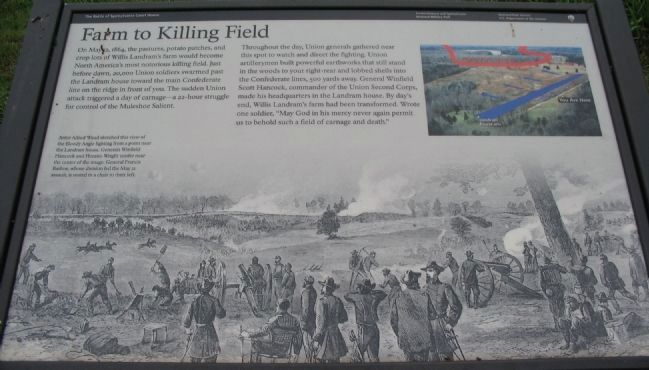
On May 12, 1864, the pastures, potato patches, and crop-lots of Willis Landram's farm would become North America's most notorious killing field. Just before dawn, 20,000 Union soldiers swarmed past the Landram house toward the main Confederate line on the ridge in front of you. The sudden Union attack triggered a day of carnage - a 22-hour struggle for control of the Muleshoe Salient.
Throughout the day, Union generals gathered near this spot to watch and direct the fighting. Union artillerymen built powerful earthworks that still stand in the woods to your right-rear and lobbed shells into the Confederate lines, 500 yards away. General Winfield Scot Hancock, commander of the Union Second Corps, made his headquarters in the Landram house. By day's end, Willis Landram's farm had been transformed. Wrote one soldier, "May God in his mercy never again permit us to behold such a field of carnage and death."
Erected by National Park Service, U.S. Department of the Interior.
Topics. This historical marker is listed in this topic list: War, US Civil. A significant historical month for this entry is May 1856.
Location. 38° 13.654′ N, 77° 35.717′ W. Marker is near Spotsylvania Courthouse, Virginia, in Spotsylvania County. Marker can be reached from Grant Drive , on the left when traveling east. Located on the Bloody Angle trail at tour stop three (Bloody Angle) on the driving tour of Spotsylvania Battlefield unit of the Fredericksburg and Spotsylvania National Military Park. Touch for map. Marker is in this post office area: Spotsylvania VA 22553, United States of America. Touch for directions.
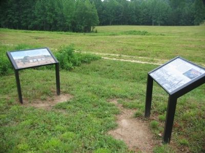
Other nearby markers. At least 8 other markers are within walking distance of this marker. The Landram House (here, next to this marker); a different marker also named Landram House (about 500 feet away, measured in a direct line); Landram Farm (about 600 feet away); Vista Clearing at Spotsylvania (approx. 0.2 miles away); Dawn Assault (approx. ¼ mile away); Spotsylvania Campaign (approx. 0.3 miles away); a different marker also named Spotsylvania Campaign (approx. 0.3 miles away); Fatal Mistake at the East Angle (approx. 0.3 miles away). Touch for a list and map of all markers in Spotsylvania Courthouse.
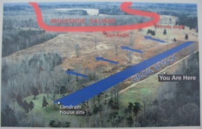
More about this marker. Artist Alfred Waud sketched this view, used as the background of the marker, of the Bloody Angle fighting from a point near the Landram house. Generals Winfield Hancock and Horatio Wright confer near the center of the image. General Francis Barlow, whose division led the May 12 assault, is seated in a chair to their left. An aerial photograph in the upper right has the lines of battle superimposed on the modern terrain.
Also see . . . Bloody Angle. National Park Service website entry (Submitted on August 15, 2008, by Craig Swain of Leesburg, Virginia.)

Photographed By Craig Swain, July 6, 2008
4. East Angle and Bloody Angle
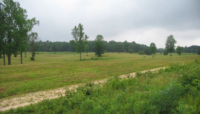
Looking east from the marker location. East Angle, the north edge of the Confederate defenses is just left of center. The Bloody Angle is to the right of center at the tree line. The open ground here had to be crossed quickly in order to allow the maximum amount of force to be applied to breaking through the Confederate lines.
Credits. This page was last revised on December 7, 2022. It was originally submitted on August 15, 2008, by Craig Swain of Leesburg, Virginia. This page has been viewed 1,382 times since then and 14 times this year. Photos: 1, 2, 3, 4. submitted on August 15, 2008, by Craig Swain of Leesburg, Virginia.


