North Newport News , Virginia — The American South (Mid-Atlantic)
Battle of Dam No. 1
The Water Boiled with Bullets
— 1862 Peninsula Campaign —
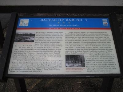
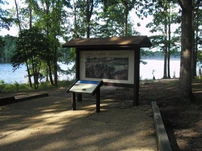
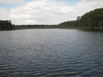
You are presently standing at the site of Dam No. 1, one of three dams constructed by Confederate commander John Bankhead Magruder to make the sluggish Warwick River into a defensive barrier. Dam No. 1 was the mid-point between two prewar tide mills at Lee’s Mill and Wynne’s Mill. The Union attack against the Confederate earthworks across the river on April 16, 1862, would veer to the left of the existing foot bridge.
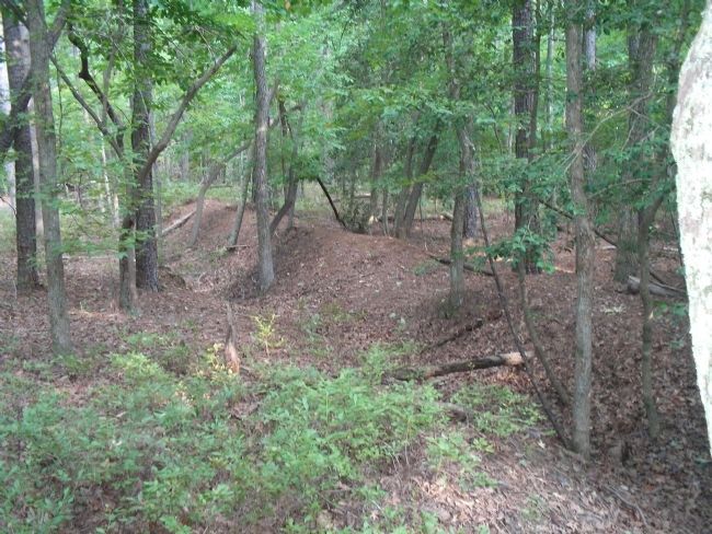
On April 5, 1862, Maj. Gen. George B. McClellan’s Union army found its progress toward Richmond blocked by the Confederate fortifications at Lee’s Mill. As the Union commander investigated the entire Warwick-Yorktown line, “Prince John” Magruder “played his ten thousand before McClellan like fireflies,” wrote diarist Mary Chestnut, “and utterly deluded him.” McClellan, despite outnumbering the Confederates almost ten to one, resolved to besiege the Southern defenses.
Southern soldiers expected an assault at any time, as Surgeon James Holloway of the 18th Mississippi wrote, “why they do not attack is strange for they have a heavy force and every day’s delay only gives us the opportunity to strengthen our defenses.” An attack finally came on April 16, 1862, when McClellan ordered Brig. Gen. William F. “Baldy” Smith, USA, to disrupt the Confederate control of Dam No. 1.
On the morning of April 16, Union artillery, including Mott’s 3rd New York Battery, began shelling the Confederate earthworks. By noon it appeared as if the Southerners had abandoned their defenses, and at 3:00 p.m. Smith sent 200 men of the 3rd Vermont forward as skirmishers. The Vermonters dashed across the river and captured the first line of rifle pits held by the 15th North Carolina. The Federal troops, however, were forced to withdraw under the stress of a vicious counterattack by Cobb’s Georgia Legion since their ammunition was wet and they had not received any reinforcements. The water “Boiled with bullets” as the Vermonters recrossed “that fatal stream.” A second attempt to capture Dam No. 1 failed to reach the Confederate lines as the Southerners had reinforced the position. The engagement resulted in 165 Federal and 145 Confederate casualties. Pvt. Wilbur Fisk, of the 2nd Vermont, called the battle, “nothing but a dam failure.”
The April 16, 1862, Battle of Dam No. 1 (also called the Battle of Burnt Chimneys) was a missed opportunity for the Union to break the Warwick River defenses. Two Federal soldiers, Capt. Samuel E. Pingree and musician Julian Scott, were awarded the Medal of Honor for heroism during the short, vicious fight along “a creek with a wide dam, which drank the blood of many of our men.”
(captions)
Ayer's battery crossing on rebel dam at Dam No. 1 - Courtesy of Vermont Historical Society
Burial of Vermont Brigade members killled during April 16, 1862 engagement. Courtesy of Vermont Historical Society
Erected by Virginia Civil War Trails.
Topics and series. This historical marker is listed in these topic lists: Notable Events • Notable Places • War, US Civil. In addition, it is included in the Virginia Civil War Trails series list. A significant historical date for this entry is April 16, 1862.
Location. 37° 10.967′ N, 76° 32.193′ W. Marker is in Newport News, Virginia. It is in North Newport News. Marker is on Constitution Way, on the left when traveling east. Marker is located in Newport News Park, near the Discovery Center. Touch for map. Marker is in this post office area: Newport News VA 23603, United States of America. Touch for directions.
Other nearby markers. At least 8 other markers are within walking distance of this marker. Battle of Lee’s Mill (Dam Number 1) (here, next to this marker); Third Regiment Vermont Volunteer Infantry (a few steps from this marker); Peninsula Campaign Warwick River (about 400 feet away, measured in a direct line); Mott’s Battery (about 400 feet away); Ten Pound Parrott Rifle and Limber (about 400 feet away); Custer’s Covered Way (approx. 0.2 miles away); One-Gun Battery
(approx. 0.2 miles away); “Their Conduct was Worthy of Veterans” (approx. ¼ mile away). Touch for a list and map of all markers in Newport News.
More about this marker. The marker contains two war-time photographs, courtesy of Vermont Historical Society. One, in the upper left of the marker, shows “Ayer’s Battery crossing on rebel dam at Dam No. 1.” The other photograph, on the bottom of the marker, shows the “Burial of Vermont Brigade members killed during the April16, 1862, engagement.”
Related markers. Click here for a list of markers that are related to this marker. Markers on the Two Forts Walking Trail in Newport News Park.
Also see . . . Civil War Yorktown. Yorktown Battlefield, National Park Service website entry (Submitted on August 17, 2008.)
Credits. This page was last revised on February 29, 2024. It was originally submitted on August 17, 2008, by Bill Coughlin of Woodland Park, New Jersey. This page has been viewed 26,602 times since then and 9,578 times this year. Last updated on August 28, 2021, by Bradley Owen of Morgantown, West Virginia. Photos: 1, 2, 3, 4. submitted on August 17, 2008, by Bill Coughlin of Woodland Park, New Jersey. • Bernard Fisher was the editor who published this page.


