Near San Miguel de Allende, Guanajuato, Mexico — The Central Highlands (North America)
Ceremonial Road
Inscription.
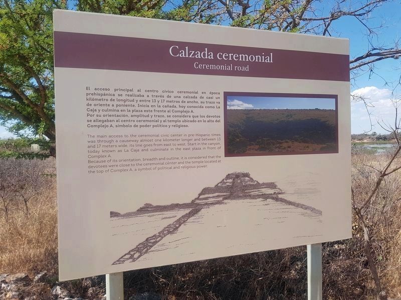
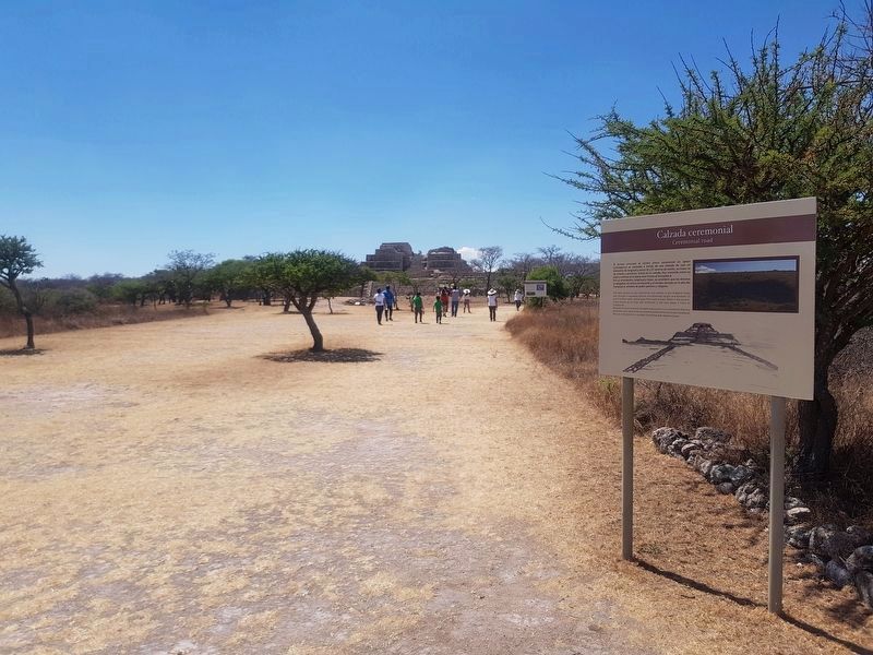
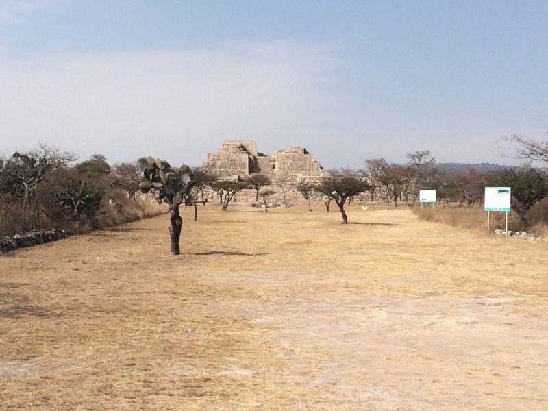
El acceso principal al centro cívico ceremonial en época prehispánica se realizaba a traves de una calzada de casi un kilómetro de longitud y entre 13 y 17 metros de ancho, su trazo va de oriente a poniente. Inicia en la cañada, hoy conocida como La Caja, y culmina en la plaza este frente al Complejo A.
Por su orientación, amplitud y trazo, se considera que los devotos se allegaban al centro ceremonial y al templo ubicado en lo alto del Complejo A, símbolo de poder político y religioso.
Ceremonial road
The main access to the ceremonial civic center in pre-Hispanic times was through a causeway almost one kilometer longer and between 13 and 17 meters wide, its line goes from east to west. Start in the canyon, today known as La Caja (“The Box”) and culminate in the east plaza in front of Complex A.
Because of its orientation, breadth and outline, it is considered that the devotees were close to the ceremonial center and the temple located at the top of Complex A, a symbol of political and religious power.
Erected by Consejo Nacional para la Cultura y las Artes de México (CONACULTA)-INAH.
Topics. This historical marker is listed in these topic lists: Anthropology & Archaeology • Man-Made Features • Native Americans.
Location. 20° 51.518′ N, 100° 55.618′ W. Marker is near San Miguel de Allende, Guanajuato. Marker can be reached from Route 67. The marker is the first marker to the right upon entering the archaeological site of Cañada de la Virgen. The archaeological site of Cañada de la Virgen is to the left when traveling north on State Road 67, some 30 km west of San Miguel de Allende. Touch for map. Marker is in this post office area: San Miguel de Allende GTO 37701, Mexico. Touch for directions.
Other nearby markers. At least 8 other markers are within walking distance of this marker. Cañada de la Virgen: A Ceremonial Civic Center in the Laja River Basin Marker (within shouting distance of this marker); Complex A The House of the Thirteen Heavens (about 90 meters away, measured in a direct line); Observing the Stars (about 120 meters away); Burial 13 The hierarch and ancestral veneration (about 180 meters away); Layout and Architecture (about 210 meters away); Complex B: The House of the Longest Night (about 210 meters away); Complex D. The wind house. (The house of the wind) (about 210 meters away); Burial 18 The Decapitated Man (approx. 0.2 kilometers away). Touch for a list and map of all markers in San Miguel de Allende.
Regarding Ceremonial Road. The previous marker had the following text:
Calzada ceremonial
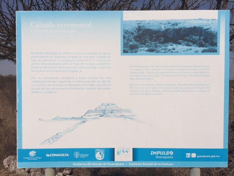
El acceso principal al centro cívico ceremonial en época prehispánica se realizaba a traves de una gran calzada de casi un kilómetro de longitud y entre 13 y 17 metros de ancho. Ésta se diseño con un trazo de oriente a poniente. Inicia en la cañada, hoy conocida como La Caja, y culmina en la plaza este frente al Complejo A.
Por su orientación, amplitud y trazo urbano fue una vialidad por la que, siguiendo el transcurso del sol, del día y la noche, los devotos se allegaban al templo ubicado en lo alto de las estructuras piramidales, símbolo del poder político y religioso.
English:
Ceremonial avenue
In Pre-Hispanic time, the main Access to the ceremonial centre was via a large avenue almost a kilometer long and between 13 and 17 meters wide. This avenue extends from east to west, starting in the George (sic, Gorge) Known as La Caja (“The Box”) and ending in the eastern plaza
opposite Complex
A.
Due to its orientation, width and layout, following the movement of the sun, day and night, the devout used this avenue to reach the temple situated at the top of the pyramidal structures, symbolic of political and religious power.
Credits. This page was last revised on September 1, 2020. It was originally submitted on May 21, 2017, by J. Makali Bruton of Accra, Ghana. This page has been viewed 131 times since then and 12 times this year. Photos: 1. submitted on May 20, 2019, by J. Makali Bruton of Accra, Ghana. 2. submitted on May 21, 2017, by J. Makali Bruton of Accra, Ghana. 3. submitted on May 20, 2019, by J. Makali Bruton of Accra, Ghana. 4. submitted on May 21, 2017, by J. Makali Bruton of Accra, Ghana.


