Beverly in Washington County, Ohio — The American Midwest (Great Lakes)
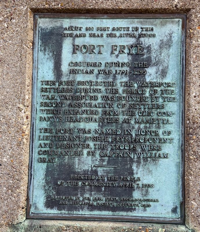
Fort Frye
This fort protected the Waterford settlers during the period of the war. Waterford was founded by the Second Association of Settlers which expanded from the Ohio Company’s headquarters at Marietta.
The fort was named in honor of Lieutenant Joseph Frye, proponent and designer. The troops were commanded by Captain William Gray.
Erected 1938 by the people of this community, on April 7. Approved by the Ohio State Archaeological and Historical Society, Columbus, Ohio.
Topics and series. This historical marker is listed in these topic lists: Forts and Castles • Settlements & Settlers • Wars, US Indian. In addition, it is included in the Ohio Historical Society / The Ohio History Connection series list. A significant historical year for this entry is 1791.
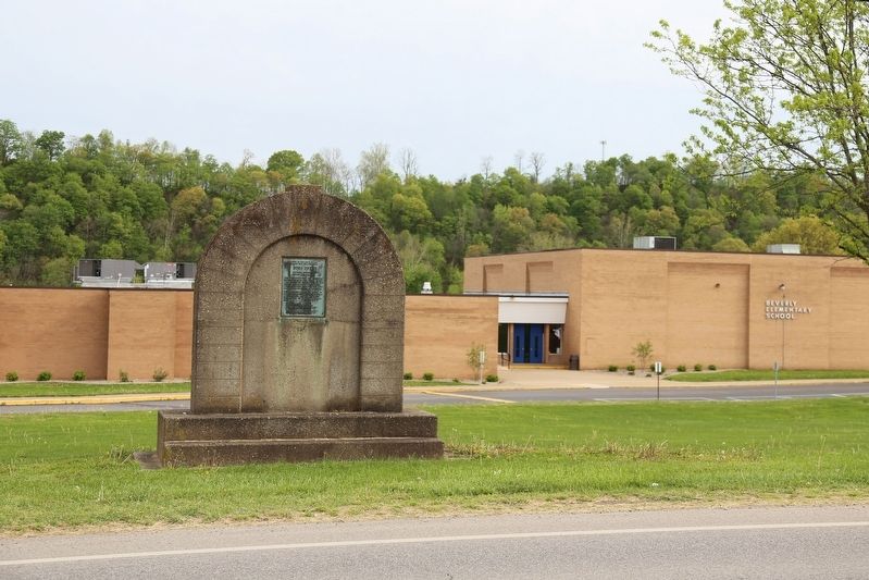
Location. 39° 32.961′ N, 81° 37.784′ W. Marker is in Beverly, Ohio, in Washington County. Marker is on 5th Street (Ohio Route 60) west of Rose Lane Drive, on the left when traveling west. Touch for map. Marker is at or near this postal address: 510 5th St, Beverly OH 45715, United States of America. Touch for directions.
Other nearby markers. At least 8 other markers are within 7 miles of this marker, measured as the crow flies. Steamer Buckeye Belle (approx. 0.2 miles away); The Buckeye Belle Explosion (approx. 0.7 miles away); The Peninsula (approx. 0.8 miles away); Round Bottom Schoolhouse / Round Bottom Cemetery (approx. 2.3 miles away); Water Power on the Muskingum River (approx. 4.9 miles away); Fortified Settlement (approx. 6.8 miles away); Lowell Veterans Memorial (approx. 6.8 miles away); Covered Bridges (approx. 6.8 miles away). Touch for a list and map of all markers in Beverly.
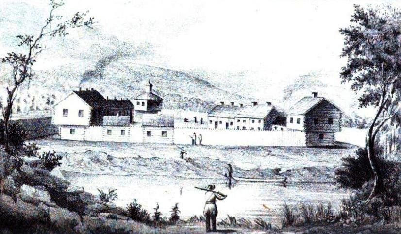
Also see . . . Wikipedia Entry. “The form of the fort was triangular, which was rather uncommon in military defenses. But as they were in a hurry, and it saved them one line of curtains, while the block houses at the angles defended the sides just as well as in any other form, it was adopted. The base of the triangle rested on the river, distant only a few paces from the bank, and was about two hundred feet in length. One of the other sides was somewhat longer, so that the work was not a regular triangle. At each corner, was a two story block house, twenty feet square below, and a foot or two more above. The two longer sides were filled in with dwelling houses, some of which were two stories high, and others of a less hight, while a considerable portion were built barrack fashion, with only one roof, pitched inward, so that the rain from it fell within the garrison. The spaces not occupied by buildings were filled in with stout pickets. Broad, substantial gates, near the northern block house, led out through the palisades into the highway and fields, while a smaller one in the curtain on the bank, called the water gate, afforded an opening to the river. A line of palisades, twelve feet high, at the distance of thirty feet, inclosed the whole, and descended to the river” (Submitted on May 26, 2017.)

Via Wikipedia Commons, 1848
3. Fort Frye Marker
From the book by S. P. Hildreth Pioneer History: Being an Account of the First Examinations of the Ohio Valley, and the Early Settlement of the Northwest Territory, H. W. Derby and Co., Cincinnati, Ohio (1848). Illustration plate located between pp. 440-41.
Credits. This page was last revised on May 26, 2017. It was originally submitted on May 26, 2017, by J. J. Prats of Powell, Ohio. This page has been viewed 735 times since then and 85 times this year. Photos: 1, 2, 3. submitted on May 26, 2017, by J. J. Prats of Powell, Ohio.

