South Londonderry in Windhall in Bennington County, Vermont — The American Northeast (New England)
Scott Nearing & Helen Knothe Nearing
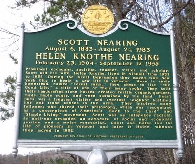
SCOTT NEARING (August 6, 1883 - August 24, 1983)
HELEN KNOTHE NEARING (February 23, 1904 - September 17, 1995)
Prominent economist, socialist, teacher, writer and scholar, Scott and his wife Helen Knothe, lived in Winhall from 1932 to 1952. During the Great Depression they moved from New York City to begin a new life in Vermont. Here in their homestead, named "Forest Farm", they chose to live "the Good Life," a title of one of their many books. They built their handcrafted stone houses, created fertile organic gardens, made maple sugar, and were sustained by the land. Pearl Buck was a frequent visitor and eventual neighbor building her own stone houses in the area. They inspired many followers who shared their philosophy, which was recognized as a centerpiece of America's "Back to the Land" and "Simple Living" movement. Scott was an outspoken radical, an anti-war crusader, an advocate of social and economic justice, and a strict vegetarian. Scott and Helen led the life of pioneers in Vermont and later in Maine, whence they moved in 1952.
Erected 2002 by Vermont Division for Historic Preservation.
Topics. This historical marker is listed in this topic list: Horticulture & Forestry. A significant historical year for this entry is 1932.
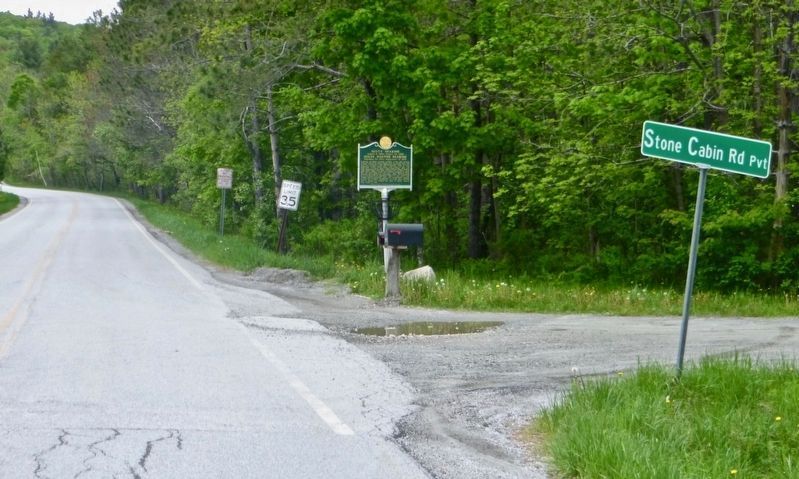
Location. 43° 6.866′ N, 72° 52.735′ W. Marker is in Windhall, Vermont, in Bennington County. It is in South Londonderry. Marker is at the intersection of Upper Taylor Hill Road and Stone Cabin Road, on the left when traveling south on Upper Taylor Hill Road. Touch for map. Marker is in this post office area: Bondville VT 05340, United States of America. Touch for directions.
Other nearby markers. At least 8 other markers are within 11 miles of this marker, measured as the crow flies. Jamaica Veterans Monument (approx. 5.2 miles away); Clarina Howard Nichols (approx. 8.7 miles away); Taft Homestead Site (approx. 8.7 miles away); The Manchester Depot (approx. 9.4 miles away); Legends & Lore - Manchester Vampire (approx. 9.7 miles away); Ye Olde Tavern (approx. 9.8 miles away); Lincoln’s "Hildene" (approx. 10.3 miles away); The Revolutionary War (approx. 10.3 miles away).
Credits. This page was last revised on February 16, 2023. It was originally submitted on May 4, 2016, by Dennis Gilkenson of Saxtons River, Vermont. This page has been viewed 599 times since then and 38 times this year. Last updated on May 29, 2017, by Dennis Gilkenson of Saxtons River, Vermont. Photos: 1. submitted on May 4, 2016, by Dennis Gilkenson of Saxtons River, Vermont. 2. submitted on May 29, 2017, by Dennis Gilkenson of Saxtons River, Vermont. • Bill Pfingsten was the editor who published this page.

