Fort Monroe in Hampton, Virginia — The American South (Mid-Atlantic)
Fort Monroe Seawall History
Protecting the Coast
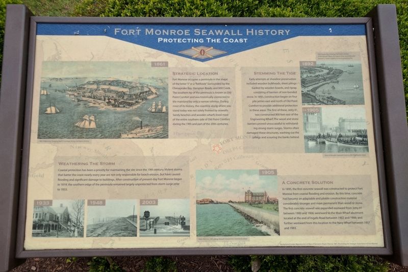
Strategic Location
Fort Monroe occupies a peninsula in the shape of the letter "J" or a “fishhook" surrounded by the Chesapeake Bay, Hampton Roads, and Mill Creek. The southern tip of the peninsula is known as Old Point Comfort and was historically connected to the mainland by only a narrow isthmus. During most of its history, the coastline along where you stand today was not solely fronted by seawalls. Sandy beaches and wooden wharfs lined most of the entire southern side of Old Point Comfort during the 19th and part of the 20th centuries.
Weathering the Storm
Coastal protection has been a priority for maintaining the site since the 19th century. Violent storms that batter the coast nearly every year are not only responsible for beach erosion, but have caused flooding and significant damage to buildings. After construction of present-day Fort Monroe began in 1819, the southern edge of the peninsula remained largely unprotected from storm surge prior to 1833.
Stemming the Tide
Early attempts at shoreline preservation included wooden bulkheads, sheet pilings backed by wooden boards, and riprap consisting of barriers of non-bonded stone. In 1891, construction began on four pile jetties east and north of Old Point Comfort to provide additional protection in these areas. The first of these, Jetty #1, was constructed 900 feet east of the Engineering Wharf. The wood and stone barriers proved unsuccessful to withstanding strong storm surges. Storms often damaged these structures, washing out the pilings and scouring the banks behind.
A Concrete Solution
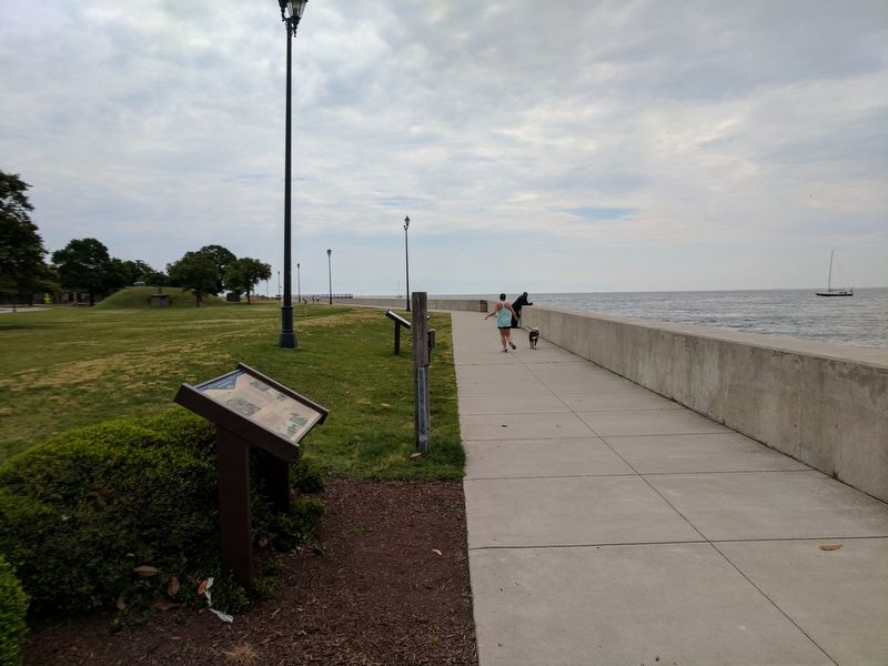
In 1895, the first concrete seawall was constructed to protect Fort Monroe from coastal flooding and erosion. By this time, concrete had become an adaptable and pliable construction material considerably stronger and more permanent than wood or stone. The first concrete seawall was expanded eastward from Jetty #1 between 1900 and 1906; westward to the Main Wharf abutment located at the end of Ingalls Road between 1902 and 1906; and further westward from this location to the Navy Wharf between 1957 and 1983.
(captions)
Background Image: Reproduction Map of Hampton Roads Area ca. 1861, Illustrating the Strategic Importance of Fort Monroe
1861 Engraving Showing Beach Frontage along Old Point Comfort
1892 Engraving Showing Old Point Comfort. A Promenade Fronts the Hygeia Hotel and a Wooden Seawall is Shown Leading to the Engineering Pier.
1905 View of Wooden Seawall Fronting the Chamberlin Hotel
Topics. This historical marker is listed in these topic lists: Forts and Castles • Man-Made Features.
Location. 37° 0.066′ N, 76° 18.433′ W. Marker is in Hampton, Virginia. It is in Fort Monroe. Marker is on Fenwick Road east of Engineer Lane, on the right when traveling east. Touch for map. Marker is in this post office area: Fort Monroe VA 23651, United States of America. Touch for directions.
Other nearby markers. At least 8 other markers are within walking distance of this marker. Engineer Wharf (here, next to this marker); a different marker also named Fort Monroe Seawall History (a few steps from this marker); Fort Monroe History (a few steps from this marker); Old Point Comfort Light (about 300 feet away, measured in a direct line); First Africans in Virginia (about 300 feet away); Jefferson Davis Memorial Arch (about 500 feet away); Notable Locations in the Hampton Roads (about 500 feet away); "Ruth Window" (about 500 feet away). Touch for a list and map of all markers in Hampton.
Also see . . .
1. Fort Monroe National Monument. National Park Service (Submitted on May 29, 2017.)
2. Fort Monroe (Stone Fort) National Register of Historic Places Registration Form. (Submitted on August 19, 2019.)
Credits. This page was last revised on February 1, 2023. It was originally submitted on May 29, 2017, by Bernard Fisher of Richmond, Virginia. This page has been viewed 293 times since then and 31 times this year. Photos: 1, 2, 3. submitted on May 29, 2017, by Bernard Fisher of Richmond, Virginia.


