Concord in Erie County, New York — The American Northeast (Mid-Atlantic)
Town of Concord
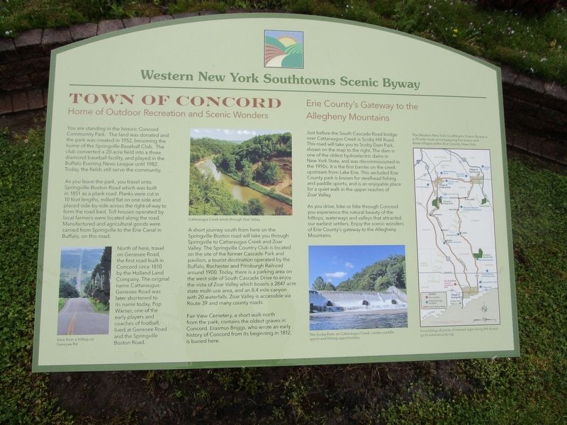
Western New York Southtowns Scenic Byway
— Home of Outdoor Recreation and Scenic Wonders —
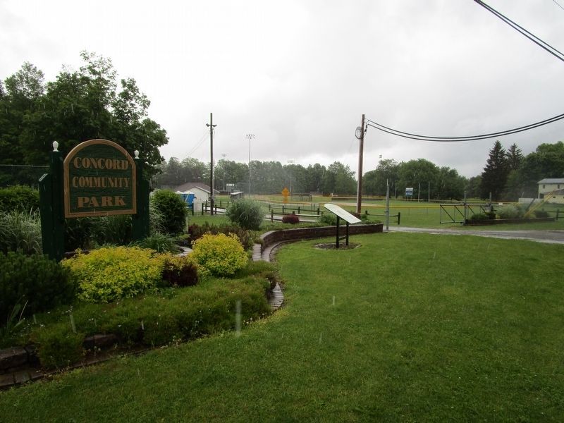
You are standing in the historic Concord Community Park. The land was donated and the park was created in 1952, becoming the home of the Springville Baseball Club. The club converted a 20 acre field into a three diamond baseball facility, and played in the Buffalo Evening News League until 1982. Today, the fields still serve the community.
As you leave the park, you travel onto Springville-Boston Road which was built in 1851 as a plank road. Planks were cut in 10 foot lengths, milled flat on one side and placed side-by-side across the right-of-way to form the road bed. Toll houses operated by local farmers were located along the road. Manufactured and agricultural goods were carried from Springville to the Erie Canal in Buffalo, on this road.
North of here, travel on Genesee Road, the first road built in Concord circa 1810 by the Holland Land Company. The original name Cattaraugus-Genesee Road was later shortened to its name today. Pop Warner, one of the early players and coaches of football, lived at Genesee Road and the Springville Boston Road.
View from a hilltop on Genesee Road. Cattaraugus Creek winds through Zoar Valley.
A short journey south from here on the Springville-Boston Road will take you through Springville to Cattaraugus Creek and Zoar Valley. The Springville Country Club is located on the site of the former Cascade Park and pavilion, a tourist destination operated by the Buffalo, Rochester and Pittsburgh Railroad around 1900. Today, there is a parking area on the west side of South Cascade Drive to enjoy the vista of Zoar Valley which boasts a 2847 acre state multi-use area, and an 8.4 mile canyon with 20 waterfalls. Zoar Valley is accessible via Route 39 and many country roads.
Fair View Cemetery, a short walk north from the park, contains the oldest graves in Concord. Erasmus Briggs, who wrote an early history of Concord from its beginning in 1812, is buried here.
Just before the South Cascade Road Bridge over Cattaraugus Creek is Scoby Dam Park, shown on the map to the right. The dam is one of the oldest hydroelectric dams in New York State, and was decommissioned in the 1990s. It is the first barrier on the creek upstream from Lake Erie. This secluded Erie County Park is known for steelhead fishing and paddle sports, and is an enjoyable place for a quiet walk in the upper reaches of Zoar Valley.
As you drive, bike or hike through Concord you experience the natural beauty of the hilltops, waterways and valleys that attracted our earliest settlers. Enjoy the scenic wonders of Erie County's gateway to the Allegheny Mountains.
The Scoby Dam, on Cattaraugus Creek, creates
paddle sports and fishing opportunities.
The Western New York Southtowns Scenic Byway is a 70 mile route encompassing five towns and three villages within Erie County, New York. For a listing of points of interest signs along the byway go to www.wnyssb.org .
Erected by Western New York Southtowns Scenic Byway.
Topics. This historical marker is listed in these topic lists: Cemeteries & Burial Sites • Charity & Public Work • Roads & Vehicles • Settlements & Settlers. A significant historical year for this entry is 1952.
Location. 42° 31.714′ N, 78° 40.168′ W. Marker is in Concord, New York, in Erie County. Marker is on Buffalo Road (County Route 413) 0.1 miles east of Springville Boston Road (County Route 228), on the left when traveling south. Touch for map. Marker is in this post office area: Springville NY 14141, United States of America. Touch for directions.
Other nearby markers. At least 8 other markers are within 2 miles of this marker, measured as the crow flies. First Settler - Town of Concord (approx. 1.2 miles away); George Schuster Wins 1908 NY to Paris Automobile Race (approx. 1.2 miles away); Our Honored Dead (approx. 1.3 miles away); First Church (approx. 1.3 miles away); Springville and Sardinia Narrow Gauge (approx. 1.3 miles away); Goddard Memorial Hall, 1902 (approx. 1.3 miles away); Concord (approx. 1.3 miles away); Springville Academy (approx. 1.3 miles away).
Also see . . . Western New York Southtowns Scenic Byway. (Submitted on June 8, 2017, by Anton Schwarzmueller of Wilson, New York.)
Credits. This page was last revised on June 8, 2017. It was originally submitted on June 8, 2017, by Anton Schwarzmueller of Wilson, New York. This page has been viewed 285 times since then and 14 times this year. Photos: 1, 2. submitted on June 8, 2017, by Anton Schwarzmueller of Wilson, New York.

