Princeton in Mercer County, New Jersey — The American Northeast (Mid-Atlantic)
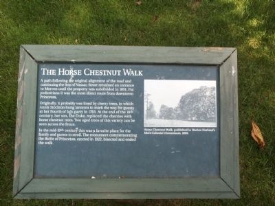
The Horse Chestnut Walk
A path following the original alignment of the road and continuing the line of Nassau Street remained an entrance to Morven until the property was subdivided in 1891. For pedestrians it was the most direct route from downtown Princeton.
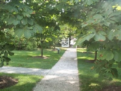
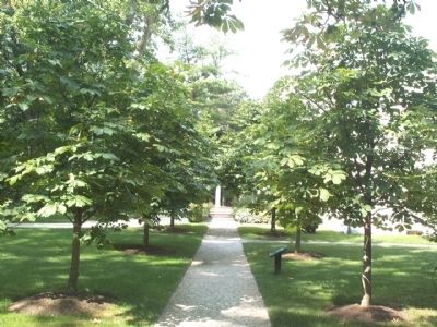
Originally, it probably was lined by cherry trees, in which Annis Stockton hung lanterns to mark the way for guests at her Fourth of July party in 1783. At the end of the 18th century, her son, the Duke, replaced the cherries with horse chestnut trees. Two aged trees of this variety can be seen across the fence.
In the mid-19th century this was a favorite place for the family and guests to stroll. The monument commemorating the Battle of Princeton, erected in 1922, bisected and ended the walk.
Topics. This historical marker is listed in these topic lists: Horticulture & Forestry • Roads & Vehicles. A significant historical year for this entry is 1891.
Location. This marker has been replaced by another marker nearby. It was located near 40° 20.834′ N, 74° 39.986′ W. Marker was in Princeton, New Jersey, in Mercer County. Marker could be reached from Stockton Street (U.S. 206). This marker is on the grounds of Morven Museum and Garden, on the walkway between the house and the adjacent municipal building and park. Touch for map. Marker was at or near this postal address: 55 Stockton Street, Princeton NJ 08540, United States of America. Touch for directions.
Other nearby markers. At least 8 other markers are within walking distance of this location. W 3 R (a few steps from this marker); “The Washington-Rochambeau Historic Route” (within shouting distance of this marker); The Great Lawn / Morven Museum & Garden (within shouting distance of this marker); a different marker also named Horse Chestnut Walk (within shouting distance of this marker); Princeton Battle Monument (within shouting distance of this marker); Colonel John Haslet (within shouting distance of this marker); Campsite of The Army of Louis XVI, King of France (within shouting distance of this marker); New Jersey Patriots (within shouting distance of this marker). Touch for a list and map of all markers in Princeton.
Related marker. Click here for another marker that is related to this marker. This marker has been replaced with the linked marker.
Also see . . . Morven Museum & Garden. (Submitted on August 20, 2008, by Kevin W. of Stafford, Virginia.)
Credits. This page was last revised on October 17, 2022. It was originally submitted on August 19, 2008, by Gary Nigh of Trenton, New Jersey. This page has been viewed 927 times since then and 9 times this year. Photos: 1, 2, 3. submitted on August 19, 2008, by Gary Nigh of Trenton, New Jersey. • Kevin W. was the editor who published this page.


