Binnenstad in Amsterdam, North Holland, Netherlands — Northwestern Europe
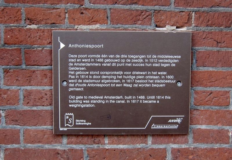
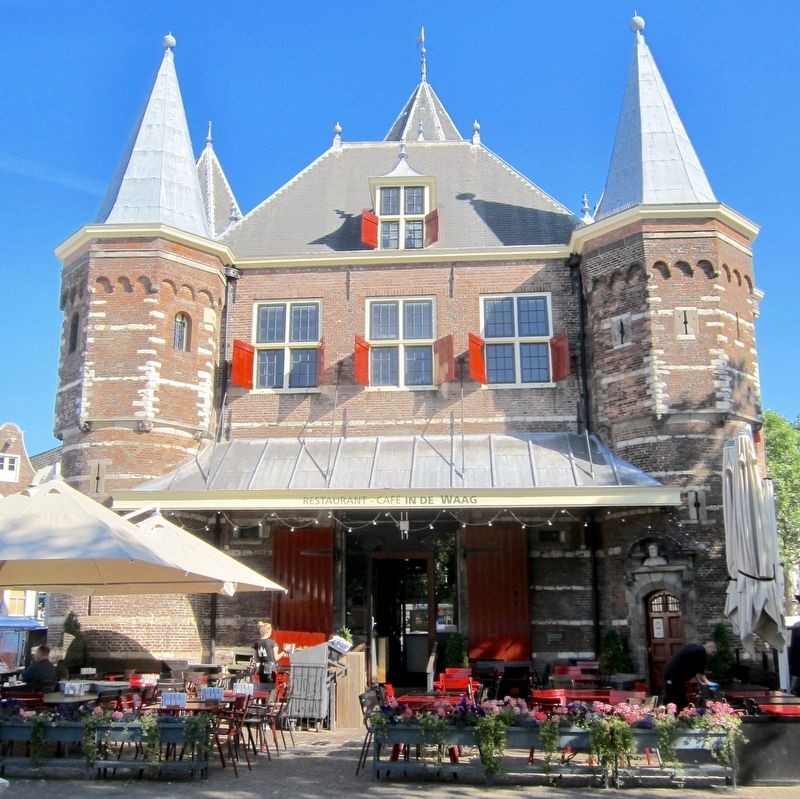
Anthoniespoort / St. Anthony's Gate
Het gebouw stond oorspronkelijk voor driekwart in het water. Pas in 1614 is door demping het huidige plein ontstaan. In 1600 werd de stadsmuur afgebroken, in 1617 besloot het stadsbestuur dat d'oude Antoniespoort tot een Waag zal worden bequam gemaect.
[English translation of the Dutch portion of the marker text:]
This gate was one of three access points to the medieval city and was built on the water in 1488. In 1512, from this point the Amsterdammers successfully defended their city against the Geldersen (attackers from the Utrecht and Gelderland areas).
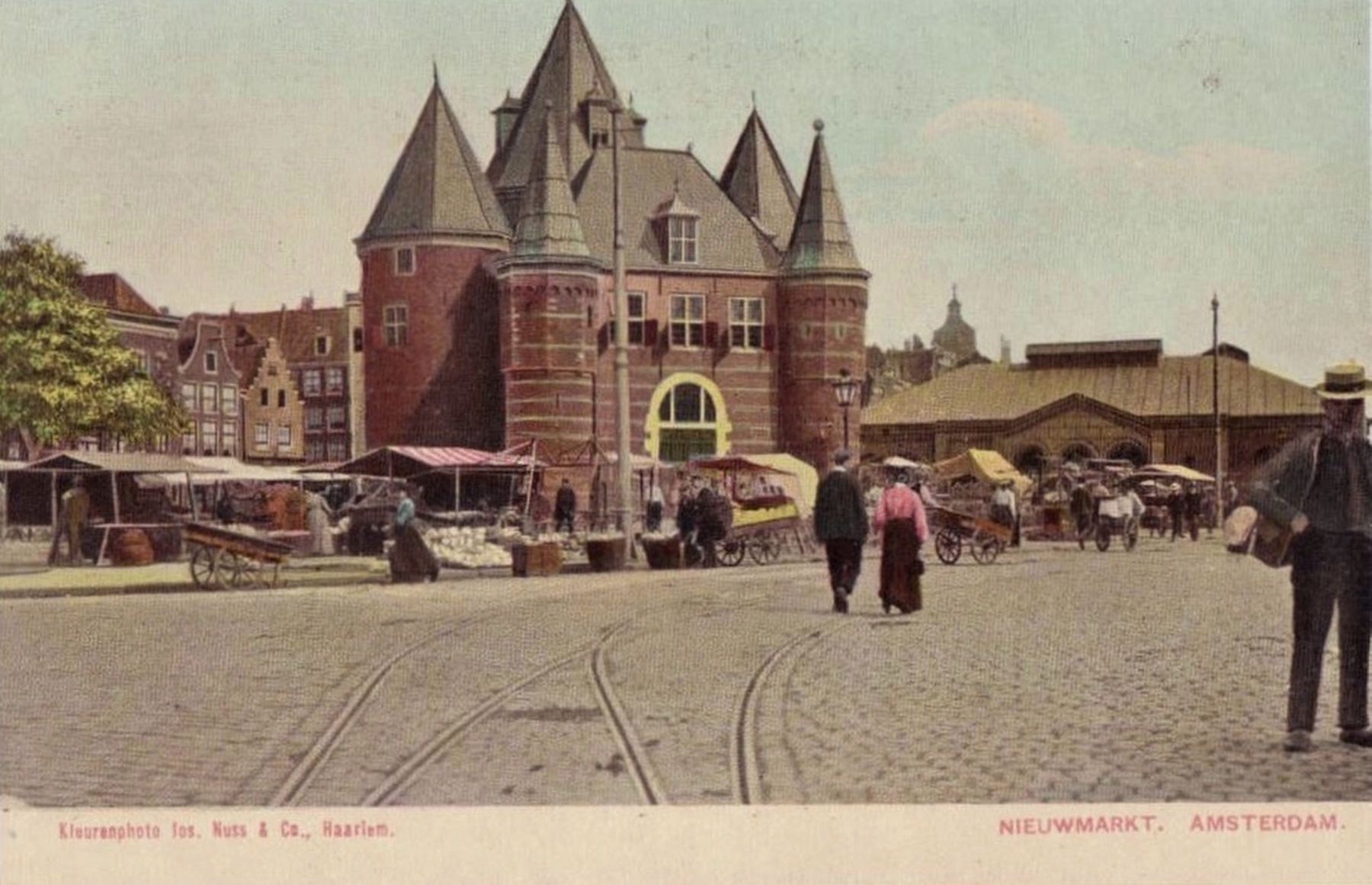
The building originally stood three-quarters in the water. Only in 1614 was the current surrounding square created by filling in the area. In 1600 the city walls were broken down, and in 1617 the city council decided that the old Antoniespoort shall would be converted to a weigh house.
Erected by Stichting Sciltraminghe, ANWB, Zimmermanfonds.
Topics. This historical marker is listed in these topic lists: Forts and Castles • Industry & Commerce.
Location. 52° 22.361′ N, 4° 54.027′ E. Marker is in Amsterdam, Noord-Holland (North Holland). It is in Binnenstad. Marker is at the intersection of Nieuwmarkt and Koningsstraat, on the left when traveling north on Nieuwmarkt. Touch for map. Marker is at or near this postal address: Nieuwmarkt 4, Amsterdam, Noord-Holland 1012 CR, Netherlands. Touch for directions.
Other nearby markers. At least 8 other markers are within walking distance of this marker. Long-time Apothecary (about 180 meters away, measured in a direct line); Peter Schat (about 210 meters away); Bet van Beeren (about 240 meters away); Municipal Morgue (approx. 0.3 kilometers away); Salomon Verbeeck (approx. 0.3 kilometers away); Jan Pietersz Sweelinck (approx. 0.3 kilometers away); Huis De Pinto (approx. 0.3 kilometers away); Dirck Volckertsz Coornhert (approx. 0.3 kilometers away). Touch for a list and map of all markers in Amsterdam.
Also see . . .
1. Haag, Amsterdam (Wikipedia). The Waag ("weigh house") is a 15th-century building on Nieuwmarkt square in Amsterdam. It was originally a city gate and part of the walls of Amsterdam. The building has also served as a guildhall, museum, fire station and anatomical theatre,
among others. The Waag is the oldest remaining non-religious building in Amsterdam. The building has held rijksmonument status since 1970....Originally, the building was one of the gates in the city wall, the Sint Antoniespoort (Saint Anthony's Gate). The gate was located at the end of the Zeedijk dike, which continued beyond the gate as the Sint Antoniesdijk... (Submitted on July 16, 2017.)
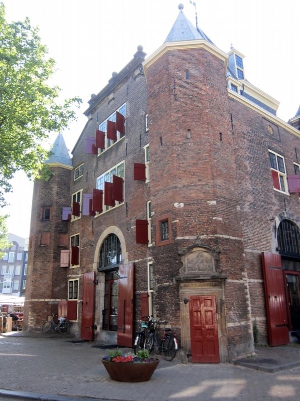
2. From City Gate to Weigh House (Café in de Waag). The weigh house was originally built in 1488 as one of Amsterdam’s city gates, St Anthony’s Port. A stone incorporated in the tower facing Zeedijk recalls the date in an inscription: In MCCCCLXXXVIII [1488] on the XXVII [27th] day of April the first stone of this port was laid.... St Anthony’s Port was one of Amsterdam’s three main gates. The others were Reguliers Port, the bottom of which forms the base of Mint Tower, and the old Haarlemmer Port, which no longer exists....In 1601 the city’s walls were torn down to allow Amsterdam to expand further. St Anthony’s Port remained standing, although it was now redundant. On either side, part of the canals were filled in to create a square: St Anthony’s Market – since renamed Nieuwmarkt. In 1617 the former city gate was provided with a new function: that of weigh house. Some of the arrowloops were widened to form windows, giving the building a more open character...Amsterdam’s merchants were pleased with the new weigh house, since the old building on Dam Square had been unable to handle the explosive growth of trade. (Submitted on July 16, 2017.)
Credits. This page was last revised on February 3, 2023. It was originally submitted on July 15, 2017, by Andrew Ruppenstein of Lamorinda, California. This page has been viewed 431 times since then and 49 times this year. Photos: 1, 2. submitted on July 15, 2017, by Andrew Ruppenstein of Lamorinda, California. 3, 4. submitted on July 16, 2017, by Andrew Ruppenstein of Lamorinda, California.


