Rough and Ready in Nevada County, California — The American West (Pacific Coastal)
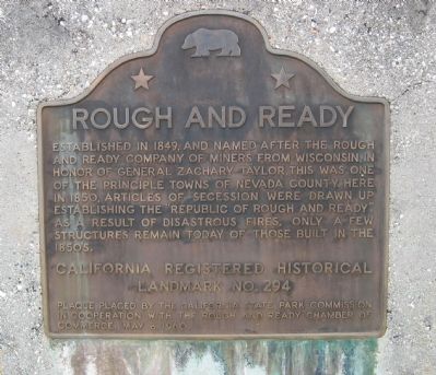
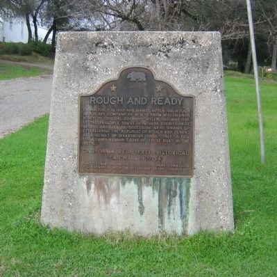
Rough and Ready
Erected 1960 by California State Park Commission in cooperation with the Rough and Ready Chamber of Commerce (May 8, 1960). (Marker Number 294.)
Topics and series. This historical marker is listed in these topic lists: Landmarks • Notable Events • Notable Places. In addition, it is included in the California Historical Landmarks, and the Former U.S. Presidents: #12 Zachary Taylor series lists. A significant historical year for this entry is 1849.
Location. 39° 13.763′ N, 121° 8.329′ W. Marker is in Rough and Ready, California, in Nevada County. Marker is at the intersection of Rough and Ready Highway and Mountain Rose Road, on the right when traveling west on Rough and Ready Highway. Touch for map. Marker is in this post office area: Rough and Ready CA 95975, United States of America. Touch for directions.
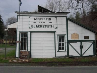
Other nearby markers. At least 8 other markers are within 4 miles of this marker, measured as the crow flies. Fippin's Blacksmith Shop (within shouting distance of this marker); Republic of Rough and Ready (within shouting distance of this marker); Toll Road Stake (about 700 feet away, measured in a direct line); Rough and Ready Toll House (about 700 feet away); Indian Grinding Rock (approx. 0.2 miles away); Rowe Saw Mill (approx. 0.2 miles away); The China Wall (approx. 0.2 miles away); Lyman Gilmore, Jr. (approx. 3˝ miles away). Touch for a list and map of all markers in Rough and Ready.
Regarding Rough and Ready. This site is a California Registered Historical Landmark (No. 294).
Also see the nearby Republic of Rough and Ready and Fippin's Blacksmith Shop markers.
Also see . . .
1. Ghost Towns: Rough and Ready. (Submitted on August 21, 2008, by Syd Whittle of Mesa, Arizona.)
2. About Nevada County: Rough and Ready. (Submitted on August 21, 2008, by Syd Whittle of Mesa, Arizona.)
Credits. This page was last revised on June 16, 2016. It was originally submitted on August 21, 2008, by Syd Whittle of Mesa, Arizona. This page has been viewed 1,594 times since then and 29 times this year. Photos: 1, 2, 3, 4, 5. submitted on August 21, 2008, by Syd Whittle of Mesa, Arizona. • Kevin W. was the editor who published this page.
