Fort Myers in Lee County, Florida — The American South (South Atlantic)
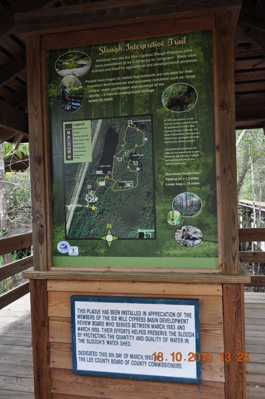
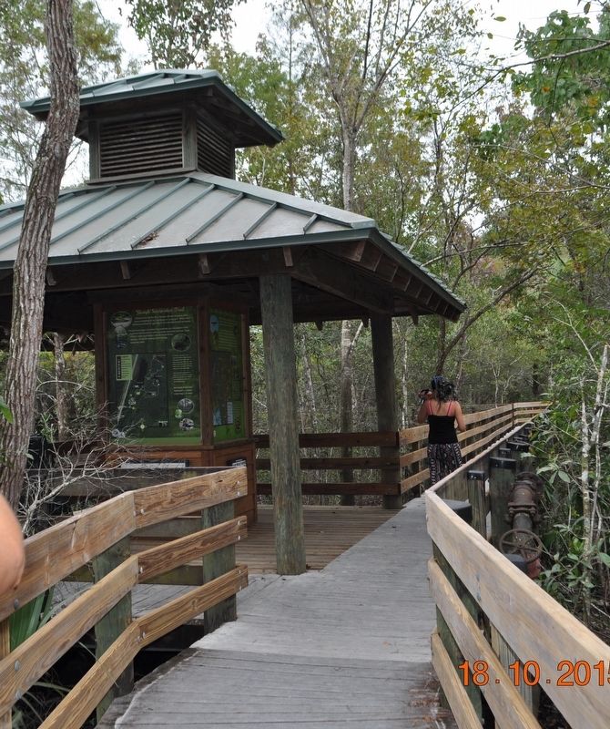
Slough Interpretive Trail
People have begun to realize that wetlands are valuable for their important environmental and economic functions such as: flood control, water purification and recharge of the aquifer - a natural underground storage space for water.
In 1976, the citizens of Lee County voted to provide funds for purchase of the Six Mile Cypress Slough Preserve. The South Florida Water Management District also contributed through the Save Our Rivers program.
The boardwalk trail ahead will offer you the opportunity to view first-hand the diversity of plants and animals that live in this wetland community.
Boardwalk length from
Parking lot =1.2 miles
Lower loop =.75 miles
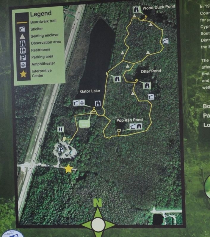
Legend:
Boardwalk trail
Shelter
Seating enclave
Observation area
Restrooms
Parking area
Amphitheater
Interpretive Center
Discover Lee County Parks & Recreation
Friends of Six Mile Cypress
Slough Preserve
This plaque has been installed in appreciation of the members of the Six Mile Cypress Basin Development Review Board who served between March 1983 and March 1993. Their efforts helped preserve the slough by protecting the quantity and quality of water in The Slough’s Water Shed.
Dedicated this 8th day of March 1993 by The Lee County Board of County Commissioners
Topics. This historical marker is listed in these topic lists: Animals • Environment • Horticulture & Forestry. A significant historical month for this entry is March 1983.
Location. 26° 34.226′ N, 81° 49.569′ W. Marker is in Fort Myers, Florida, in Lee County. Marker is on Penzance Blvd. Touch for map. Marker is at or near this postal address: 7791 Penzance Blvd, Fort Myers FL 33966, United States of America. Touch for directions.
Other nearby markers. At least 8 other markers are within 6 miles of this marker, measured as the crow flies. Six Mile Cypress Slough Preserve (a few steps from this marker); A Slice of Slough (within shouting distance of this marker); The Twilight Zone (within shouting distance of this marker); Great Blue Heron Pavilion (within shouting distance of this marker); The Dragon And His Tail (approx. 2.8 miles away); Locomotive 143 (approx. 4.3 miles away); Williams Academy (approx. 5.1 miles away); Frierson-Hendry Cemetery (approx. 5.2 miles away). Touch for a list and map of all markers in Fort Myers.
Credits. This page was last revised on August 30, 2017. It was originally submitted on August 3, 2017, by Sandra Hughes Tidwell of Killen, Alabama, USA. This page has been viewed 175 times since then and 11 times this year. Photos: 1, 2, 3. submitted on August 3, 2017, by Sandra Hughes Tidwell of Killen, Alabama, USA. • Bill Pfingsten was the editor who published this page.


