Near Bar Harbor in Hancock County, Maine — The American Northeast (New England)
“Hot Line” to Europe
Acadia National Park
— National Park Service, U.S. Department of the Interior —
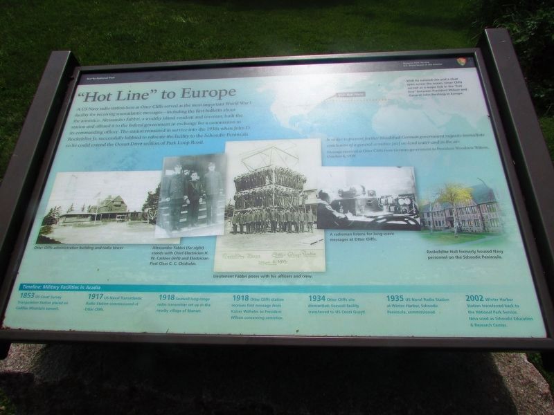
A US Navy radio station here at Otter Cliffs served as the most important World War I facility for receiving transatlantic messages – including the first bulletin about the armistice. Alessandro Fabbri, a wealthy island resident and inventor, built the station and offered it to the federal government in exchange for a commission as its commanding officer. The station remained in service into the 1930s when John D. Rockefeller Jr. successfully lobbied to relocate the facility to the Schoodic Peninsula so he could extend the Ocean Drive section of Park Loop Road.
With its isolated site and a clear span across the ocean, Otter Cliffs served as a major link in the “hot line” between President Wilson and General John Pershing in Europe.
“In order to prevent further bloodshed German government requests immediate conclusion of a general armstice [sic] on land water and in the air.”
Message received at Otter Cliffs from German government to President Woodrow Wilson, October 6, 1918
Timeline: Military Facilities in Acadia
1853 US Coast Survey Triangulation Station placed on Cadillac Mountain summit.
1917 US Naval Transatlantic Radio Station commissioned at Otter Cliffs.
1918 Seawall long-range radio transmitter set up in the nearby village of Manset.
1918 Otter Cliffs station receives first message from Kaiser Wilhelm to President Wilson concerning armistice.
1934 Otter Cliffs site dismantled; Seawall facility transferred to US Coast Guard.
1935 US Naval Radio Station at Winter Harbor, Schoodic Peninsula, commissioned.
2002 Winter Harbor Station transferred back to the National Park Service. Now used as Schoodic Education & Research Center.
Erected by National Park Service, U.S. Department of the Interior.
Topics and series. This historical marker is listed in this topic list: War, World I. In addition, it is included in the Former U.S. Presidents: #28 Woodrow Wilson series list.
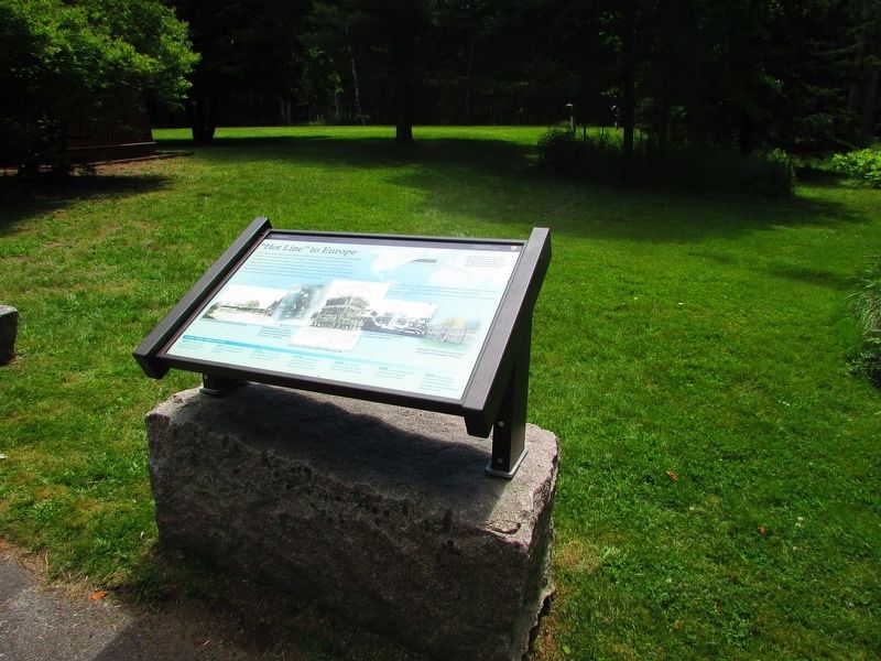
Location. 44° 18.856′ N, 68° 11.712′ W. Marker is near Bar Harbor, Maine, in Hancock County. Marker is on Otter Cliff Road, on the right when traveling south. Marker is in Acadia National Park, in the Fabbri picnic ground. Touch for map. Marker is in this post office area: Bar Harbor ME 04609, United States of America. Touch for directions.
Other nearby markers. At least 8 other markers are within 2 miles of this marker, measured as the crow flies. Alessandro Fabbri, Lieutenant, U.S.N.R.F. (within shouting distance of this marker); Once a Busy Waterfront (about 300 feet away, measured in a direct line); Thunder Hole (approx. half a mile away); Thunder Hole Ranger Station (approx. half a mile away); Sounds of the Sea (approx. 0.6 miles away); Icy Depths (approx. 0.6 miles away); What Do Park Rangers Do? (approx. 0.6 miles away); Satterlee Field (approx. 1.2 miles away). Touch for a list and map of all markers in Bar Harbor.
More about this marker. Pictures along the bottom of the marker depict “Otter Cliffs administration building and radio tower.”; “Alessandro Fabbri (far right) stands with Chief Electrician H. W. Castner (left) and Electrician First Class C. C. Chisholm.”; “Lieutenant Fabbri poses with his officers and crew.”; “A radioman listens for long-wave messages at Otter Cliffs.”; and “Rockefeller Hall formerly housed Navy personnel on the Schoodic Peninsula.”
Credits. This page was last revised on June 23, 2020. It was originally submitted on August 4, 2017, by Bill Coughlin of Woodland Park, New Jersey. This page has been viewed 357 times since then and 9 times this year. Photos: 1, 2, 3. submitted on August 4, 2017, by Bill Coughlin of Woodland Park, New Jersey.


