Harpers Ferry in Jefferson County, West Virginia — The American South (Appalachia)
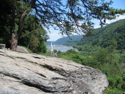
Jefferson Rock
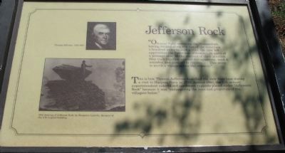
"On your right comes up the Shenandoah, having ranged along the foot of the mountain a hundred miles to seek a vent. On your left approaches the Patowmac [Potomac], in quest of a passage also. In the moment of their junction they rush together against the mountain, rend it asunder, and pass off to the sea....This scene is worth a voyage across the Atlantic."
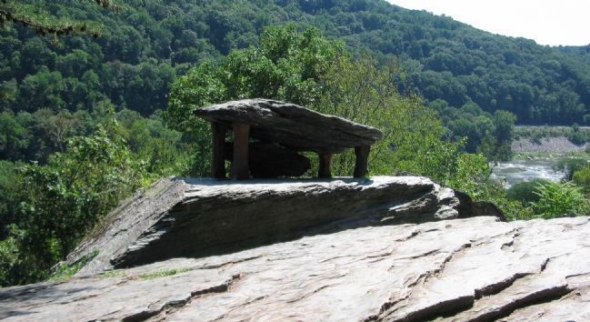
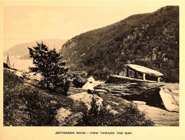
This is how Thomas Jefferson described the view from here during a visit to Harpers Ferry in 1783. Around 1860, the U.S. armory superintendent ordered red sandstone supports placed under "Jefferson Rock" because it was "endangering the lives and properties of the villagers below."
Topics and series. This historical marker is listed in these topic lists: Natural Features • Notable Places. In addition, it is included in the Former U.S. Presidents: #03 Thomas Jefferson series list. A significant historical year for this entry is 1783.
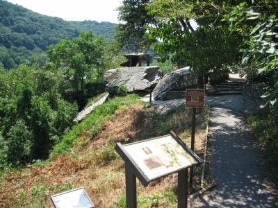
Location. 39° 19.346′ N, 77° 44.097′ W. Marker is in Harpers Ferry, West Virginia, in Jefferson County. Marker can be reached from Shenandoah Street (Business U.S. 340), on the right when traveling west. Located along the Appalachian Trail overlooking the Lower Town section of Harpers Ferry. Touch for map. Marker is in this post office area: Harpers Ferry WV 25425, United States of America. Touch for directions.
Other nearby markers. At least 8 other markers are within walking distance of this marker. A different marker also named Jefferson Rock (here, next to this marker); Shenandoah Canal (within shouting distance of this marker); Nathan Cook Brackett (about 300 feet away, measured in a direct line); Revolutionary War Soldier (about 400 feet away); Island Access (about 400 feet away); Jonathan Child House (about 400 feet away); Harper Cemetery (about 500 feet away); Island Mills (about 500 feet away). Touch for a list and map of all markers in Harpers Ferry.
More about this marker. On the left is a portrait of Thomas Jefferson, 1743-1826. Below the portrait is a 1810 drawing of Jefferson Rock, by Benjamin Latrobe, designer of the U.S. Capitol building.
Also see . . . Thomas Jefferson at Harpers Ferry. Harpers Ferry National Historical Park website entry (Submitted on August 23, 2008, by Craig Swain of Leesburg, Virginia.)
Additional commentary.
1. John Quincy Adams' Retort
In 1834 former President John Quincy Adams visited the Armory at Harpers Ferry and in particular observed the scene described by Jefferson. From the Diaries of John Quincy Adams, May 24, 1834-
"Here we saw the junction of the Potomac and Shenandoah Rivers, described somewhat enthusiastically by Mr. Jefferson. I went to the hanging rock that bears his name, and observed the double range of precipitous rocky hills between which the river flows - It has some resemblance on a much smaller scale to the course of the Elbe between Dresden, and the borders of Bohemia. There is not much of the sublime in the Scene, and those who first see it after reading Mr. Jefferson's description are usually disappointed..."
— Submitted August 23, 2008, by Craig Swain of Leesburg, Virginia.
Credits. This page was last revised on February 2, 2022. It was originally submitted on August 23, 2008, by Craig Swain of Leesburg, Virginia. This page has been viewed 3,113 times since then and 28 times this year. Photos: 1, 2, 3. submitted on August 23, 2008, by Craig Swain of Leesburg, Virginia. 4. submitted on December 20, 2014. 5. submitted on August 23, 2008, by Craig Swain of Leesburg, Virginia.
