Adrian in Malheur County, Oregon — The American West (Northwest)
The South Alternate Route of the Oregon Trail
Inscription.
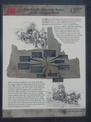
During the late 19th century thousands of Americans left farms, families and friends to trek the Oregon Trail toward new lives in the West. The trail was nearly 2,000 miles across prairies, mountains and parched deserts. Contrary to popular belief, it was not a single set of parallel ruts leading from Missouri to the Willamette Valley. Pioneers, alway searching for short cuts or easier traveling often followed alternative routes, and on the wester portion of the journey they developed several: the Barlow Road, the path across the Columbia Plarteau, and the South Alternate Rout along the Snake River are the best known.
Native Americans traveled the course of the Snake River for centuries before fur trappers learned of the route in the early 1800s, and they in turn passed on the knowledge to westbound emigrants. By 1843, and for nearly thirty years thereafter, wagon trains followed the watershed of the Snake River from Fort Hall to Three Island Crossing near the town of Glens Ferry, Idaho. From this river crossing wagon companies often split: some forded the Snake River to gain the north bank; others follow there river's south bank. Those traveling the South Alternate Route avoided two crossings of the Snake and one of the Boise River. The hot, dry, dusty trail, which passed near this site, was more difficult than the northern route
and exacted a heavy toll from both emigrants and livestock.Erected by Oregon Travel Information Council, Malheur County Historical Society.
Topics and series. This historical marker is listed in these topic lists: Roads & Vehicles • Settlements & Settlers. In addition, it is included in the Oregon Beaver Boards, and the Oregon Trail series lists. A significant historical year for this entry is 1843.
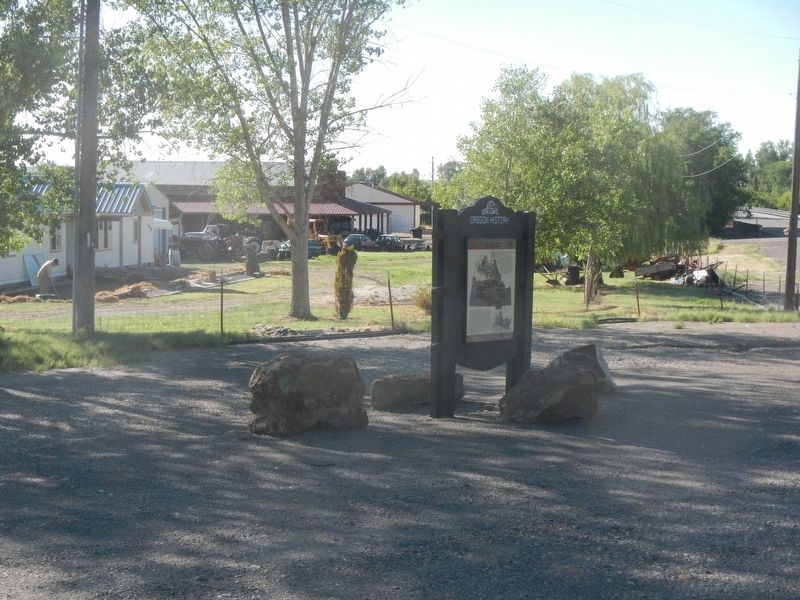
Location. 43° 43.99′ N, 117° 4.455′ W. Marker is in Adrian, Oregon, in Malheur County. Marker is at the intersection of Roswell Road (Oregon Route 452) and Succor Creek Highway (Oregon Route 201), on the left when traveling west on Roswell Road. Touch for map. Marker is in this post office area: Adrian OR 97901, United States of America. Touch for directions.
Other nearby markers. At least 8 other markers are within 11 miles of this marker, measured as the crow flies. Starvation Camp (approx. 6.6 miles away); Old Fort Boise Snake River Crossing Kiosk (approx. 6.6 miles away); Old Oregon Trail (approx. 6.6 miles away); Marie Dorion (approx. 7.8 miles away in Idaho); Fort Boise (approx. 7.8 miles away in Idaho); Old Fort Boise (approx. 7.8 miles away in Idaho); a different marker also named Old Oregon Trail (approx. 7.8 miles away in Idaho); Oregon Trail (approx. 10.7 miles away in Idaho).

Photographed By Barry Swackhamer, June 28, 2017
2. The South Alternate Route of the Oregon Trail Marker, detail
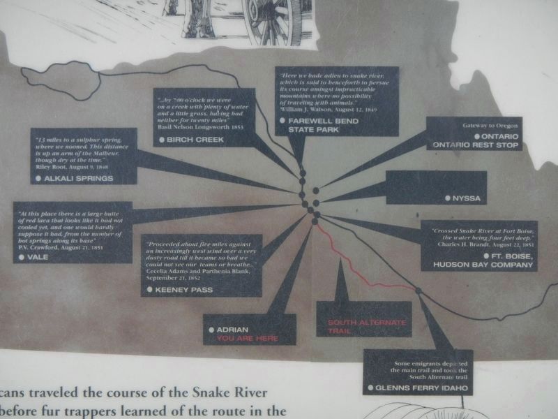
Captions: (clockwise from 12 o'clock) Farewell Bend State Park "Here we bade adieu to snake river, which is said to henceforth to pursue its course amingst impracticable mountains where no possibility of traveling with animals." - William J. Watson, August 12, 1849; Ontario, Ontario Rest Stop Gateway tp Oregon; Nyssa; Ft. Boise, Hudson Bay Company "Crossed Snake River at Fort Boise, the water being four feet deep." - Charles H. Brandt, August 22, 1851; Glenns Ferry Road Some emigrants departed the main trail and took the South Alternate trail; South Alternate Trail, Adrian You Are Here; Keeney Pass "Proceeded about five miles against an increasingly west wind over a very dusty road till it became so bad we could not see our teams or breathe..." - Cecelia Adams and Parthenia Blank, September 21, 1852; Vale "At this place there is a large butte of red lava that looks like it had not cooled yet, and one would hardly suppose it had, from the number of hot springs along its base" - P.V. Crawford, August 21, 1851; Alkali Springs "13 miles to a sulphur spring, where we mooned. This distance is up arm of the Malheur, though dry at time." - Riley Root, August 9, 1848; Birch Creek "...by 7:00 o'clock we were on a creek with plenty of water and a little grass, having had neither for twenty miles" - Basil Nelson Longsworth 1853.
Credits. This page was last revised on February 11, 2018. It was originally submitted on August 13, 2017, by Barry Swackhamer of Brentwood, California. This page has been viewed 618 times since then and 61 times this year. Photos: 1, 2, 3. submitted on August 13, 2017, by Barry Swackhamer of Brentwood, California.

