Near Vale in Malheur County, Oregon — The American West (Northwest)
John D. Henderson
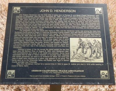
John D. Henderson was the third child of twelve born to Perman D. and Sarah (Trapp) Henderson, both originally of Tennessee. John was born December 30, 1828, in what is now part of downtown Kansas City, then farmland, where his parents had settled soon after their marriage in present Lafayette County, Missouri, on Christmas Day, 1821. Soon after the birth of their sixth child in 1835, they moved to Rush Township, Buchanan County, Missouri, where six more Henderson children were born. Nearby lived the family of James H. and Jane (Hawkins) Moody. They were originally from Kentucky where their daughter Mary Ann was born May 6, 1835. John Henderson and Mary Ann Moody, then not yet fifteen-years-old, were married January 24, 1850. The census record compiled later that year shows that John and Mary were living near his parents in the household of Newcomb J. Ireland, a millwright. John's occupation is listed as "laborer." He was twenty-one, and MaryAnn was said to be seventeen, but she was really just fifteen at the time the census was taken.
The emigration across the plains was heavy in 1852, and the Henderson family was among the many from Buchanan County going to Oregon or California. According to family tradition, soon after starting they turned around and headed home because of the cholera epidemic then raging. The Hendersons' thirteen-year-old daughter, Mary Kathrina, died May 28, 1852, when they were is Weston, Missouri. While the circumstances of the child's are unknown, her illness and eventual death may have been the reason the trip was aborted. However, the next year, on April 12, 1853, a large wagon train of some sixty wagons, captained by Perman Henderson, left Rush Township, crossed the Missouri River into Indian Territory, and headed for Oregon. The entire Henderson family, with all the surviving children, some with spouses of their own, was in the company, including John and Mary Ann Henderson.
Nothing is known of the trip across the plains except the fact that here, near the Malheur River on August 9, 1853, John Henderson died. The circumstances and cause of this death are unknown. Some have speculated that he died of "black measles" or mountain fever, diseases with similar symptoms, but there is no evidence for either. His name and date of death were inscribed on a native rock adjacent to his grave. The family went on to the Willamette Valley and settled near Wren in Benton County and later near Philomath.
Mary Ann Henderson married for a second time in 1854 to Isaac B. Justice and died in 1918 while residing in Coeur d'Alene, Idaho.
Erected 2017 by Oregon-California Trails Association.
Topics. This historical marker is listed in these topic lists: Cemeteries & Burial Sites • Settlements & Settlers. A significant historical date for this entry is August 9, 1853.
Location. 43° 58.296′ N, 117° 14.106′ W. Marker is near Vale, Oregon, in Malheur County. Marker can be reached from Sand Hollow Road near Lytle Boulevard, on the right when traveling north. Touch for map. Marker is at or near this postal address: 1601 Sand Hollow Road, Vale OR 97918, United States of America. Touch for directions.
Other nearby markers. At least 8 other markers are within 6 miles of this marker, measured as the crow flies. Rinehart's Stone House (approx. 0.7 miles away); Cutoff Fever (approx. 0.8 miles away); Vale Oregon Trail Kiosk (approx. 0.8 miles away); Vale (approx. one mile away); Stephen Meek's Cutoff (approx. one mile away); Under the Wagon Cover (approx. 5.2 miles away); First People of the Land (approx. 5.2 miles away); In Search of a Dream (approx. 5.2 miles away). Touch for a list and map of all markers in Vale.
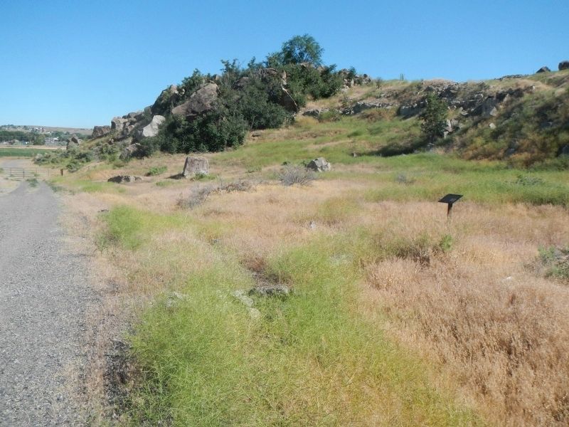
More about this marker. The Henderson burial site is on an unnamed side road leading north from Sand Hollow Road.
Credits. This page was last revised on October 11, 2021. It was originally submitted on August 14, 2017, by Barry Swackhamer of Brentwood, California. This page has been viewed 451 times since then and 44 times this year. Photos: 1, 2. submitted on August 14, 2017, by Barry Swackhamer of Brentwood, California.

