Vale in Malheur County, Oregon — The American West (Northwest)
Vale
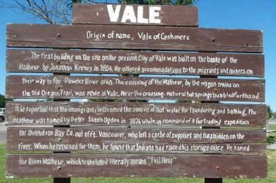
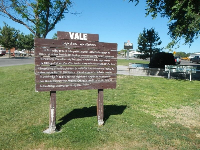
The first building on the site on the present City of Vale was built on the banks of the Malheur by Jonathan Keeney in 1864. He offered accommodations to the migrants and miners on their way to the Powder River area. The crossing of the Malheur, by the wagon trains on the Old Oregon Trail, was made at Vale. Near the crossing, natural hot springs bubbled forth and it is reported that the immigrants welcomed the source of hot water for laundering and bathing. The Malheur was named by Peter Skeen Ogden in 1826 while in command of a fur trading expedition for the Hudson Bay Co. out of Ft. Vancouver, who left a cache of supplies and furs hidden on the river. When he returned for them, he found that Indians had raided his storage place. He named the river Malheur, which translated literally means “Evil Hour”.
Topics and series. This historical marker is listed in this topic list: Settlements & Settlers. In addition, it is included in the Oregon Trail series list. A significant historical year for this entry is 1865.
Location. 43° 58.926′ N, 117° 14.964′ W. Marker is in Vale, Oregon, in Malheur County. Marker is on A Street West near Clark Street North, on the right when traveling west. Touch for map. Marker is at or near this postal address: 950 A Street West, Vale OR 97918, United States of America. Touch for directions.
Other nearby markers. At least 8 other markers are within 7 miles of this marker, measured as the crow flies. Stephen Meek's Cutoff (a few steps from this marker); Rinehart's Stone House (approx. half a mile away); Vale Oregon Trail Kiosk (approx. 0.7 miles away); Cutoff Fever (approx. 0.8 miles away); John D. Henderson (approx. one mile away); Under the Wagon Cover (approx. 6.2 miles away); First People of the Land (approx. 6.2 miles away); In Search of a Dream (approx. 6.2 miles away). Touch for a list and map of all markers in Vale.
More about this marker. This markers is located in Lewin City Park, a triangular park bound by A Street West, Clark Street North, and Washington Street West.
Also see . . . History - City of Vale. At the present time Vale is not only the county seat but is also headquarters for the Vale Bureau of Land Management District. Oregon Trail Mushroom and Eagle-Picher Industries have plants in the Vale area. Oregon Trail Mushroom uses the natural occurring hot water in their operation. Cattle and livestock continue to play a role in the local economy... (Submitted on August 15, 2017, by Barry Swackhamer of Brentwood, California.)
Credits. This page was last revised on August 15, 2017. It was originally submitted on August 15, 2017, by Barry Swackhamer of Brentwood, California. This page has been viewed 272 times since then and 25 times this year. Photos: 1, 2. submitted on August 15, 2017, by Barry Swackhamer of Brentwood, California.

