Vale in Malheur County, Oregon — The American West (Northwest)
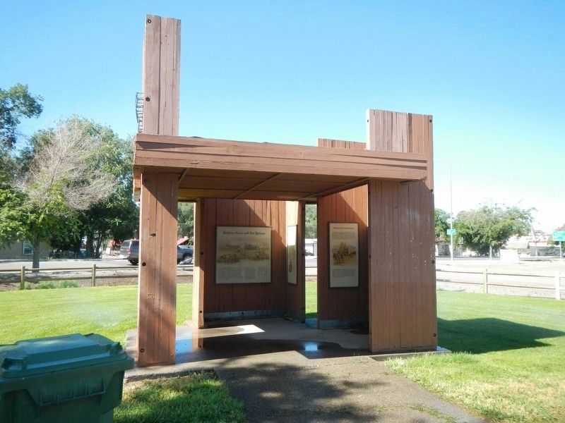
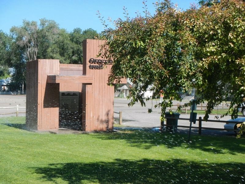
Vale Oregon Trail Kiosk
Photographed By Barry Swackhamer, June 28, 2017
1. Vale Oregon Trail Kiosk Marker
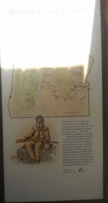
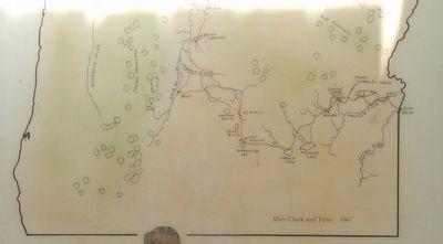
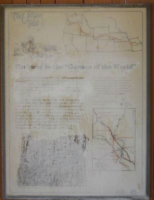
Captions: (top right) Map of the Oregon Trail; (bottom left) Relief Map of Oregon showing the route of the Oregon Trail.: (center right) Remained in camp to graze our poor brave cattle. Will start about two and go as far as we can tonight, as the days are so excessively hot, and we have 28 miles to go without water! Felt very unwell today, Am almost worn down with the fatigue of constant travel. Our way seem endless! -- Esther Bell McMillan Hanna, August 13, 1852. (map of Oregon Trail sites near Ontario, Idaho.)
(This panel is water damaged)
(This panel is water damaged)
Excitement filled the air May 22, 1843 as nearly one thousand Americans left Missouri toward new lives in the Oregon Country. During the next two decades, more than 50,000 people emigrated to a land of abundance. a land that Abigail Scott, emigrant of 1852, called the "Garden of the World."
The Oregon Trail was more than two thousand miles through what Riley Root, emigrant of 1848, called "Landscape without soil! River bottoms with scarcely enough grass to support emigrant teams." The fragile landscape's ability to sustain life eroded as numbers of emigrants increased and privation, illness and death often plagued emigrants. Survivors endured an extremely wearisome road, and by the time they reached this portion of the Trail, with much of the journey behind them, the "Garden of the World" still seemed very distant.
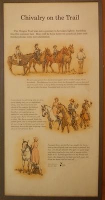
The Oregon Trail was not a journey to be taken lightly: hardship was the common fare. Boys will be boys however; practical jokes and monkeyshines were not uncommon.
We were soon joined by a band of youngsters from another camp, all on horseback. The bantered me to join them, but I pleaded I was on foot and could not join them, a young fellow knowing my timidity and awkwardness told me to take his horse. I accepted and started with them.
I soon found myself along side of a time jovial young lady, as we road slowly along, soon found ourselves far ahead of the wagons, but behind our own company, suddenly a hoodlum came galloping up behind us, and as he passed the young lady's horse struck him with a whip. Her horse jumped, broke the saddle girth, and the young lady saddle and all were lying in the dust and sand near knee deep, but as she was laughing I knew she was not seriously hurt.
I jumped down, picked her up, caught her horse, tied up the old girth and was ready to proceed, but how will she get aboard? The girl was quite large and heavy, and not a tree, rock or stump within miles of us. I finally got down on my hands and knees, she stepped on my back and as I arose, she lit on her horse, and we were off... -- John Johnson, July 25, 1851
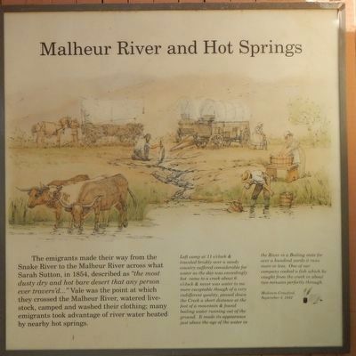
The emigrants made their way from the Snake River to the Malheur River across what Sarah Sutton, in 1854, described as “the most dusty dry and hot bare desert that any person ever travers’d...” Vale was the point at which they crossed the Malheur River, watered livestock, camped and washed their clothing; many emigrants took advantage of river water heated by nearby hot springs.
Left camp at 11 o'clock & traveled briskly over a sandy country suffered considerable for water as the day was exceedingly hot came to a creek about 6 o/clock & never was water to me more executable though of very indifferent quality, passed down the Creek a short distance at the foot of a mountain & found boiling water running out of the ground. It made its appearance just above the age of the water in the River in a Boiling state for over a hundred yards it runs more or less. One of out company cooked a fish which he caught fro the creek in about two minutes perfectly through. Medorem Crawford, September 3, 1842
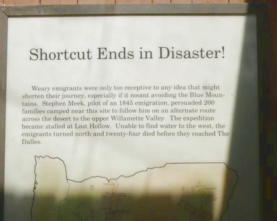
Weary emigrants were only too receptive to any idea that might shorten their journey, especially if it meant avoiding the Blue Mountains. Stephen Meek, pilot of an 1845 emigration, persuaded 200 families camped near this site to follow him on an alternate route across the desert to the upper Willamette Valley. The expedition became stalled at Lost Hollow. Unable to find water to the west, the emigrants turned north and twenty-four died before they reached The Dalles.
At this place are two trails, the fork is in the bottom above the crossing of the creek, and there is a possibility of emigrants pursuing the wrong route ... Mr. Meek, who had been engaged as our pilot ... informed the emigrants that he could, by taking up this stream to hear its source, and then striking across the plains, so as to intersect the old road near the mouth of the Deschutes or Falls river, save about one hundred and fifty miles travel; also that he was perfectly familiar with the country through which the proposed route lay, as he had traveled it; that no difficulty or danger attended its travel. -- Joel Palmer, September 3, 1845
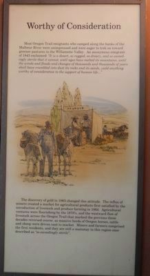
Most Oregon Trail emigrants who camped along the banks of the Malheur River were unimpressed and were eager to trek on toward greener pastures in the Willamette Valley. An anonymous emigrant of 1843 exclaimed: “It is a desert, so rugged, so dreary, and so exceedingly sterile that it cannot, until ages have melted its mountains, until the winds and floods and changes of thousands and thousands of years shall have crumbled into dust its rocks and its sands, yield anything worthy of consideration to the support of human life...”
The discovery of gold in 1863 changed this attitude. The influx of miners created a market for agricultural products first satisfied by the introduction of livestock and produce farming in 1864. Agricultural ventures were flourising by the 1870's, and the west ward flow of livestock across the Oregon Trail that marked the previous three decades reversed course, as massive heard of Oregon horses, cattle and sheep were driven east to market. Miners and farmers comprised the first residents, and they are still the mainstay in this region once described as "so exceedingly sterile."
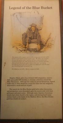
Stephen Meek, pilot of an ill-fated 1845 emigration, successfully persuaded 200 families to attempt a shortcut around the Blue Mountains. Although the endeavor proved disastrous, legend holds that in their desperate search for water the lost emigrants discovered a small amount of gold!
The search for the Blue Bucket gold led to other discoveries, and prospectors soon descended upon the countryside with their gold pans and pack mules. Although many deposits of precious metals have been found in the region, and mining lured many settlers back to the banks of the Malheur River, the Blue Bucket gold has eluded all seekers.
The captain of the company told all of the young people who had saddle horses to take buckets and go hunt for water. My father, who was then 23 years old and his sister ... took their old blue wooden buckets and started out to find water. They finally found a dry creek bed which they followed until they found a place were a little water was seeping through the gravel, and while my father was digging for water his sister saw something bright and picked it up. W.H. Herron, son of W.J. Herren, emigrant of 1845.
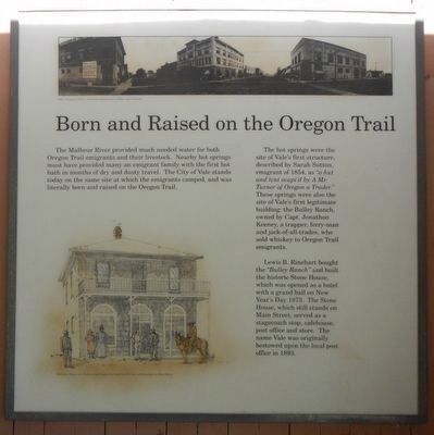
The Malheur River provided much needed water for both Oregon Trail emigrants and their livestock. Nearby hot springs must have provided many an emigrant family with the first hot bath in months of dry and dusty travel. The City of Vale stands today on the same site at which the emigrants camped, and was literally born and raised on the Oregon Trail.
The hot springs were the site of Vale’s first structure, described by Sarah Sutton, emigrant of 1854, as “a hut and tent ocupi’d by A Mr. Turner of Oregon a Trader.” These springs were also the site of Vale’s first legitimate building: The Bulley Ranch, owned by Capt. Jonathon Keeney, a trapper, ferry-man and jack-of-all-trades, who sold whiskey to Oregon Trail emigrants.
Lewis B. Rinehart bought the “Bulley Ranch” and built the historic Stone House, which was opened as a hotel with a grand ball on New Year’s Day 1873. The Stone House, which still stands on Main Street, served as a stagecoach stop, safehouse, post office and store. The name Vale was originally bestowed upon the local post office in 1893.
Topics and series. This historical marker is listed in these topic lists: Roads & Vehicles • Settlements & Settlers • Waterways & Vessels. In addition, it is included in the Oregon Trail series list. A significant historical date for this entry is May 22, 1843.
Location. 43° 58.973′ N, 117° 14.153′ W. Marker is in Vale, Oregon, in Malheur County. Marker is at the intersection of Washington Street East (U.S. 26) and Short Street North, on the right when traveling west on Washington Street East. Touch for map. Marker is at or near this postal address: 500 Washington Street East, Vale OR 97918, United States of America. Touch for directions.
Other nearby markers. At least 8 other markers are within 6 miles of this marker, measured as the crow flies. Cutoff Fever (approx. 0.2 miles away); Rinehart's Stone House (approx. ¼ mile away); Stephen Meek's Cutoff (approx. 0.7 miles away); Vale (approx. 0.7 miles away); John D. Henderson (approx. 0.8 miles away); Under the Wagon Cover (approx. 5.8 miles away); First People of the Land (approx. 5.9 miles away); Imagine a Day's Journey (approx. 5.9 miles away). Touch for a list and map of all markers in Vale.
More about this marker. This kiosk is located in Kiosk Park.
Credits. This page was last revised on August 15, 2017. It was originally submitted on August 15, 2017, by Barry Swackhamer of Brentwood, California. This page has been viewed 380 times since then and 28 times this year. Photos: 1, 2, 3, 4, 5, 6, 7, 8, 9, 10, 11. submitted on August 15, 2017, by Barry Swackhamer of Brentwood, California.
