Jean in Clark County, Nevada — The American Mountains (Southwest)
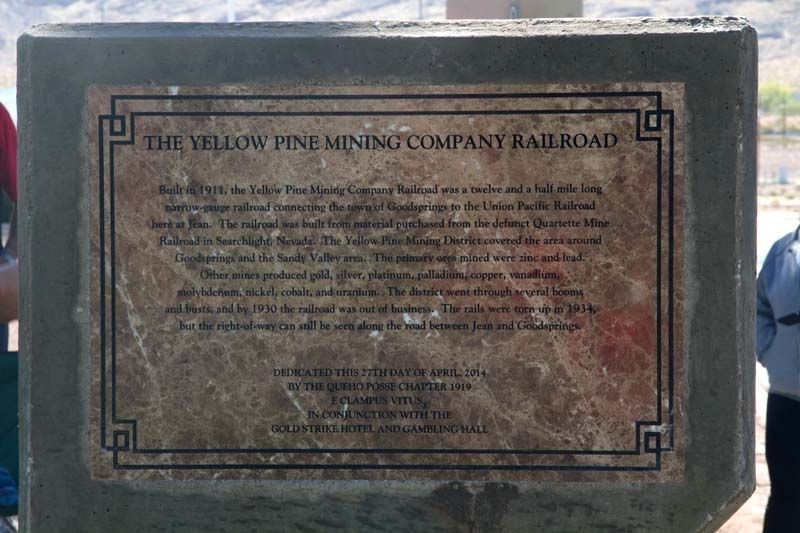
The Yellow Pine Mining Company Railroad
Inscription.
Built in 1911, The Yellow Pine Mining Company Railroad was a twelve and a half mile long narrow gauge railroad connecting the town of Goodsprings with the Union Pacific Railroad here in Jean. The railroad was built using materials from the defunct Quarter Mine Railroad in Searchlight, Nevada. The Yellow Pine Mining District covered the area around Goodsprings and the Sandy Valley area. The primary ores mined were zinc and lead. Other mines produced gold, silver, platinum, palladium, copper, vanadium, molybdenum, nickel, cobalt and uranium.The district went through several booms and busts and by 1930 the Railroad was out of business. The rails were torn up in 1934 but the right-of-way can still be seen along the road between Jean and Goodsprings.
Erected 2014 by Queho Posse Chapter 1919 of the Ancient and Honorable Order of E Clampus Vitus In Conjunction with the Gold Strike Hotel and Gambling Hall.
Topics and series. This historical marker is listed in these topic lists: Railroads & Streetcars • Settlements & Settlers. In addition, it is included in the E Clampus Vitus series list. A significant historical month for this entry is April 2014.
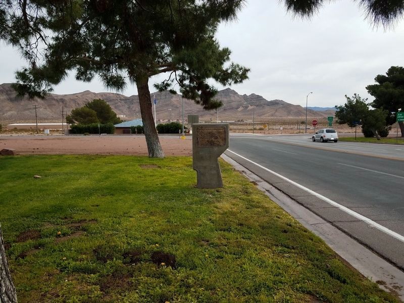
Location. 35° 46.753′ N, 115° 19.495′ W. Marker is in Jean, Nevada, in Clark County. Marker is on Main Street (Nevada Route 161), on the left when traveling south. Located on the backside of The Arrowhead Trail Highway. Touch for map. Marker is at or near this postal address: 1 Main Street, Jean NV 89019, United States of America. Touch for directions.
Other nearby markers. At least 7 other markers are within 8 miles of this marker, measured as the crow flies. The Arrowhead Trail Highway (here, next to this marker); Jean, Nevada (a few steps from this marker); The Last Spike (approx. 3.7 miles away); a different marker also named The Last Spike (approx. 5.2 miles away); The Pioneer Saloon (approx. 7 miles away); Goodsprings Mining District 1856 - 1957 (approx. 7.1 miles away); Good's Spring (approx. 7.2 miles away).
Credits. This page was last revised on December 4, 2017. It was originally submitted on August 15, 2017, by Frank Gunshow Sanchez of Hollister, California. This page has been viewed 457 times since then and 58 times this year. Photos: 1. submitted on August 15, 2017. 2. submitted on November 18, 2017, by Denise Boose of Tehachapi, California. • Syd Whittle was the editor who published this page.
Editor’s want-list for this marker. Photo of the railroad right-of-way as seen from the road. Mentioned in the marker text. • Can you help?

