Wills Corner in Isle of Wight County, Virginia — The American South (Mid-Atlantic)
Isle of Wight County / Nansemond County
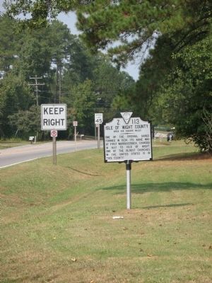
Isle of Wight County. Area 314 Square Miles. One of the original Shires formed in 1634. Its name was at first Warrascoyack, changed in 1637 to Isle of Wight. Of the oldest churches in the United States is in this County.
Nansemond County. Area 423 Square Miles.. Formed in 1637 from New Norfolk County, it was first called Upper Norfolk County, but in 1642 it was named Nansemond for an Indian Tribe. Dismal Swamp is partly in this county.
Erected 1948 by Virginia Conservation Commission. (Marker Number Z-113.)
Topics and series. This historical marker is listed in this topic list: Political Subdivisions. In addition, it is included in the Virginia Department of Historic Resources (DHR) series list. A significant historical year for this entry is 1634.
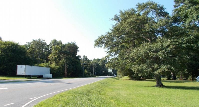
Location. Marker has been permanently removed. It was located near 36° 52.876′ N, 76° 34.933′ W. Marker was in Wills Corner, Virginia, in Isle of Wight County. Marker was at the intersection of Benns Church Blvd. (Virginia Route 32) and Oliver Drive (County Route 600), on the right on Benns Church Blvd.. Touch for map. Marker was in this post office area: Smithfield VA 23430, United States of America.
We have been informed that this sign or monument is no longer there and will not be replaced. This page is an archival view of what was.
Other nearby markers. At least 8 other markers are within 5 miles of this location, measured as the crow flies. St. John's Church (approx. 2.1 miles away); Nansemond Indian Villages (approx. 2.1 miles away); Benn’s Church (approx. 3.9 miles away); African American Oystermen (approx. 3.9 miles away); St. Luke’s Church (approx. 4 miles away); Historic St. Luke's Church (approx. 4 miles away); Saint Luke's Church (approx. 4.1 miles away); Dumpling Island (approx. 4.3 miles away).
Regarding Isle of Wight County / Nansemond County. Nansemond County is an extinct Virginia county. The county became the independent city of Nansemond in July 1972 and in 1974 merged with the city of Suffolk. Suffolk was incorporated as a town in 1808, and as a city in 1910.
Credits. This page was last revised on July 7, 2021. It was originally submitted on September 23, 2007, by Laura Troy of Burke, Virginia. This page has been viewed 1,528 times since then and 31 times this year. Last updated on September 10, 2017, by Cynthia L. Clark of Suffolk, Virginia. Photos: 1. submitted on September 23, 2007, by Laura Troy of Burke, Virginia. 2. submitted on September 1, 2017, by Cynthia L. Clark of Suffolk, Virginia. • Bernard Fisher was the editor who published this page.

