Yorktown in York County, Virginia — The American South (Mid-Atlantic)
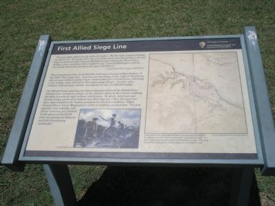
First Allied Siege Line
1781 Siege of Yorktown
— Colonial National Historical Park —
“The next night, which was the sixth of October … We this night completed laying out the works. The troops of the line were there ready with entrenching tools and began to entrench, after General Washington had struck a few blows with a pickax, a mere ceremony, that it might be said “General Washington with his own hands first broke ground at the siege of Yorktown.”
Joseph Plum Martin, Sappers and Miners
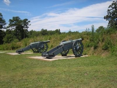
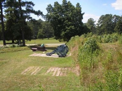
This reconstructed line of earthworks replicates a French artillery battery of the Allies’ First Siege Line. A gentle rain was falling on the night of October 6, 1781, as 1,500 soldiers quietly began constructing these fortifications, following a row of pine strips laid out by the engineering officers. Another 2,800 soldiers, with muskets, silently stood guard in case of a British assault.
The British troops manning the left or eastern portion of the British Inner Defense Line remained unaware of the Allied soldiers to their front, enabling the allies to work all night without interference. By dawn, American and French troops stood safely behind their first siege line. Over the next two days, they completed the battery positions for the heavy artillery. Major General Henry Knox, Washington’s Chief of Artillery, recalled that “The first parallel, some redoubts, and all our batteries were finished by the 9th at 2 o’clock P.M. when we opened our batteries and kept them playing continually.”
Erected by Colonial National Historical Park, National Park Service.
Topics and series. This historical marker is listed in these topic lists: Notable Events • Notable Places • War, US Revolutionary. In addition, it is included in the Former U.S. Presidents: #01 George Washington series list. A significant historical year for this entry is 1781.
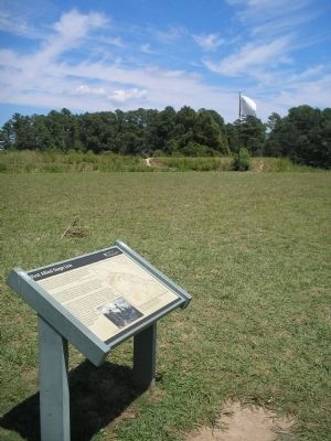
Location. 37° 13.382′ N, 76° 30.367′ W. Marker is in Yorktown, Virginia, in York County. Marker is on Cook Road (Virginia Route 704), on the left when traveling south. Marker is located on the Yorktown Battlefield in Colonial National Historical Park, at stop B on the Battlefield Tour. Touch for map. Marker is in this post office area: Yorktown VA 23690, United States of America. Touch for directions.
Other nearby markers. At least 8 other markers are within walking distance of this marker. The Grand French Battery (within shouting distance of this marker); a different marker also named Grand French Battery (about 300 feet away, measured in a direct line); Shiloh Baptist Church (approx. 0.2 miles away); Yorktown National Cemetery (approx. 0.2 miles away); a different marker also named Shiloh Baptist Church (approx. 0.2 miles away); Slabtown (approx. 0.2 miles away); Surrender at Yorktown (approx. ¼ mile away); Second Allied Siege Line (approx. ¼ mile away). Touch for a list and map of all markers in Yorktown.
More about this marker. The bottom of the marker contains a painting by Sidney King of soldiers digging the fortifications. The right side of the marker features a map with the caption “Lieutenant Louis-Alexandre Berthier, a topographical engineer by training, served on the French army’s quartermaster staff. As part of his duties, he drew maps of the Yorktown siege. This map shows the fortifications of both armies as of October 9, 1781. Courtesy of Republique Francais, Armie De Terre.”
Also see . . .
1. Yorktown Battlefield. National Park Service. (Submitted on August 29, 2008, by Bill Coughlin of Woodland Park, New Jersey.)
2. The Battle of Yorktown. The Patriot Resource website. (Submitted on August 29, 2008, by Bill Coughlin of Woodland Park, New Jersey.)
3. The Battle of Yorktown 1781. A British perspective of the Battle of Yorktown from BritishBattles.com. (Submitted on August 29, 2008, by Bill Coughlin of Woodland Park, New Jersey.)
Credits. This page was last revised on June 16, 2016. It was originally submitted on August 29, 2008, by Bill Coughlin of Woodland Park, New Jersey. This page has been viewed 1,089 times since then and 29 times this year. Photos: 1, 2, 3, 4, 5. submitted on August 29, 2008, by Bill Coughlin of Woodland Park, New Jersey.
