Near Free Union in Greene County, Virginia — The American South (Mid-Atlantic)
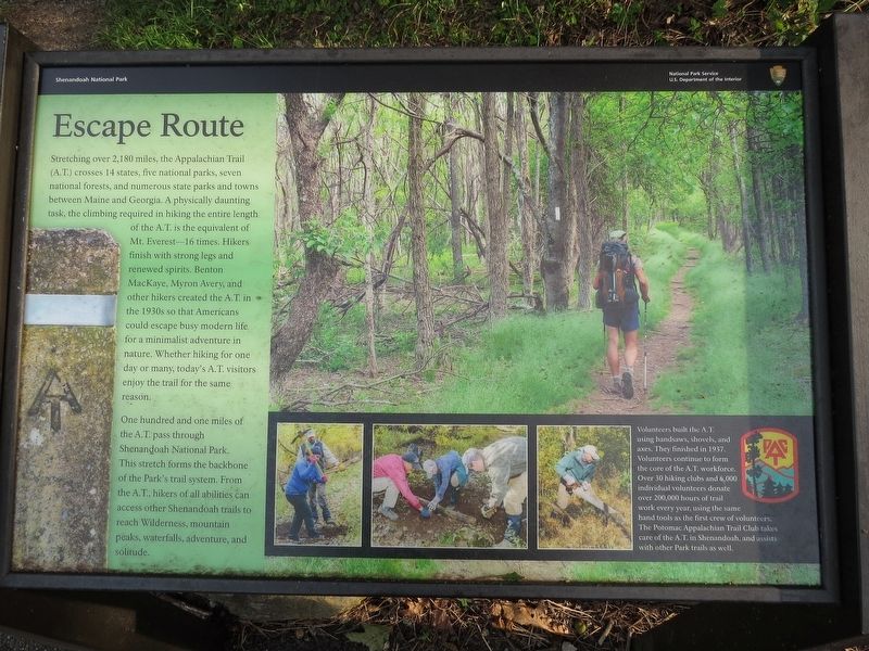
Escape Route
Shenandoah National Park
One hundred and one miles of the A.T. pass through Shenandoah National Park. This stretch forms the backbone of the Park's trail system. From the A.T. hikers of all abilities can access other Shenandoah trails to reach Wilderness, mountain peaks, waterfalls, adventure, and solitude.
(caption)
Volunteers built the A.T. using handsaws, shovels, and axes. They finished in 1937. Volunteers continue to form the core of the A.T. workforce. Over 30 hiking clubs and 6,000 individual volunteers donate over 200,000 hours of trail work every year, using the same hand tools as the first crew of volunteers. The Potomac Appalachian Trail Club takes care of the A.T. in Shenandoah, and assists with other Park trails as well.
Erected by National Park Service, U.S. Department of the Interior.
Topics. This historical marker is listed in these topic lists: Environment • Man-Made Features. A significant historical year for this entry is 1937.
Location. 38° 17.055′ N, 78° 39.528′ W. Marker is near Free Union, Virginia, in Greene County. Marker is on Skyline Drive (at milepost 77), 12 miles south of Spotswood Trail (U.S. 33), on the left when traveling south. Marker is at south end of Ivy Creek Overlook. Touch for map. Marker is in this post office area: Free Union VA 22940, United States of America. Touch for directions.
Other nearby markers. At least 8 other markers are within 5 miles of this marker, measured as the crow flies. Rekindling Nature (approx. half a mile away); Shenandoah’s Deer (approx. 1˝ miles away); Skyline Drive (approx. 1˝ miles away); What's Special about Shenandoah? (approx. 1˝ miles away); Nature Without Us, For Us (approx. 2˝ miles away); Appalachian Trail (approx. 3.2 miles away); Big Run Watershed (approx. 3.3 miles away); Civilian Conservation Corps (approx. 4.7 miles away).
Also see . . .
1. Shenandoah National Park. National Park Service (Submitted on September 19, 2017.)
2. Potomac Appalachian Trail Club. (Submitted on September 19, 2017.)
Credits. This page was last revised on September 19, 2017. It was originally submitted on September 18, 2017, by Samuel Paik of Gainesville, Virginia. This page has been viewed 308 times since then and 24 times this year. Photos: 1, 2. submitted on September 18, 2017, by Samuel Paik of Gainesville, Virginia. • Bernard Fisher was the editor who published this page.

