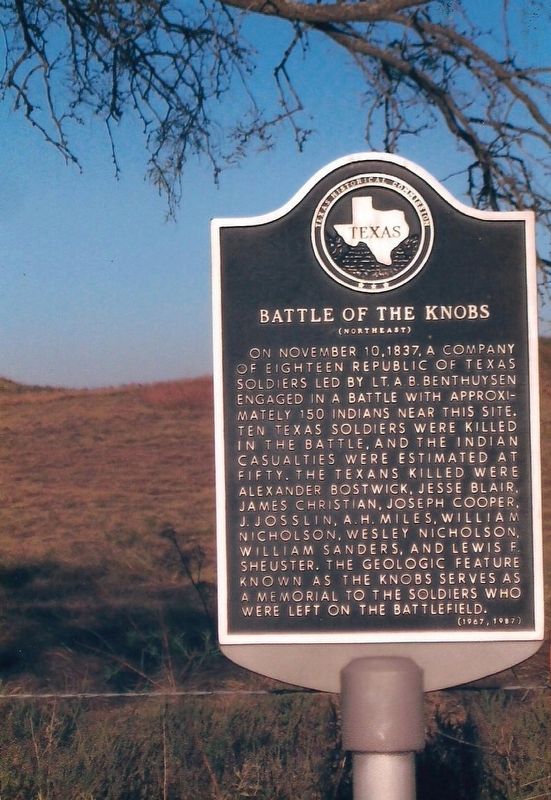
Near Decatur in Wise County, Texas — The American South (West South Central)
Battle of the Knobs
(Northeast)
Erected 1967 by Texas Historical Commission. (Marker Number 333.)
Topics. This historical marker is listed in this topic list: Wars, US Indian. A significant historical date for this entry is November 10, 1837.
Location. 33° 15.926′ N, 97° 35.612′ W. Marker is near Decatur, Texas, in Wise County. Marker is on Old Decatur Road, 1.1 miles west of Farm to Market Road 730, on the right when traveling north. Touch for map. Marker is in this post office area: Decatur TX 76234, United States of America. Touch for directions.
Other nearby markers. At least 8 other markers are within 3 miles of this marker, measured as the crow flies. Butterfield Overland Stage Line (approx. 1.8 miles away); St. John Missionary Baptist Church (approx. 2 miles away); East Side Elementary School (approx. 2 miles away); Gose Trees (approx. 2.1 miles away); First National Bank of Decatur (approx. 2.2 miles away); Colonel Absalom Bishop (approx. 2.2 miles away); Wise County Courthouse (approx. 2.2 miles away); Captain George W. Stevens (approx. 2.2 miles away). Touch for a list and map of all markers in Decatur.
More about this marker. For additional information, see:
http://www.wisehistory.com/battle_of_the_knobs.html
Credits. This page was last revised on September 20, 2017. It was originally submitted on September 20, 2017, by James R. Murray of Elkton, Florida. This page has been viewed 587 times since then and 78 times this year. Photo 1. submitted on September 20, 2017, by James R. Murray of Elkton, Florida. • Bernard Fisher was the editor who published this page.
