Corona in Queens in Queens County, New York — The American Northeast (Mid-Atlantic)
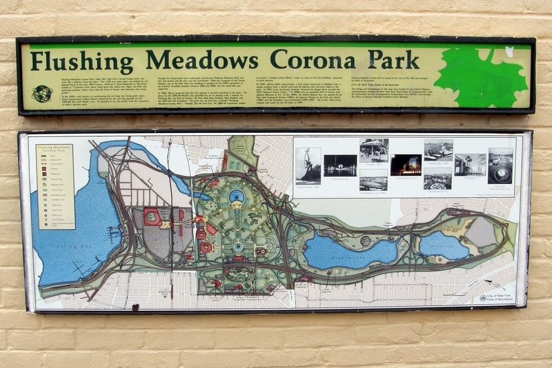
Flushing Meadows Corona Park
Flushing Meadows Corona Park, today New York City’s second largest park, has risen like a phoenix from the ashes. The 1,255-acre open space was indeed an ash disposal heap in the early 20th Century, noted by F. Scott Fitzgerald in The Great Gatsby as “a fantastic farm where ashes grow like wheat into ridges and hills and grotesque gardens, where ashes take the form of houses and chimneys and rising smoke…”
In the 1930s, with dreams of transforming the ash heap into living green space, Parks Commissioner Robert Moses converted the site into the grounds for the 1939-1940 New York World’s Fair. He planned to use the profits from the exposition to build a glorious park.
Though the grounds were landscaped and became Flushing Meadows Park, the Fair lost money and the area was left unfinished. With the exception of the United Nations’ use of the New York City building (a product of the 1939 exposition) as the General Assembly chamber between 1946 and 1950, the site stood idle and neglected.
In 1960, Moses proposed that the City sponsor a second exposition in the park. Th plans for the 1964-65 World’s Fair provided for an ice skating rink, a marina on Flushing Bay, the Hall of Science, the New York State Pavilion, Shea Stadium and the 120-foot-tall Unisphere. The park was, by local law, renamed “Flushing Meadows Corona Park.” Though, like the first Fair, the 1964-65 exposition yielded no profits, it helped realize Moses’ vision, as some of the Fair buildings remained as Park features.
By 1968, athletic fields, playgrounds, a boat rental concession in Meadow Lake, a model airplane field, a bicycle path and the Queens Zoo had been added to the park. In 1978, Louis Armstrong Stadium, formerly the Singer Bowl, became the USTA National Tennis Center. The 1980s saw an expanded Hall of Science and Queens Museum of Art. In the 1990s, the rebuilt Queens Zoo was opened by the New York Zoological Society (1992), the Queens Theatre in the Park was rebuilt (1993) and the Unisphere was refurbished (1994-1995). The Arthur Ashe tennis stadium was ready for the US Open in 1997.
Flushing Meadows Corona Park is owned by the City of New York and managed by Parks & Recreation.
CITY OF NEW YORK PARKS AND RECREATION
The design and development of this map was funded by the Federal Highway Administration through the New York State Department of Transportation under the Intermodal Surface Transportation Enhancement Act (ISTEA) and through the office of Queens Borough President Claire Shulman.
Erected by New York City Parks & Recreation.
Topics. This historical marker is listed in these topic lists: Charity & Public Work
• Entertainment.
Location. 40° 45.089′ N, 73° 50.602′ W. Marker is in Queens, New York, in Queens County. It is in Corona. Marker is at the intersection of New York Avenue and Avenue of the Americas, on the right when traveling west on New York Avenue. Touch for map. Marker is in this post office area: Corona NY 11368, United States of America. Touch for directions.
Other nearby markers. At least 8 other markers are within walking distance of this marker. David Dinkins Circle (within shouting distance of this marker); George Washington (approx. 0.2 miles away); The Unisphere (approx. 0.3 miles away); Column of Jerash (approx. 0.3 miles away); a different marker also named Unisphere (approx. 0.3 miles away); New York Worlds Fair (approx. 0.3 miles away); a different marker also named Unisphere (approx. 0.4 miles away); a different marker also named Unisphere (approx. 0.4 miles away). Touch for a list and map of all markers in Queens.
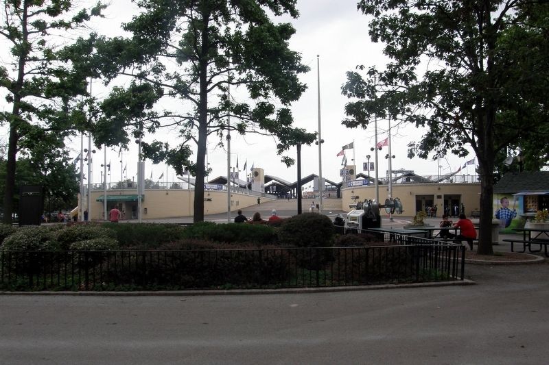
More about this marker. The marker is at the end of the Passarelle Ramp near David Dinkins Circle.
Also see . . . Flushing Meadows Corona Park. Official NYC Parks description. (Submitted on April 15, 2020, by Larry Gertner of New York, New York.)
Credits. This page was last revised on January 31, 2023. It was originally submitted on September 25, 2017, by Larry Gertner of New York, New York. This page has been viewed 630 times since then and 59 times this year. Last updated on April 15, 2020, by Larry Gertner of New York, New York. Photos: 1, 2. submitted on September 25, 2017, by Larry Gertner of New York, New York. • Bill Pfingsten was the editor who published this page.

