Yorktown in York County, Virginia — The American South (Mid-Atlantic)
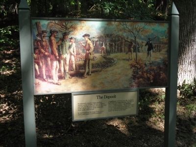
The Deposit
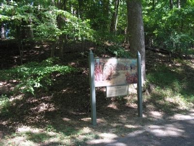
In constructing the siege lines, engineers and sappers used quantities of gabions (wickerwork-like baskets), fascines and saucissons (bundles of stout wooden sticks), and fraises (heavy pointed poles). These materials of war were temporarily stored in this ravine until American troops were ready for them on the line.
Erected by Colonial National Historical Park, National Park Service.
Topics. This historical marker is listed in these topic lists: Notable Events • Notable Places • War, US Revolutionary.
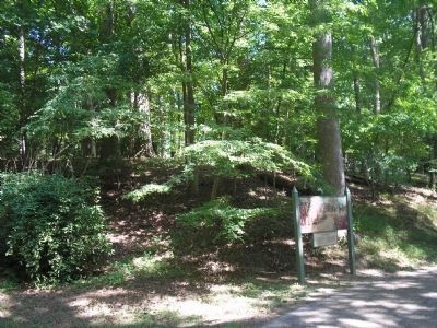
Location. 37° 13.291′ N, 76° 29.56′ W. Marker is in Yorktown, Virginia, in York County. Marker is on Tour Road, on the left when traveling south. Marker is located on the Yorktown Battlefield in Colonial National Historical Park, along the Battlefield Tour between stops D and E. Touch for map. Marker is in this post office area: Yorktown VA 23690, United States of America. Touch for directions.
Other nearby markers. At least 8 other markers are within walking distance of this marker. American Approach Road (about 400 feet away, measured in a direct line); The First Siege Line (approx. 0.3 miles away); Wormley Creek Crossing (approx. 0.3 miles away); Moore House (approx. 0.4 miles away); Wear Of Centuries (approx. 0.4 miles away); Communicating Trench (approx. 0.4 miles away); Unknown Confederate Soldiers (approx. half a mile away); Redoubt 9 (approx. half a mile away). Touch for a list and map of all markers in Yorktown.
More about this marker. The painting above the marker shows soldiers working on various siege elements. Gabions, fraises and saucissons are depicted, as well as trenching tools such as shovels and pick axes.
Also see . . .
1. Yorktown Battlefield. National Park Service. (Submitted on August 30, 2008, by Bill Coughlin of Woodland Park, New Jersey.)
2. The Battle of Yorktown. The Patriot Resource website. (Submitted on August 30, 2008, by Bill Coughlin of Woodland Park, New Jersey.)
3. The Battle of Yorktown 1781. A British perspective of the Battle of Yorktown from BritishBattles.com. (Submitted on August 30, 2008, by Bill Coughlin of Woodland Park, New Jersey.)
Credits. This page was last revised on June 16, 2016. It was originally submitted on August 30, 2008, by Bill Coughlin of Woodland Park, New Jersey. This page has been viewed 924 times since then and 28 times this year. Photos: 1, 2, 3. submitted on August 30, 2008, by Bill Coughlin of Woodland Park, New Jersey.


