Locust Point Industrial Area in Baltimore, Maryland — The American Northeast (Mid-Atlantic)
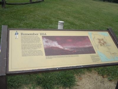
Remember 1814
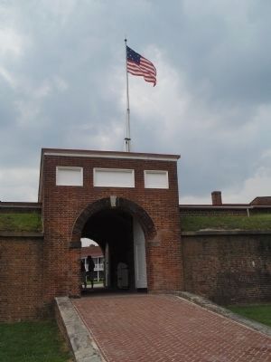
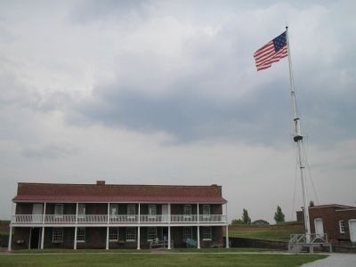
Fort McHenry protected the water approaches to Baltimore for more than a hundred years, but was attacked only once. On September 13-14, 1814, British ships fired rockets and mortars at the fort for twenty-five hours. Fort McHenry withstood the bombardment, and when the smoke cleared the American flag was still waving where you see it now.
Francis Scott Key watched these dramatic events from the deck of a truce ship down the river to your left. His description of the battle was immortalized in “The Star-Spangled Banner,” the song that later became our National Anthem.
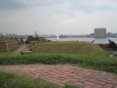
The fort has undergone many changes since 1814, yet many original structures survive in whole or part. Historic sites on this tour will help you to recall those unforgettable hours when Fort McHenry’s defenders saved a city and inspired a song.
Erected by National Park Service, U.S. Department of the Interior.
Topics and series. This historical marker is listed in these topic lists: Notable Events • Notable Places • War of 1812. In addition, it is included in the Maryland, Fort McHenry series list. A significant historical month for this entry is September 1932.
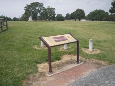
Location. Marker has been permanently removed. It was located near 39° 15.85′ N, 76° 34.802′ W. Marker was in Baltimore, Maryland. It was in the Locust Point Industrial Area. Marker could be reached from East Fort Avenue, on the right when traveling east. Marker is on grounds of Fort McHenry National Monument, at the beginning of the walking trail of the fort. Touch for map. Marker was at or near this postal address: 2400 E Fort Ave, Baltimore MD 21230, United States of America.
We have been informed that this sign or monument is no longer there and will not be replaced. This page is an archival view of what was.
Other nearby markers. At least 8 other markers are within walking distance of this location. Armistead (within shouting distance of this marker); Allegiance by Force (within shouting distance of this marker); Evolution of Fort McHenry (within shouting distance of this marker); Preservation of Earthworks (within shouting distance of this marker); Another Day on Duty… 1814 (within shouting distance of this marker); Heritage of Courage…The Society of the War of 1812 (within shouting distance of this marker); British Bomb (within shouting distance of this marker); Welcome! You Are Now "On Post" (within shouting distance of this marker). Touch for a list and map of all markers in Baltimore.
More about this marker. The middle of the marker contains a picture of Fort McHenry under attack by the British fleet. It has a caption of “The British attack on Baltimore came during the closing months of the War of 1812. The enemy fleet fired more than 1,500 mortar bombs at the fort, but inflicted little damage. Unable to destroy the cannon in the fort’s water batteries, the British abandoned their attempt to capture the city. Painting courtesy Maryland Historical Society.”
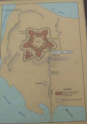
The right of the marker features a map of the fort grounds as they are today. The caption is “Fort McHenry in 1814 - The brick walls and earthen parapets of Fort McHenry have changed somewhat since 1814. Other structures have long since disappeared.
Many of the buildings inside the fort were modified for military purposes after 1814. Other structures were added later, that do not appear on the map.
Locations of several early buildings outside the fort are outlined in brick on the lawn.”
Also see . . .
1. Fort McHenry National Monument and Historic Shrine. National Park Service. (Submitted on August 30, 2008, by Bill Coughlin of Woodland Park, New Jersey.)
2. Battle of Baltimore. HistoryCentral.com. (Submitted on August 30, 2008, by Bill Coughlin of Woodland Park, New Jersey.)
Credits. This page was last revised on October 25, 2023. It was originally submitted on August 30, 2008, by Bill Coughlin of Woodland Park, New Jersey. This page has been viewed 1,915 times since then and 32 times this year. Photos: 1. submitted on August 30, 2008, by Bill Coughlin of Woodland Park, New Jersey. 2. submitted on August 24, 2010, by Craig Swain of Leesburg, Virginia. 3, 4, 5, 6. submitted on August 30, 2008, by Bill Coughlin of Woodland Park, New Jersey.
