Industrial Shoreline
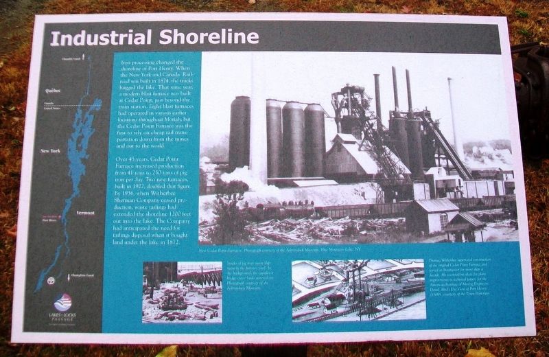
Iron processing changed the shoreline of Port Henry. When the New York and Canada Railroad was built in 1874, the tracks hugged the lake. That same year, a modern blast furnace was built at Cedar Point, just beyond the train station. Eight blast furnaces had operated in various earlier locations throughout Moriah, but the Cedar Point Furnace was the first to rely on cheap rail transportation down from the mines and out to the world.
Over 45 years, Cedar Point Furnace increased production from 41 tons to 250 tons of pig iron per day. Two new furnaces, built in 1922, doubled that figure. By 1936, when Witherbee Sherman Company ceased production, waste tailings had extended the shoreline 1200 feet out into the lake. The Company had anticipated the need for tailings disposal when it bought land under the lake in 1872.
[Photo captions, from left to right, read]
• New Cedar Point Furnaces. Photograph courtesy of the Adirondack Museum, Blue Mountain Lake, NY.
• Stacks of pig iron await shipment in the furnace yard. In the background, the cantilever bridge crane loads sintered ore. Photograph courtesy of the Adirondack Museum.
• Thomas Witherbee supervised construction of the original Cedar Point Furnace and served as Ironmaster for more than a decade. He recorded his ideas for plant improvements in technical
papers for the American Institute of Mining Engineers. Detail, Bird's Eye View of Port Henry (1889), courtesy of the Town Historian.Erected by Lakes to Locks Passage.
Topics. This historical marker is listed in these topic lists: Environment • Industry & Commerce • Man-Made Features • Waterways & Vessels. A significant historical year for this entry is 1874.
Location. 44° 2.6′ N, 73° 27.475′ W. Marker is in Port Henry, New York, in Essex County. Marker is on Park Place east of Main Street (New York State Route 9N/22), on the left when traveling east. Marker is at the Iron Center Museum. Touch for map. Marker is at or near this postal address: 34 Park Place, Port Henry NY 12974, United States of America. Touch for directions.
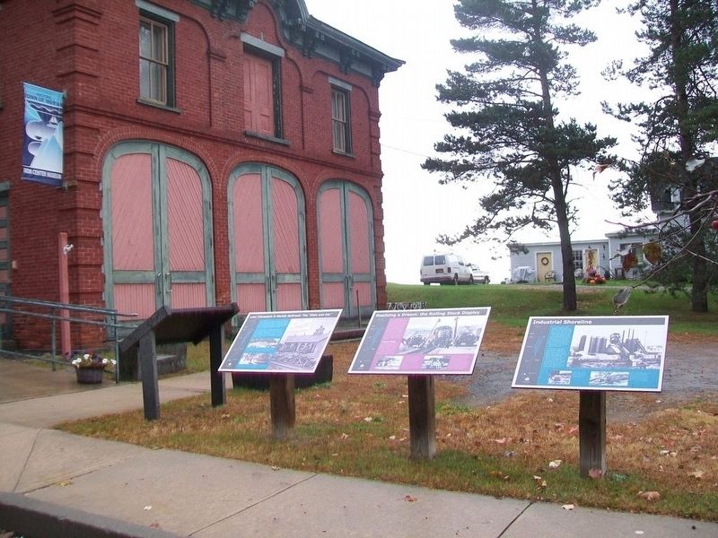
Other nearby markers. At least 8 other markers are within walking distance of this marker. Realizing a Dream: the Rolling Stock Display (here, next to this marker); Lake Champlain & Moriah Railroad: The "Elsie and Em" (here, next to this marker); A Busy Iron Port (here, next to this marker); The 1929 Lake Champlain Bridge (a few steps from this marker); Veterans Memorial (within shouting distance of this marker); Office Building of Witherbee and Sherman Iron Ore Company (within shouting distance of this marker); Witherbee Park and Town Hall (within shouting distance of this marker); LC&M Caboose (about 400 feet away, measured in a direct line). Touch for a list and map of all markers in Port Henry.
Also see . . .
1. The Iron Center Museum, Port Henry NY. (Submitted on October 18, 2017, by William Fischer, Jr. of Scranton, Pennsylvania.)
2. Photos of Cedar Point Furnace in Moriah and Port Henry in the Adirondacks (2013). (Submitted on October 18, 2017, by William Fischer, Jr. of Scranton, Pennsylvania.)
3. A walking tour of Port Henry: Mining capital of the Adirondacks. (Submitted on October 18, 2017, by William Fischer, Jr. of Scranton, Pennsylvania.)
Credits. This page was last revised on October 18, 2017. It was originally submitted on October 18, 2017, by William Fischer, Jr. of Scranton, Pennsylvania. This page has been viewed 204 times since then and 7 times this year. Photos: 1. submitted on October 18, 2017, by William Fischer, Jr. of Scranton, Pennsylvania. 2. submitted on October 17, 2017, by William Fischer, Jr. of Scranton, Pennsylvania.

