Near Orofino in Clearwater County, Idaho — The American West (Mountains)
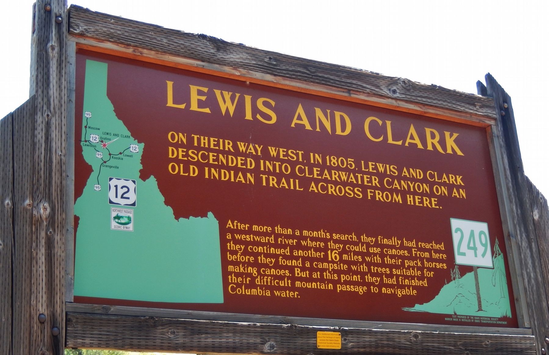
Lewis and Clark
On their way West, in 1805
— Lewis and Clark descended into Clearwater Canyon on an old Indian trail across from here —
Erected by Idaho Historical Society & Idaho Transportation Department. (Marker Number 249.)
Topics and series. This historical marker is listed in these topic lists: Exploration • Native Americans • Waterways & Vessels. In addition, it is included in the Idaho State Historical Society, and the Lewis & Clark Expedition series lists. A significant historical year for this entry is 1805.
Location. 46° 26.655′ N, 116° 12.884′ W. Marker is near Orofino, Idaho, in Clearwater County. Marker is on U.S. 12, 3 miles south of Michigan Avenue, on the right when traveling west. Marker is located in a pull-out on the east side of US Highway 12, overlooking the Clearwater River. Touch for map. Marker is in this post office area: Orofino ID 83544, United States of America. Touch for directions.
Other nearby markers. At least 8 other markers are within 7 miles of this marker, measured as the crow flies. River Crossing Over Time (approx. 3.3 miles away); Routes Through the Region (approx. 3.3 miles away); Gold Rush Ferry (approx. 4.8 miles away); Gold Rush Historic Byway (approx. 4.8 miles away); Dworshak Dam (approx. 6½ miles away); Indian Fishing Rock (approx. 6.6 miles away); Canoe Building Site (approx. 6.7 miles away); Ahsakha Village Site (approx. 6.7 miles away). Touch for a list and map of all markers in Orofino.
More about this marker. Large wooden marker in good condition
Credits. This page was last revised on November 9, 2017. It was originally submitted on November 8, 2017, by Cosmos Mariner of Cape Canaveral, Florida. This page has been viewed 335 times since then and 29 times this year. Photo 1. submitted on November 8, 2017, by Cosmos Mariner of Cape Canaveral, Florida. • Bill Pfingsten was the editor who published this page.
