Lewiston in Nez Perce County, Idaho — The American West (Mountains)
The Early Years in Nez Perce County
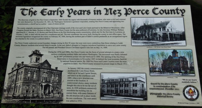
The discovery of gold in September 1860 flooded the region with thousands of treasure seekers, who were a civil and criminal law unto themselves. On December 20, 1861, the Washington Territorial Legislature responded, creating Nez Perce County and appointing two commissioners, a sheriff and an auditor – none of whom served.
The country originally encompassed all of the Clearwater drainage south of the river and Lolo Creek eastward to the Bitterroot Mountains. After Congress formed the Idaho Territory in March 1863, Nez Perce County lost the area northwest of Lewiston. In July Governor William Wallace appointed B. C. Stevens, A. B. Brower and David Reese as the first functioning county commission, which met for the first time in Lewiston on October 5, 1863, to deal with the need for a courthouse and jail. The new courthouse was never built, forcing the county to rent office space. The territorial legislature reorganized the county on February 24, 1864, leaving the northern part of Idaho’s current panhandle as an unorganized region but attached to the county in a judicial district.
Nez Perce County underwent several boundary changes during its first 50 years, but none were more contentious than those relating to Latah County. Moscow residents tried several times to secede. In the end, Idaho’s delegate to Congress introduced legislation to carve out a new county. The bill passed, and President Grover Cleveland signed it into law on May 14, 1888.
During the 1870’s and 1880’s, Nez Perce County was the focus of several attempts to create a new territory combining northern Idaho and eastern Washington. The movement was finally defeated by an 1887 presidential pocket veto and statehood in 1890. The opening of the Nez Perce Reservation to homesteaders in November 1895 revitalized the local economy, hard-hit by national panics. By 1900 Nez Perce and Latah Counties were the most populous in Idaho. Nez Perce County assumed its present shape in March 1911.
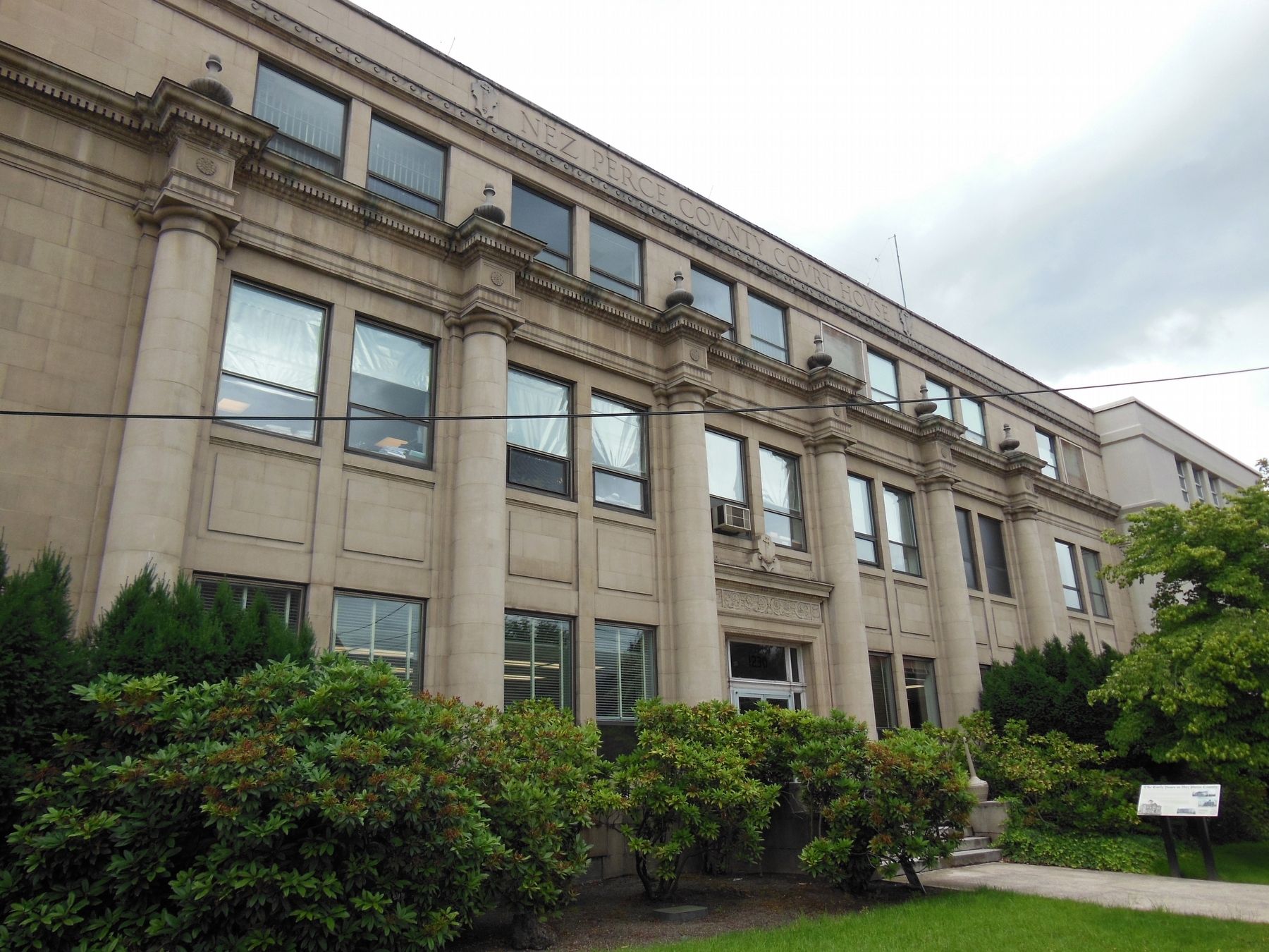
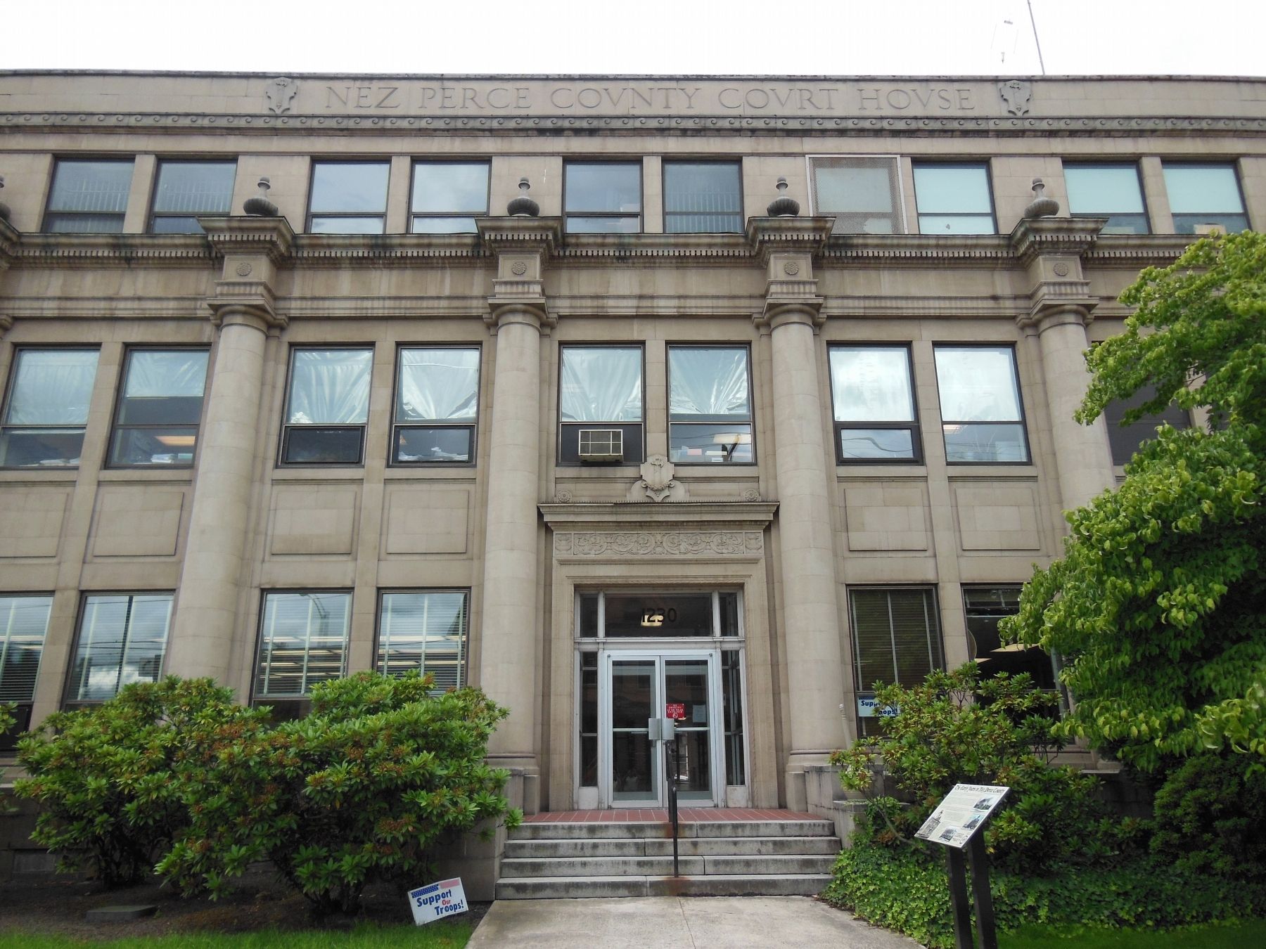
In January 1882 the county commissioners purchased the Luna House Hotel, which sat at 3rd and Capital Streets, and used it as the courthouse until 1889, when a new structure was erected at this location. A controversial choice, many residents thought this site to be too far out of town. In 1928 architects extensively remodeled the building into its current form, with many features of the old structure left in place inside the new courthouse. The west annex was added in 1974.
Erected 2011 by Nez Perce County in commemoration of its sesquicentennial.
Topics and series. This historical marker is listed in these topic lists: Architecture
• Industry & Commerce • Settlements & Settlers. In addition, it is included in the Former U.S. Presidents: #22 and #24 Grover Cleveland series list.
Location. 46° 25.105′ N, 117° 0.979′ W. Marker is in Lewiston, Idaho, in Nez Perce County. Marker is at the intersection of Main Street and 13th Street, on the right when traveling east on Main Street. Marker is located directly in front of the Nez Perce County Courthouse main entrance. Touch for map. Marker is in this post office area: Lewiston ID 83501, United States of America. Touch for directions.
Other nearby markers. At least 8 other markers are within walking distance of this marker. Relic of Rustic Past (about 400 feet away, measured in a direct line); Idaho's First Capitol (about 400 feet away); 18th St. Bridge (approx. 0.6 miles away); John Silcott (approx. 0.6 miles away); Means Building (approx. 0.6 miles away); Lewis and Clark (approx. 0.7 miles away); Site of Luna House (approx. 0.7 miles away); Pacific Northwest Bell Building (Historic Name) (approx. 0.7 miles away). Touch for a list and map of all markers in Lewiston.
Also see . . . Nez Perce County.
The county as we know it today was established February 4, 1864 by the Idaho Territorial Legislature with its county seat at Lewiston and present boundaries set by 1911. Lewis and Clark were the first white men to enter the area in 1805 that would later be named for the Nez Perce Indians who occupied it. Lewiston served as the territorial capital for twenty-two months before the capital was moved to Boise. (Submitted on November 11, 2017, by Cosmos Mariner of Cape Canaveral, Florida.)
Credits. This page was last revised on October 21, 2020. It was originally submitted on November 11, 2017, by Cosmos Mariner of Cape Canaveral, Florida. This page has been viewed 317 times since then and 25 times this year. Photos: 1, 2, 3. submitted on November 11, 2017, by Cosmos Mariner of Cape Canaveral, Florida. • Bill Pfingsten was the editor who published this page.


