Near Bonanza City (ghost town) in Custer County, Idaho — The American West (Mountains)
Building the Dredge
Inscription.
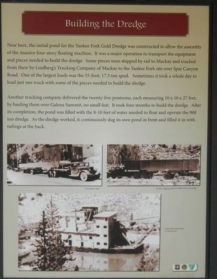
Near here, the initial pond of the Yankee Fork Gold Dredge was constructed to allow the assembly of the massive four-story floating machine. It was a major operation to transport the equipment and pieces needed to build the dredge. Some pieces were shipped by rail to Mackay and trucked from there by Lindberg's Trucking Company of Mackay to the Yankee Fork site over Spar Canyon Road. One of the largest loads was the 55-foot, 17.5 ton spud. Sometimes it took a whole day to load just one truck with some of the pieces needed to build the dredge.
Another trucking company delivered the twenty-five pontoons, each measuring 10 x10 x 27 feet, by hauling them over Galena Summit, no small feat. It took four months to build the dredge. After its completion, the pond was filled with the 8-10 feet of water needed to float and operate the 988 ton dredge. As the dredge worked, it continuously dug its own pond in front and filled it in with tailings at the back.
Erected by U.S. Forest Service, Idaho Department of Parks and Recreation, and the Bureau of Land Management.
Topics. This historical marker is listed in this topic list: Industry & Commerce.
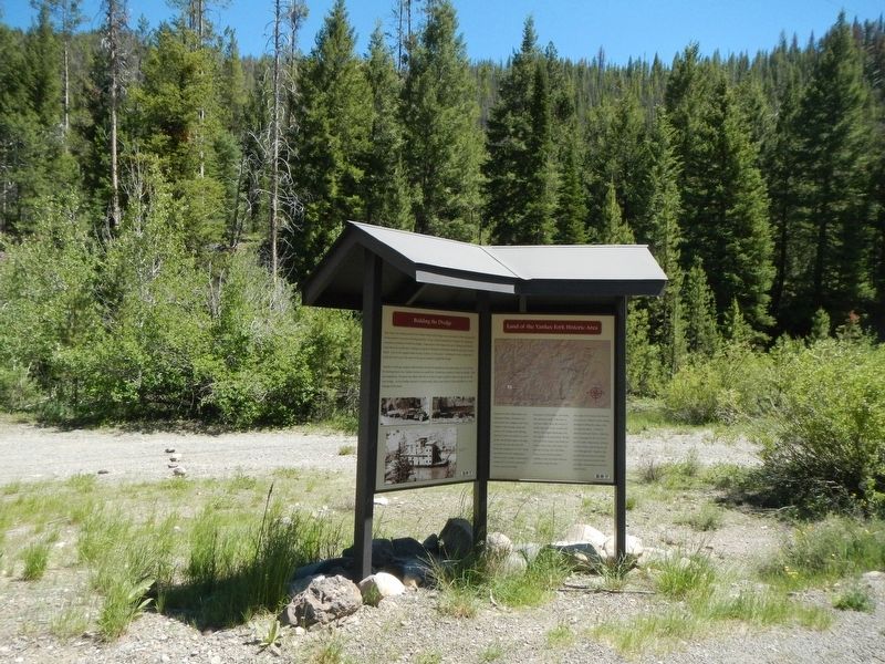
Location. 44° 18.27′ N, 114° 43.176′ W. Marker is near Bonanza City (ghost town), Idaho, in Custer County. Marker is on Yankee Fork Road - Custer Motorway Adventure Road near Ramey Creek Road, on the left when traveling south. Touch for map. Marker is in this post office area: Stanley ID 83278, United States of America. Touch for directions.
Other nearby markers. At least 8 other markers are within 5 miles of this marker, measured as the crow flies. River Recreation (approx. 2˝ miles away); Sunbeam Dam (approx. 2˝ miles away); In the Early Days (approx. 2˝ miles away); Remnants of the Past (approx. 2.6 miles away); Sunbeam Bathhouse (approx. 2.9 miles away); The Boiling Fountain (approx. 2.9 miles away); Of Cabins and Chicken Ranches (approx. 2.9 miles away); Bonanza City (approx. 4.7 miles away). Touch for a list and map of all markers in Bonanza City (ghost town).

Photographed By Barry Swackhamer, June 25, 2017
3. Land of the Yankee Fork Historic Area panel
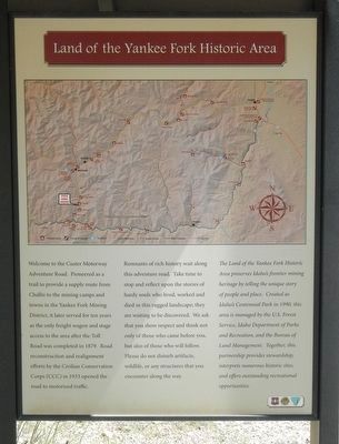
Welcome to the Custer Motorway Adventure Road. Pioneered as a trail to provide a supply route from Challis to the mining camps and towns of the Yankee Fork Mining District, it later served for ten years as the only freight wagon and stage access to the area after the Toll Road was completed in 1879. Road reconstruction and realignment efforts by the Civilian Conservation Corps (CCC) in 1933 opened the road to motorized traffic.
Remnants of rich history wait along this adventure road. Take time to stop and reflect upon the stories of hardy souls who lived, worked and died in this rugged landscape; they are waiting to be discovered. We ask that you show respect and think not only of those who came before you, but also of those who will follow. Please do not disturb the artifacts, wildlife, or any structures that you encounter along the way.
The Land of the Yankee Fork Historic Area preserves Idaho's frontier mining heritage by telling the unique story of people and place. Created as Idaho's Centennial Park in 1990, this area is managed by the U.Sl Forest Service, Idaho Department of Park and Recreation, and the Bureau of Land Management. Together, this partnership provides stewardship, interprets numerous historic sites, and offers outstanding recreational opportunities.
Credits. This page was last revised on November 13, 2017. It was originally submitted on November 13, 2017, by Barry Swackhamer of Brentwood, California. This page has been viewed 178 times since then and 8 times this year. Photos: 1, 2, 3. submitted on November 13, 2017, by Barry Swackhamer of Brentwood, California.

